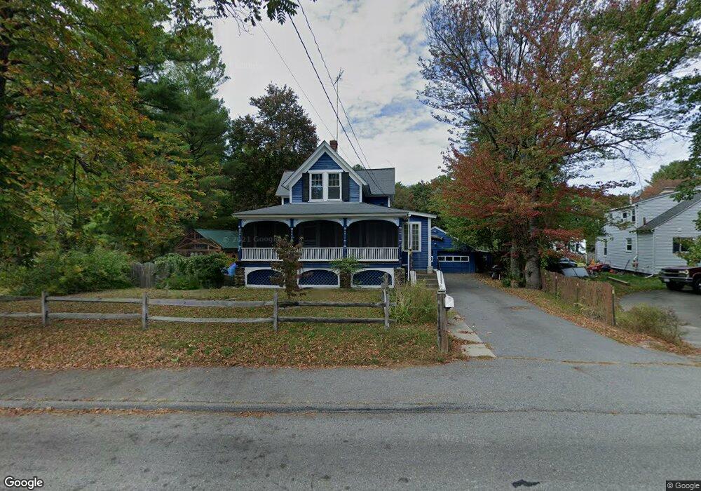
283 Whalom Rd Lunenburg, MA 01462
Estimated Value: $455,290 - $484,000
3
Beds
2
Baths
1,476
Sq Ft
$316/Sq Ft
Est. Value
About This Home
This home is located at 283 Whalom Rd, Lunenburg, MA 01462 and is currently estimated at $465,823, approximately $315 per square foot. 283 Whalom Rd is a home located in Worcester County with nearby schools including Lunenburg Primary School, Lunenburg High School, and St Bernards Elementary School.
Ownership History
Date
Name
Owned For
Owner Type
Purchase Details
Closed on
Sep 3, 2008
Sold by
Letarte Dennis G and Letarte Charles R
Bought by
Letarte Christopher and Letarte Melony
Current Estimated Value
Home Financials for this Owner
Home Financials are based on the most recent Mortgage that was taken out on this home.
Original Mortgage
$217,000
Outstanding Balance
$145,504
Interest Rate
6.69%
Mortgage Type
Purchase Money Mortgage
Estimated Equity
$320,319
Purchase Details
Closed on
Mar 18, 2005
Sold by
Letarte Rt and Letarte Dennis G
Bought by
Letarte Edgar R
Purchase Details
Closed on
Nov 30, 2004
Sold by
Letarte Edgar R
Bought by
Letarte Rt and Letarte Dennis G
Purchase Details
Closed on
Oct 15, 2004
Sold by
Letarte Rt and Letarte Dennis G
Bought by
Letarte Edgar R
Create a Home Valuation Report for This Property
The Home Valuation Report is an in-depth analysis detailing your home's value as well as a comparison with similar homes in the area
Home Values in the Area
Average Home Value in this Area
Purchase History
| Date | Buyer | Sale Price | Title Company |
|---|---|---|---|
| Letarte Christopher | $218,000 | -- | |
| Letarte Edgar R | -- | -- | |
| Letarte Rt | -- | -- | |
| Letarte Edgar R | -- | -- |
Source: Public Records
Mortgage History
| Date | Status | Borrower | Loan Amount |
|---|---|---|---|
| Open | Letarte Christopher | $217,000 |
Source: Public Records
Tax History Compared to Growth
Tax History
| Year | Tax Paid | Tax Assessment Tax Assessment Total Assessment is a certain percentage of the fair market value that is determined by local assessors to be the total taxable value of land and additions on the property. | Land | Improvement |
|---|---|---|---|---|
| 2025 | $5,734 | $399,300 | $162,700 | $236,600 |
| 2024 | $5,365 | $380,500 | $154,400 | $226,100 |
| 2023 | $5,387 | $368,500 | $138,800 | $229,700 |
| 2022 | $4,956 | $288,300 | $117,800 | $170,500 |
| 2020 | $4,894 | $270,100 | $118,000 | $152,100 |
| 2019 | $4,790 | $256,400 | $110,000 | $146,400 |
| 2018 | $4,618 | $234,400 | $110,100 | $124,300 |
| 2017 | $4,262 | $213,300 | $100,000 | $113,300 |
| 2016 | $4,153 | $211,800 | $100,800 | $111,000 |
| 2015 | $3,743 | $204,300 | $97,100 | $107,200 |
Source: Public Records
Map
Nearby Homes
- 1479 Main St
- 5 Ramgren Rd
- 3 Rennie St
- 23-25 Kimball St
- 819 West St
- 452 Hollis Rd
- 200-365 Hollis Rd
- 24 North St
- 1084 Main St
- 77 Electric Ave
- 4 Lincoln St
- 313 Lincoln St
- 0 Summer St
- 9 Pleasant St
- 363 Lunenburg St
- 23 Tilton Ave
- 17 Fernwood Dr Unit G
- 36 Fox Meadow Rd Unit A
- 17 Fernwood Dr Unit D
- 51 Fox Meadow Rd Unit C
- 3 Joslin St
- 284 Whalom Rd
- 273 Whalom Rd
- 8 The Clearing St
- 280 Whalom Rd
- 46 Clearing St
- 297 Whalom Rd
- 13 Joslin St
- 12 Joslin St
- 7 The Clearing St
- 9 Lesure Ave
- 16 Joslin St
- 261 Whalom Rd
- 261 Whalom Rd
- 18 The Clearing St
- 18 The Clearing St Unit 2
- 18 The Clearing St Unit 1
- 11 The Clearing St
- 306 Whalom Rd
- 15 Lesure Ave