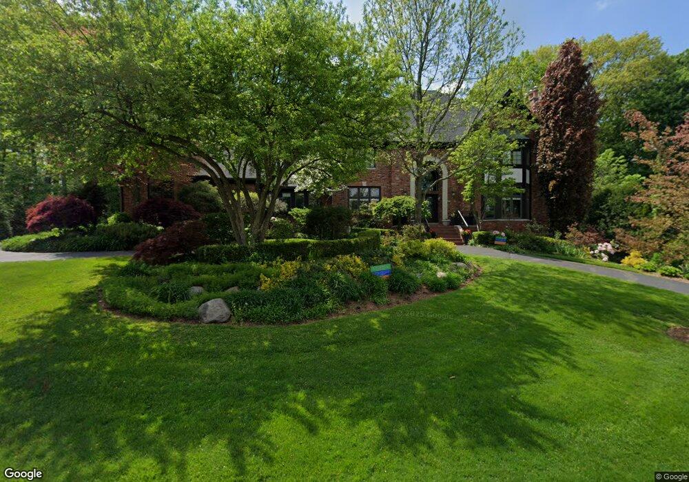
2830 Meadowood Ln Bloomfield Hills, MI 48302
Estimated Value: $1,079,000 - $1,322,000
5
Beds
6
Baths
5,128
Sq Ft
$239/Sq Ft
Est. Value
About This Home
This home is located at 2830 Meadowood Ln, Bloomfield Hills, MI 48302 and is currently estimated at $1,224,980, approximately $238 per square foot. 2830 Meadowood Ln is a home located in Oakland County with nearby schools including Way Elementary School, South Hills Middle School, and Bloomfield Hills High School.
Ownership History
Date
Name
Owned For
Owner Type
Purchase Details
Closed on
Jun 13, 2002
Sold by
Davis Richard O
Bought by
Mersol-Barg Michael
Current Estimated Value
Home Financials for this Owner
Home Financials are based on the most recent Mortgage that was taken out on this home.
Original Mortgage
$75,000
Outstanding Balance
$31,734
Interest Rate
6.82%
Estimated Equity
$1,193,246
Create a Home Valuation Report for This Property
The Home Valuation Report is an in-depth analysis detailing your home's value as well as a comparison with similar homes in the area
Home Values in the Area
Average Home Value in this Area
Purchase History
| Date | Buyer | Sale Price | Title Company |
|---|---|---|---|
| Mersol-Barg Michael | -- | -- |
Source: Public Records
Mortgage History
| Date | Status | Borrower | Loan Amount |
|---|---|---|---|
| Open | Mersol-Barg Michael | $75,000 |
Source: Public Records
Tax History Compared to Growth
Tax History
| Year | Tax Paid | Tax Assessment Tax Assessment Total Assessment is a certain percentage of the fair market value that is determined by local assessors to be the total taxable value of land and additions on the property. | Land | Improvement |
|---|---|---|---|---|
| 2024 | $10,758 | $640,920 | $0 | $0 |
| 2023 | $10,411 | $571,790 | $0 | $0 |
| 2022 | $19,541 | $538,480 | $0 | $0 |
| 2021 | $19,401 | $540,170 | $0 | $0 |
| 2020 | $9,510 | $547,240 | $0 | $0 |
| 2019 | $18,255 | $556,840 | $0 | $0 |
| 2018 | $18,338 | $572,280 | $0 | $0 |
| 2017 | $18,207 | $595,230 | $0 | $0 |
| 2016 | $18,241 | $591,880 | $0 | $0 |
| 2015 | -- | $533,250 | $0 | $0 |
| 2014 | -- | $523,540 | $0 | $0 |
| 2011 | -- | $429,060 | $0 | $0 |
Source: Public Records
Map
Nearby Homes
- 2863 Meadowood Ln
- 363 Sycamore Ct
- 2875 Rambling Way
- 425 Kendry
- 3060 Chickering Ln
- 164 Timber Trace Ln
- 240 Applewood Ln
- 2851 Franklin Rd
- 2665 Lahser Rd
- 00 S Berkshire
- 284 Woodwind Dr
- 136 Belroi Place
- 3403 Chickering Ln
- 3515 Brookside Dr
- 200 Astorwood St
- 3435 Devon Brook Dr
- 3531 Brookside Dr
- 3627 Shallow Brook Dr
- 95 Hillsdale Rd
- 1250 Club Dr
- 2838 Meadowood Ln
- 2822 Chestnut Run Dr
- 2823 Aspen Ln
- 2847 Aspen Ln
- 2835 Aspen Ln
- 2846 Meadowood Ln
- 423 Wilshire Dr
- 2859 Aspen Ln
- 2831 Chestnut Run Dr
- 2837 Meadowood Ln
- 435 Wilshire Dr
- 411 Wilshire Dr
- 9999 Meadowood Ln
- 2845 Meadowood Ln
- 2871 Aspen Ln
- 2854 Meadowood Ln
- 2855 Meadowood Ln
- 0 Wilshire Dr
- 2835 Chestnut Run Dr
- 2824 Aspen Ln