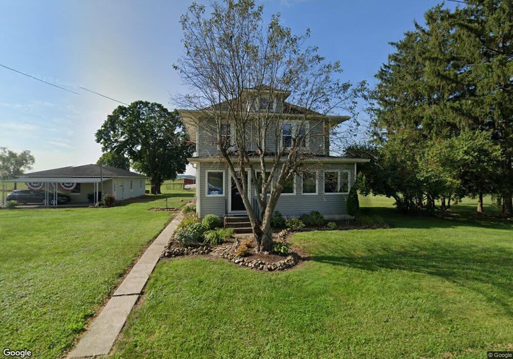
2831 Palmer Rd Hebron, OH 43025
Union NeighborhoodEstimated Value: $276,000 - $462,000
5
Beds
2
Baths
1,728
Sq Ft
$214/Sq Ft
Est. Value
About This Home
This home is located at 2831 Palmer Rd, Hebron, OH 43025 and is currently estimated at $369,465, approximately $213 per square foot. 2831 Palmer Rd is a home located in Licking County with nearby schools including Jackson Intermediate School, Lakewood Middle School, and Lakewood High School.
Ownership History
Date
Name
Owned For
Owner Type
Purchase Details
Closed on
Apr 12, 2004
Sold by
Keller David C and Keller Bonita F
Bought by
Wiest John C and Wiest Nichole
Current Estimated Value
Home Financials for this Owner
Home Financials are based on the most recent Mortgage that was taken out on this home.
Original Mortgage
$176,500
Outstanding Balance
$80,326
Interest Rate
5.85%
Mortgage Type
Unknown
Estimated Equity
$289,139
Purchase Details
Closed on
Apr 14, 2003
Sold by
Vanwinkle Richard M
Bought by
Keller David C and Keller Bonita F
Home Financials for this Owner
Home Financials are based on the most recent Mortgage that was taken out on this home.
Original Mortgage
$213,500
Interest Rate
6.02%
Mortgage Type
Unknown
Purchase Details
Closed on
Jun 25, 2002
Sold by
Est Paul R Delancey
Bought by
Armstrong Clyde O and Armstrong Sherry L
Create a Home Valuation Report for This Property
The Home Valuation Report is an in-depth analysis detailing your home's value as well as a comparison with similar homes in the area
Home Values in the Area
Average Home Value in this Area
Purchase History
| Date | Buyer | Sale Price | Title Company |
|---|---|---|---|
| Wiest John C | $177,000 | -- | |
| Keller David C | $240,000 | Corbin Commonwealth Land Tit | |
| Armstrong Clyde O | $75,000 | -- |
Source: Public Records
Mortgage History
| Date | Status | Borrower | Loan Amount |
|---|---|---|---|
| Open | Wiest John C | $176,500 | |
| Closed | Keller David C | $213,500 |
Source: Public Records
Tax History
| Year | Tax Paid | Tax Assessment Tax Assessment Total Assessment is a certain percentage of the fair market value that is determined by local assessors to be the total taxable value of land and additions on the property. | Land | Improvement |
|---|---|---|---|---|
| 2025 | $4,147 | $101,230 | $40,360 | $60,870 |
| 2024 | $4,025 | $101,230 | $40,360 | $60,870 |
| 2023 | $4,036 | $101,230 | $40,360 | $60,870 |
| 2022 | $3,262 | $77,390 | $25,830 | $51,560 |
| 2021 | $3,368 | $77,390 | $25,830 | $51,560 |
| 2020 | $3,491 | $77,390 | $25,830 | $51,560 |
| 2019 | $3,085 | $64,270 | $24,610 | $39,660 |
| 2018 | $3,118 | $0 | $0 | $0 |
| 2017 | $2,991 | $0 | $0 | $0 |
| 2016 | $2,892 | $0 | $0 | $0 |
| 2015 | $2,874 | $0 | $0 | $0 |
| 2014 | $4,372 | $0 | $0 | $0 |
| 2013 | $3,036 | $0 | $0 | $0 |
Source: Public Records
Map
Nearby Homes
- 13673 Cherry Ln
- 9257 Lancaster Rd
- 12580 W Bank Dr NE
- 12730 W Bank Dr NE
- 3273 Shepard Ave
- 3371 Shepard Ave
- 3483 N Bank Rd
- 780 National Rd SE
- 90 Louella Dr
- 3787 Refugee Rd SW
- 3222 Cottonwood Ct NE
- 12291 Ohio Ave
- 3792 Avalon Dr NE
- 2448 Refugee St
- 12345 Cherry Ln
- 2709 Terrace St
- 2595 Canal Dr
- 11890 Broad St
- 4412 Hickory Ln
- 145 E Main St
- 2873 Palmer Rd
- 2708 Palmer Rd
- 3082 Palmer Rd
- 2617 Palmer Rd
- 4037 Palmer Rd
- 2482 Palmer Rd
- 3278 Palmer Rd
- 3400 Palmer Rd
- 11368 Lancaster Rd
- 11171 Lancaster Rd
- 1989 Walnut Rd NE
- 13890 Lancaster Newark Rd NE
- 13844 Lancaster Newark Rd NE
- 10938 Lancaster Rd
- 10616 Lancaster Rd
- 13500 Lancaster Newark Rd NE
- 927 Blacklick Rd
- 955 Blacklick Rd
- 927 Blacklick Rd
- 1265 Blacklick Rd
Your Personal Tour Guide
Ask me questions while you tour the home.