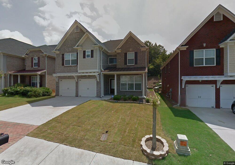
2831 Royston Dr Duluth, GA 30097
Estimated Value: $586,000 - $625,000
5
Beds
4
Baths
3,354
Sq Ft
$180/Sq Ft
Est. Value
About This Home
This home is located at 2831 Royston Dr, Duluth, GA 30097 and is currently estimated at $604,610, approximately $180 per square foot. 2831 Royston Dr is a home located in Gwinnett County with nearby schools including M. H. Mason Elementary School, Hull Middle School, and Peachtree Ridge High School.
Ownership History
Date
Name
Owned For
Owner Type
Purchase Details
Closed on
Dec 4, 2008
Sold by
Cwalt Inc Trust 2006 & Oc3
Bought by
Gharpure Shriram and Gharpure Vaishali
Current Estimated Value
Home Financials for this Owner
Home Financials are based on the most recent Mortgage that was taken out on this home.
Original Mortgage
$199,900
Interest Rate
6.1%
Mortgage Type
Stand Alone Second
Purchase Details
Closed on
Aug 5, 2008
Sold by
Yang Hyung S
Bought by
Cwalt Inc Trust 2006 & Oc3
Purchase Details
Closed on
Dec 14, 2005
Sold by
Hm Centex
Bought by
Yang Hyung S
Home Financials for this Owner
Home Financials are based on the most recent Mortgage that was taken out on this home.
Original Mortgage
$273,040
Interest Rate
7.5%
Mortgage Type
New Conventional
Create a Home Valuation Report for This Property
The Home Valuation Report is an in-depth analysis detailing your home's value as well as a comparison with similar homes in the area
Home Values in the Area
Average Home Value in this Area
Purchase History
| Date | Buyer | Sale Price | Title Company |
|---|---|---|---|
| Gharpure Shriram | $249,900 | -- | |
| Cwalt Inc Trust 2006 & Oc3 | $248,625 | -- | |
| Yang Hyung S | $341,300 | -- |
Source: Public Records
Mortgage History
| Date | Status | Borrower | Loan Amount |
|---|---|---|---|
| Previous Owner | Gharpure Shriram | $199,900 | |
| Previous Owner | Yang Hyung S | $273,040 |
Source: Public Records
Tax History
| Year | Tax Paid | Tax Assessment Tax Assessment Total Assessment is a certain percentage of the fair market value that is determined by local assessors to be the total taxable value of land and additions on the property. | Land | Improvement |
|---|---|---|---|---|
| 2025 | $1,509 | $248,200 | $36,000 | $212,200 |
| 2024 | $6,806 | $218,560 | $47,600 | $170,960 |
| 2023 | $6,806 | $223,480 | $40,000 | $183,480 |
| 2022 | $6,043 | $188,240 | $34,000 | $154,240 |
| 2021 | $4,763 | $145,200 | $26,000 | $119,200 |
| 2020 | $4,799 | $145,200 | $26,000 | $119,200 |
| 2019 | $4,489 | $136,200 | $26,000 | $110,200 |
| 2018 | $4,509 | $136,200 | $26,000 | $110,200 |
| 2016 | $3,574 | $108,080 | $20,800 | $87,280 |
| 2015 | $3,396 | $101,320 | $20,000 | $81,320 |
| 2014 | -- | $95,880 | $20,000 | $75,880 |
Source: Public Records
Map
Nearby Homes
- 3614 Clearbrooke Way
- 3706 Thornbrooke Ct
- 2643 Timberbrooke Place
- 3833 Stonecroft Place
- 3590 North St
- 3592 North St
- 2717 Kenwood Dr
- 2281 Bransley Place
- 3653 North St
- 3476 Flycatchers Way
- 3742 Terrah Point Dr
- 3742 Terrah Point Dr Unit 43
- 3476 Flycatcher Way
- 2572 Carnot Ct
- 3955 Longlake Dr
- 2382 Harpers Way
- 2569 Wynnton Dr
- 2711 Old Coach Rd
- 4105 Cavalier Way
- 4220 Cavalier Way
- 2821 Royston Dr
- 2841 Royston Dr
- 2851 Royston Dr
- 2811 Royston Dr
- 3507 Ashby Pond Ln
- 3497 Ashby Pond Ln
- 3517 Ashby Pond Ln
- 2820 Royston Dr
- 2861 Royston Dr
- 2801 Royston Dr
- 3527 Ashby Pond Ln
- 2830 Royston Dr
- 2840 Royston Dr
- 3547 Ashby Pond Ln
- 2810 Royston Dr
- 2870 Royston Dr
- 2791 Royston Dr
- 2871 Royston Dr
- 2800 Royston Dr
- 3557 Ashby Pond Ln
Your Personal Tour Guide
Ask me questions while you tour the home.