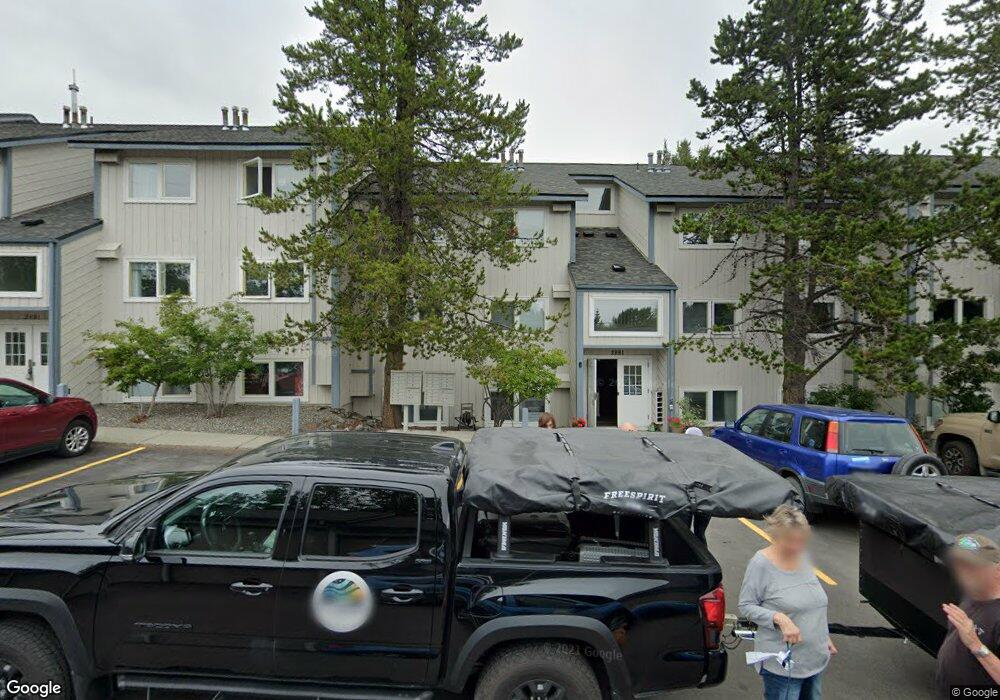
2831 W Intl Airport Rd Anchorage, AK 99502
Spenard NeighborhoodEstimated Value: $121,000 - $234,000
2
Beds
2
Baths
1,033
Sq Ft
$188/Sq Ft
Est. Value
About This Home
This home is located at 2831 W Intl Airport Rd, Anchorage, AK 99502 and is currently estimated at $194,315, approximately $188 per square foot. 2831 W Intl Airport Rd is a home located in Anchorage Municipality with nearby schools including Northwood Elementary School, Romig Middle School, and West High School.
Ownership History
Date
Name
Owned For
Owner Type
Purchase Details
Closed on
Dec 18, 2019
Sold by
Villanueva Florencio P
Bought by
Villanueva Florencio P
Current Estimated Value
Home Financials for this Owner
Home Financials are based on the most recent Mortgage that was taken out on this home.
Original Mortgage
$112,500
Outstanding Balance
$76,355
Interest Rate
3.6%
Mortgage Type
New Conventional
Estimated Equity
$117,960
Purchase Details
Closed on
Mar 9, 2018
Sold by
Creed John and Andrews Susan B
Bought by
Villanueva Florencio P
Home Financials for this Owner
Home Financials are based on the most recent Mortgage that was taken out on this home.
Original Mortgage
$131,920
Interest Rate
4.15%
Purchase Details
Closed on
Oct 13, 2010
Sold by
Tucker Shaun G
Bought by
Creed John and Andrews Susan B
Purchase Details
Closed on
Feb 5, 2007
Sold by
Seibert Brent E and Seibert Angela M
Bought by
Tucker Shaun G
Home Financials for this Owner
Home Financials are based on the most recent Mortgage that was taken out on this home.
Original Mortgage
$165,000
Interest Rate
9.5%
Purchase Details
Closed on
Jan 21, 2004
Sold by
Piaskowski Angela M
Bought by
Piaskowski Angela M and Seibert Brent E
Home Financials for this Owner
Home Financials are based on the most recent Mortgage that was taken out on this home.
Original Mortgage
$26,500
Interest Rate
5.86%
Purchase Details
Closed on
Dec 15, 2000
Sold by
Swalling Kate A and Slyker Kate A
Bought by
Piaskowski Angela M
Home Financials for this Owner
Home Financials are based on the most recent Mortgage that was taken out on this home.
Original Mortgage
$97,261
Interest Rate
7.67%
Mortgage Type
FHA
Purchase Details
Closed on
Jan 22, 1997
Sold by
Thompson Curtis Lee
Bought by
Swalling Kate A
Purchase Details
Closed on
Apr 27, 1989
Sold by
Federal National Mortgage Assn
Bought by
Cole Cheryl E
Home Financials for this Owner
Home Financials are based on the most recent Mortgage that was taken out on this home.
Original Mortgage
$44,000
Interest Rate
11.11%
Mortgage Type
Seller Take Back
Create a Home Valuation Report for This Property
The Home Valuation Report is an in-depth analysis detailing your home's value as well as a comparison with similar homes in the area
Home Values in the Area
Average Home Value in this Area
Purchase History
| Date | Buyer | Sale Price | Title Company |
|---|---|---|---|
| Villanueva Florencio P | -- | None Available | |
| Villanueva Florencio P | -- | None Available | |
| Creed John | -- | Atga | |
| Tucker Shaun G | -- | None Available | |
| Piaskowski Angela M | -- | First American Title Of Alas | |
| Piaskowski Angela M | -- | -- | |
| Swalling Kate A | -- | -- | |
| Swalling Kate A | -- | -- | |
| Cole Cheryl E | -- | -- | |
| Cole Cheryl E | -- | -- |
Source: Public Records
Mortgage History
| Date | Status | Borrower | Loan Amount |
|---|---|---|---|
| Open | Villanueva Florencio P | $112,500 | |
| Closed | Villanueva Florencio P | $131,920 | |
| Previous Owner | Tucker Shaun G | $165,000 | |
| Previous Owner | Piaskowski Angela M | $26,500 | |
| Previous Owner | Piaskowski Angela M | $97,261 | |
| Previous Owner | Cole Cheryl E | $44,000 | |
| Closed | Swalling Kate A | $0 |
Source: Public Records
Tax History Compared to Growth
Tax History
| Year | Tax Paid | Tax Assessment Tax Assessment Total Assessment is a certain percentage of the fair market value that is determined by local assessors to be the total taxable value of land and additions on the property. | Land | Improvement |
|---|---|---|---|---|
| 2025 | $1,777 | $229,300 | -- | $229,300 |
| 2024 | $1,777 | $183,400 | $0 | $183,400 |
| 2023 | $2,791 | $163,900 | $0 | $163,900 |
| 2022 | $2,011 | $149,300 | $0 | $149,300 |
| 2021 | $2,784 | $154,500 | $0 | $154,500 |
| 2020 | $2,033 | $149,700 | $0 | $149,700 |
| 2019 | $1,974 | $150,800 | $0 | $150,800 |
| 2018 | $2,370 | $144,500 | $0 | $144,500 |
| 2017 | $2,435 | $155,500 | $0 | $155,500 |
| 2016 | $2,482 | $172,900 | $0 | $172,900 |
| 2015 | $2,482 | $158,400 | $0 | $158,400 |
| 2014 | $2,482 | $154,700 | $0 | $154,700 |
Source: Public Records
Map
Nearby Homes
- 2815 W International Airport Rd Unit B104
- 2891 W Intl Airport Rd Unit C108
- 2808 Iris Dr
- 4302 Forrest Rd
- 2101 W 47th Ave
- 3333 Lakeshore Dr Unit 5
- 3333 Lakeshore Dr Unit 2
- NHN Northwood Dr
- 5000 Northwood Dr
- 2040 Wenmatt Cir
- 3913 Barbara Dr
- 4000 Iowa Dr
- 1808 W 47th Ave
- 2202 Lincoln Ave
- 6017 Collins Way
- 6305 Blackberry St
- 3900 Crosson Dr
- 3223 W 62nd Ave
- 6140 Collins Way
- 2105 Mckinley Ave
- 2831 W Intl Airport Rd
- 2831 W Intl Airport Rd
- 2831 W Intl Airport Rd
- 2831 W Intl Airport Rd
- 2831 W Intl Airport Rd
- 2831 W Intl Airport Rd
- 2831 W Intl Airport Rd
- 2831 W Intl Airport Rd
- 2831 W Intl Airport Rd
- 2831 W Intl Airport Rd
- 2831 W Intl Airport Rd
- 2831 W International Airport Rd Unit F303
- 2831 W International Airport Rd
- 2831 W International Airport Rd Unit F302
- 2831 W International Airport Rd Unit F304
- 2831 W International Airport Rd Unit F301
- 2831 W International Airport Rd Unit F103
- 2831 W International Airport Rd Unit F202
- 2831 W International Airport Rd Unit F203
- 2831 W International Airport Rd Unit F104