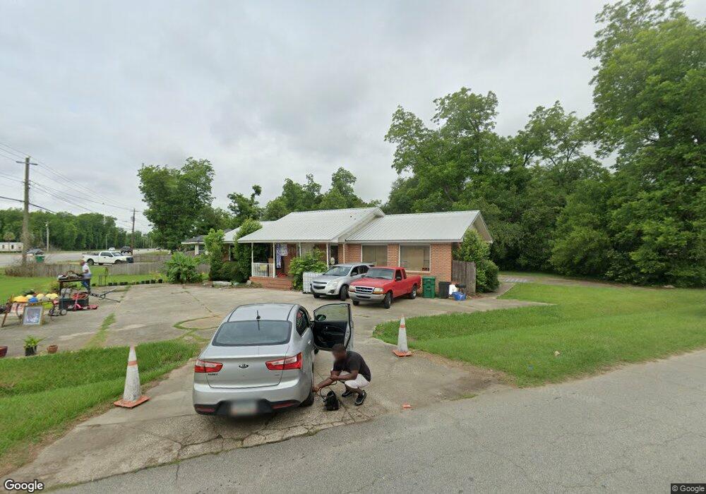
2833 Sylvester Rd Albany, GA 31705
Estimated Value: $68,000 - $89,000
3
Beds
2
Baths
1,592
Sq Ft
$51/Sq Ft
Est. Value
About This Home
This home is located at 2833 Sylvester Rd, Albany, GA 31705 and is currently estimated at $81,399, approximately $51 per square foot. 2833 Sylvester Rd is a home located in Dougherty County with nearby schools including Turner Elementary School, Albany Middle School, and Radium Springs Middle School.
Ownership History
Date
Name
Owned For
Owner Type
Purchase Details
Closed on
Mar 29, 2013
Sold by
Federal National Mortgage Association
Bought by
Smith Roger D
Current Estimated Value
Purchase Details
Closed on
Dec 10, 2012
Sold by
Navy Federal Credit Union
Bought by
Federal National Mortgage Association
Purchase Details
Closed on
Dec 4, 2012
Sold by
Jackson Ricky D
Bought by
Navy Federal Credit Union
Purchase Details
Closed on
Nov 4, 2004
Sold by
Mitchell Carol and Steve Mitchell
Bought by
Jackson Ricky D
Purchase Details
Closed on
Mar 3, 2000
Sold by
Mitchell Lawrence and Mitchell Carol
Bought by
Mitchell Lawrence and Mitchell Carol
Purchase Details
Closed on
Mar 21, 1977
Sold by
Weatherly Weatherly E and Weatherly Bev
Bought by
Mitchell Lawrence
Create a Home Valuation Report for This Property
The Home Valuation Report is an in-depth analysis detailing your home's value as well as a comparison with similar homes in the area
Home Values in the Area
Average Home Value in this Area
Purchase History
| Date | Buyer | Sale Price | Title Company |
|---|---|---|---|
| Smith Roger D | -- | -- | |
| Federal National Mortgage Association | -- | -- | |
| Federal National Mtg Associati | $50,037 | -- | |
| Navy Federal Credit Union | -- | -- | |
| Navy Federal Cr Un | $50,037 | -- | |
| Jackson Ricky D | $49,900 | -- | |
| Mitchell Lawrence | -- | -- | |
| Mitchell Lawrence | -- | -- |
Source: Public Records
Tax History Compared to Growth
Tax History
| Year | Tax Paid | Tax Assessment Tax Assessment Total Assessment is a certain percentage of the fair market value that is determined by local assessors to be the total taxable value of land and additions on the property. | Land | Improvement |
|---|---|---|---|---|
| 2024 | $1,122 | $23,520 | $2,000 | $21,520 |
| 2023 | $1,096 | $23,520 | $2,000 | $21,520 |
| 2022 | $1,100 | $23,520 | $2,000 | $21,520 |
| 2021 | $1,020 | $23,520 | $2,000 | $21,520 |
| 2020 | $1,022 | $23,520 | $2,000 | $21,520 |
| 2019 | $1,026 | $23,520 | $2,000 | $21,520 |
| 2018 | $1,030 | $23,520 | $2,000 | $21,520 |
| 2017 | $960 | $23,520 | $2,000 | $21,520 |
| 2016 | $960 | $23,520 | $2,000 | $21,520 |
| 2015 | $963 | $23,520 | $2,000 | $21,520 |
| 2014 | $951 | $23,520 | $2,000 | $21,520 |
Source: Public Records
Map
Nearby Homes
- 148 Force Dr
- 2731 Yorktown Ave
- 308 Forrestal Ln
- 2802 Banks Ave
- 3625 Sylvester Rd
- 2529 Cherokee Dr
- 2523 Cherokee Dr
- 100 Gurr Dr
- 410 Johnson Rd
- 513 Johnson Rd
- 0 Lumpkin St
- 234 Cone St
- 306 Elsom St
- 307 Acorn St
- 309 Acorn St
- 2006 Keystone Ave
- 2004 Keystone Ave
- 3431 Gladys Ct
- 2221 Duitman Rd
- 1618 Beverly Ave
- 2811 Sylvester Rd
- 2813 Sylvester Rd
- 101 Almond Dr
- 2901 Sylvester Rd
- 2809 Sylvester Rd
- 103 Almond Dr
- 106 Force Dr
- 105 Almond Dr
- 2903 Sylvester Rd
- 2807 Sylvester Rd
- 108 Force Dr
- 107 Almond Dr
- 2805 Sylvester Rd
- 110 Force Dr
- 100 Almond Dr
- 104 Almond Dr
- 109 Almond Dr
- 112 Force Dr
- 2803 Sylvester Rd
- 114 Force Dr