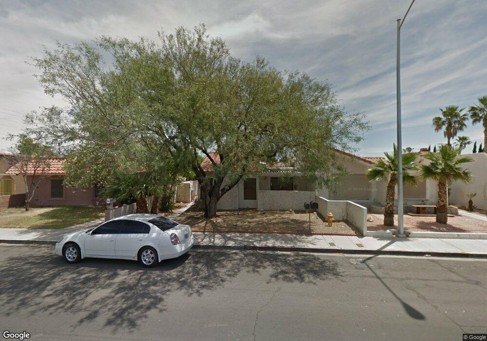
2834 Mohawk St Las Vegas, NV 89146
Estimated Value: $302,196 - $336,000
2
Beds
2
Baths
1,580
Sq Ft
$201/Sq Ft
Est. Value
About This Home
This home is located at 2834 Mohawk St, Las Vegas, NV 89146 and is currently estimated at $318,049, approximately $201 per square foot. 2834 Mohawk St is a home located in Clark County with nearby schools including Dr. C Owen Roundy Elementary School, Elaine Wynn Elementary School, and Kenny C Guinn Middle School.
Ownership History
Date
Name
Owned For
Owner Type
Purchase Details
Closed on
Jul 26, 2005
Sold by
Brown Florence L
Bought by
Ohm Todd A
Current Estimated Value
Home Financials for this Owner
Home Financials are based on the most recent Mortgage that was taken out on this home.
Original Mortgage
$196,000
Outstanding Balance
$98,439
Interest Rate
5.37%
Mortgage Type
Unknown
Estimated Equity
$219,610
Create a Home Valuation Report for This Property
The Home Valuation Report is an in-depth analysis detailing your home's value as well as a comparison with similar homes in the area
Purchase History
| Date | Buyer | Sale Price | Title Company |
|---|---|---|---|
| Ohm Todd A | $245,000 | Fidelity National Title |
Source: Public Records
Mortgage History
| Date | Status | Borrower | Loan Amount |
|---|---|---|---|
| Open | Ohm Todd A | $196,000 |
Source: Public Records
Tax History
| Year | Tax Paid | Tax Assessment Tax Assessment Total Assessment is a certain percentage of the fair market value that is determined by local assessors to be the total taxable value of land and additions on the property. | Land | Improvement |
|---|---|---|---|---|
| 2026 | $976 | $70,516 | $36,050 | $34,466 |
| 2025 | $948 | $67,493 | $32,200 | $35,293 |
| 2024 | $921 | $67,493 | $32,200 | $35,293 |
| 2023 | $921 | $59,762 | $26,250 | $33,512 |
| 2022 | $894 | $55,090 | $22,750 | $32,340 |
| 2021 | $868 | $49,837 | $22,750 | $27,087 |
| 2020 | $840 | $46,822 | $18,200 | $28,622 |
| 2019 | $815 | $42,814 | $14,000 | $28,814 |
| 2018 | $791 | $38,540 | $10,500 | $28,040 |
| 2017 | $1,142 | $38,928 | $10,500 | $28,428 |
| 2016 | $751 | $35,171 | $5,600 | $29,571 |
| 2015 | $748 | $34,950 | $5,600 | $29,350 |
| 2014 | $726 | $24,022 | $5,600 | $18,422 |
Source: Public Records
Map
Nearby Homes
- 5131 Tara Ave Unit K1
- 2821 Hauck St
- 5181 Eldora Ave
- 5048 Via de Palma Dr
- 5087 Eldora Ave Unit 3
- 2771 Eldora Cir
- 3040 Westwind Rd
- 2675 Westwind Rd
- 5610 Eldora Ave
- 5175 Palmyra Ave
- 5380 Jade Crystal Ave
- 3090 Westwind Rd
- 3155 Mountain Spring Rd
- 5151 Golden Spring Ave
- 2625 Westwind Rd
- 5030 Schumann Dr
- 0 Palmyra Unit 2747507
- 3214 Anacapa Way
- 3113 Black Forest Dr
- 5134 W Desert Inn Rd
- 2828 Mohawk St
- 2840 Mohawk St
- 2822 Mohawk St
- 2846 Mohawk St
- 5322 Taravilla Cir Unit O
- 5322 Taravilla Cir
- 5318 Taravilla Cir
- 5323 Tara Ave
- 2810 Mohawk St
- 5319 Tara Ave
- 5319 Tara Ave Unit none
- 5314 Taravilla Cir
- 2852 Mohawk St
- 5315 Tara Ave
- 5310 Taravilla Cir
- 2858 Mohawk St
- 5311 Tara Ave
- 5234 Monterey Park Cir
- 5238 Monterey Park Cir
- 2864 Mohawk St
Your Personal Tour Guide
Ask me questions while you tour the home.