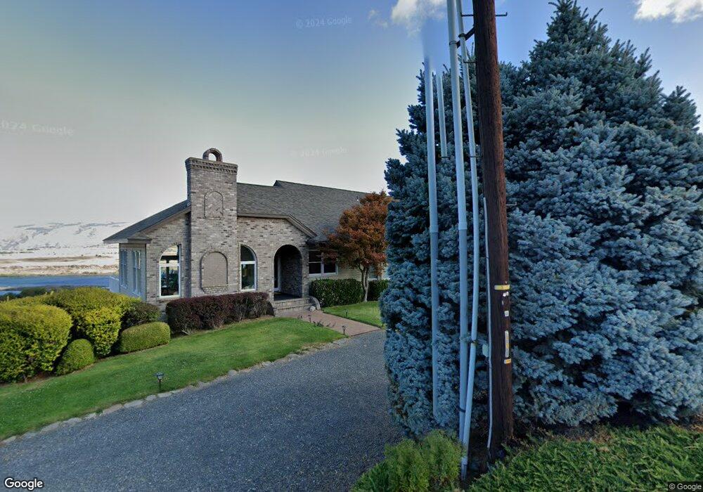
2835 E 10th St the Dalles, OR 97058
Estimated Value: $955,055
5
Beds
4
Baths
3,070
Sq Ft
$311/Sq Ft
Est. Value
About This Home
This home is located at 2835 E 10th St, the Dalles, OR 97058 and is currently estimated at $955,055, approximately $311 per square foot. 2835 E 10th St is a home located in Wasco County with nearby schools including Dry Hollow Elementary School, The Dalles Middle School, and The Dalles High School.
Ownership History
Date
Name
Owned For
Owner Type
Purchase Details
Closed on
Feb 13, 2023
Sold by
Gingrich Gary A and Gingrich Terri J
Bought by
Gingrich Living Trust
Current Estimated Value
Purchase Details
Closed on
Jan 30, 2023
Sold by
Gingrich Gary A and Gingrich Terri J
Bought by
Gingrich Living Trust
Create a Home Valuation Report for This Property
The Home Valuation Report is an in-depth analysis detailing your home's value as well as a comparison with similar homes in the area
Home Values in the Area
Average Home Value in this Area
Purchase History
| Date | Buyer | Sale Price | Title Company |
|---|---|---|---|
| Gingrich Living Trust | -- | -- | |
| Gingrich Living Trust | -- | -- |
Source: Public Records
Tax History Compared to Growth
Tax History
| Year | Tax Paid | Tax Assessment Tax Assessment Total Assessment is a certain percentage of the fair market value that is determined by local assessors to be the total taxable value of land and additions on the property. | Land | Improvement |
|---|---|---|---|---|
| 2024 | $13,076 | $726,447 | -- | -- |
| 2023 | $12,695 | $705,289 | $0 | $0 |
| 2022 | $12,412 | $130,475 | $0 | $0 |
| 2021 | $11,583 | $126,675 | $0 | $0 |
| 2020 | $9,811 | $122,985 | $0 | $0 |
| 2019 | $13,146 | $119,403 | $0 | $0 |
| 2018 | $12,781 | $645,440 | $0 | $0 |
| 2017 | $10,968 | $626,641 | $0 | $0 |
| 2016 | $10,871 | $608,389 | $0 | $0 |
| 2015 | $9,377 | $533,480 | $0 | $0 |
| 2014 | $11,391 | $564,552 | $0 | $0 |
Source: Public Records
Map
Nearby Homes
- 2803 E 12th St
- 2718 E 2nd St
- 936 Richmond St
- 3103 Fremont St
- 2444 E 10th St
- 2545 E 18th St
- 2318 E 13th St
- 500 E Knoll Ct
- 512 E Knoll Ct
- 192 Honeysuckle Ln
- 112 Southshore Ave
- 2205 E 9th St
- 1700 Lone Pine Blvd
- 125 Southshore Ln
- 122 123 Southshore Ln
- 155 Southshore Ave
- 1500 Lone Pine Blvd
- 1400 Lone Pine Blvd
- 240 Lone Pine Ln Unit 2
- 1300 Lone Pine Blvd