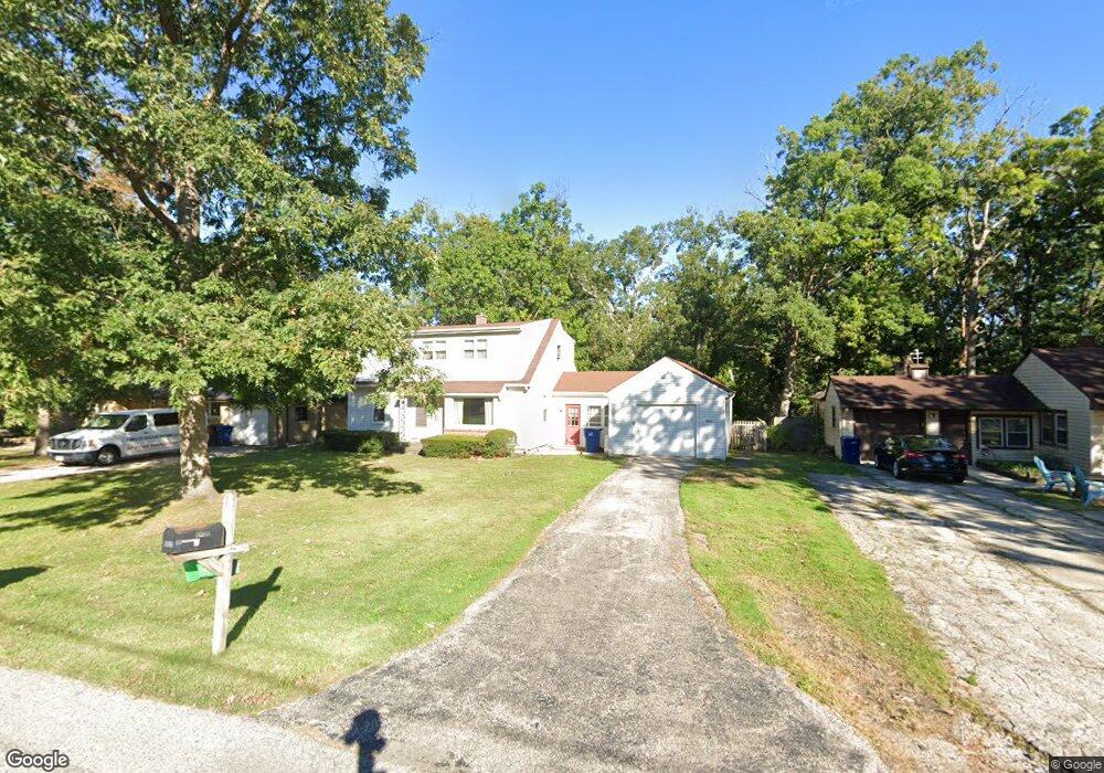
2835 W Bonnie Brook Ln Waukegan, IL 60087
Bonnie Brook NeighborhoodEstimated Value: $247,000 - $320,000
4
Beds
2
Baths
2,036
Sq Ft
$142/Sq Ft
Est. Value
About This Home
This home is located at 2835 W Bonnie Brook Ln, Waukegan, IL 60087 and is currently estimated at $288,119, approximately $141 per square foot. 2835 W Bonnie Brook Ln is a home located in Lake County with nearby schools including H R McCall Elementary School, Jack Benny Middle School, and Waukegan High School.
Ownership History
Date
Name
Owned For
Owner Type
Purchase Details
Closed on
Dec 10, 1993
Sold by
Hewitt Michael E and Lord Penelope J
Bought by
Hewitt Michael E and Hewitt Penelope J
Current Estimated Value
Home Financials for this Owner
Home Financials are based on the most recent Mortgage that was taken out on this home.
Original Mortgage
$80,000
Interest Rate
7.25%
Create a Home Valuation Report for This Property
The Home Valuation Report is an in-depth analysis detailing your home's value as well as a comparison with similar homes in the area
Home Values in the Area
Average Home Value in this Area
Purchase History
| Date | Buyer | Sale Price | Title Company |
|---|---|---|---|
| Hewitt Michael E | -- | Chicago Title Insurance Co |
Source: Public Records
Mortgage History
| Date | Status | Borrower | Loan Amount |
|---|---|---|---|
| Closed | Hewitt Michael E | $80,000 |
Source: Public Records
Tax History Compared to Growth
Tax History
| Year | Tax Paid | Tax Assessment Tax Assessment Total Assessment is a certain percentage of the fair market value that is determined by local assessors to be the total taxable value of land and additions on the property. | Land | Improvement |
|---|---|---|---|---|
| 2024 | $5,797 | $78,323 | $13,859 | $64,464 |
| 2023 | $4,644 | $69,473 | $12,499 | $56,974 |
| 2022 | $4,644 | $53,508 | $11,852 | $41,656 |
| 2021 | $4,778 | $51,825 | $10,392 | $41,433 |
| 2020 | $4,793 | $48,281 | $9,681 | $38,600 |
| 2019 | $4,771 | $44,242 | $8,871 | $35,371 |
| 2018 | $5,155 | $46,250 | $12,162 | $34,088 |
| 2017 | $4,967 | $40,918 | $10,760 | $30,158 |
| 2016 | $3,935 | $31,465 | $8,274 | $23,191 |
| 2015 | $3,744 | $28,161 | $7,405 | $20,756 |
| 2014 | $3,889 | $28,527 | $8,051 | $20,476 |
| 2012 | $5,040 | $30,906 | $8,722 | $22,184 |
Source: Public Records
Map
Nearby Homes
- 3101 Country Club Ln
- 12312 W Audrey Ave
- 2613 N Lewis Ave
- 2708 Dana Ave
- 3211 Rugby Ct
- 2705 Dana Ave
- 1612 Whitney St
- 1636 Rice St
- 2350 N Lewis Ave
- 2713 Varonen Ave
- 36955 N Garrick Ave
- 37966 N Cornell Rd
- 3411 N Lewis Ave
- 3032 W Vermont Ave
- 36245 N Green Bay Rd
- 3320 Sunset Ave
- 1913 Chippewa Rd
- 2928 W Country Club Ave
- 3000 W Country Club Ave
- 2946 W Country Club Ave
- 2829 W Bonnie Brook Ln
- 2841 W Bonnie Brook Ln
- 2425 N Bonnie Brook Ln Unit W
- 2823 W Bonnie Brook Ln
- 2836 Forest Ln
- 2830 Forest Ln
- 2848 Forest Ln
- 2842 W Bonnie Brook Ln
- 2817 W Bonnie Brook Ln
- 2824 Forest Ln
- 2420 N Bonnie Brook Ln Unit W
- 2836 W Bonnie Brook Ln
- 2818 Forest Ln
- 2830 W Bonnie Brook Ln
- 2818 W Bonnie Brook Ln
- 2811 W Bonnie Brook Ln
- 2515 N Bonnie Brook Ln Unit W
- 2824 W Bonnie Brook Ln
- 2410 N Bonnie Brook Ln Unit W
- 2911 W Bonnie Brook Ln