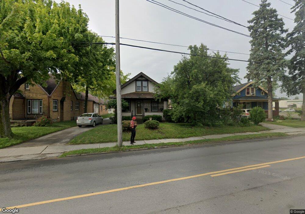
2837 Airport Hwy Toledo, OH 43609
Southside NeighborhoodEstimated Value: $89,000 - $101,000
3
Beds
1
Bath
1,386
Sq Ft
$69/Sq Ft
Est. Value
About This Home
This home is located at 2837 Airport Hwy, Toledo, OH 43609 and is currently estimated at $96,267, approximately $69 per square foot. 2837 Airport Hwy is a home located in Lucas County with nearby schools including Burroughs Elementary School, Bowsher High School, and Explorers Academy of Science and Technology.
Ownership History
Date
Name
Owned For
Owner Type
Purchase Details
Closed on
Feb 27, 2025
Sold by
Zuber Thomas S
Bought by
Twps Investments Llc
Current Estimated Value
Purchase Details
Closed on
Aug 21, 2024
Sold by
Dahar Braheem
Bought by
Zuber Thomas
Purchase Details
Closed on
Apr 16, 2021
Sold by
Jones Holly
Bought by
Dahar Braheem
Purchase Details
Closed on
Jul 22, 2014
Sold by
Tasbury Properties Llc
Bought by
Dahar Braheem and Jones Holly
Purchase Details
Closed on
Mar 20, 2012
Sold by
Lamak Llc
Bought by
Tasbury Properties Llc
Purchase Details
Closed on
Oct 3, 2011
Sold by
Adka Properties Ltd
Bought by
Lamak Llc
Purchase Details
Closed on
Jun 23, 2010
Sold by
Fannie Mae
Bought by
Adka Properties Ltd
Purchase Details
Closed on
Jul 16, 2009
Sold by
Boudrie Joseph D
Bought by
Federal National Mortgage Association
Create a Home Valuation Report for This Property
The Home Valuation Report is an in-depth analysis detailing your home's value as well as a comparison with similar homes in the area
Home Values in the Area
Average Home Value in this Area
Purchase History
| Date | Buyer | Sale Price | Title Company |
|---|---|---|---|
| Twps Investments Llc | -- | None Listed On Document | |
| Zuber Thomas | $9,500 | None Listed On Document | |
| Dahar Braheem | -- | None Available | |
| Dahar Braheem | $23,900 | None Available | |
| Tasbury Properties Llc | -- | Attorney | |
| Lamak Llc | -- | None Available | |
| Adka Properties Ltd | $19,500 | Accutitle Agency Inc | |
| Federal National Mortgage Association | $46,000 | None Available |
Source: Public Records
Tax History Compared to Growth
Tax History
| Year | Tax Paid | Tax Assessment Tax Assessment Total Assessment is a certain percentage of the fair market value that is determined by local assessors to be the total taxable value of land and additions on the property. | Land | Improvement |
|---|---|---|---|---|
| 2024 | $3,853 | $21,105 | $6,615 | $14,490 |
| 2023 | $1,748 | $21,455 | $4,760 | $16,695 |
| 2022 | $2,316 | $21,455 | $4,760 | $16,695 |
| 2021 | $1,457 | $21,455 | $4,760 | $16,695 |
| 2020 | $1,568 | $20,475 | $4,515 | $15,960 |
| 2019 | $1,522 | $20,475 | $4,515 | $15,960 |
| 2018 | $1,544 | $20,475 | $4,515 | $15,960 |
| 2017 | $1,566 | $20,020 | $4,410 | $15,610 |
| 2016 | $2,636 | $57,200 | $12,600 | $44,600 |
| 2015 | $1,557 | $57,200 | $12,600 | $44,600 |
| 2014 | $1,941 | $20,020 | $4,410 | $15,610 |
| 2013 | $1,294 | $20,020 | $4,410 | $15,610 |
Source: Public Records
Map
Nearby Homes
- 2828 South Ave
- 2437 Airport Hwy
- 546 Elmdale Rd
- 663 Foredale Ave
- 728 Foredale Ave
- 560 Williamsville Ave
- 569 Apple Ave
- 541 Apple Ave
- 2332 Airline Ave
- 552 Wyman St
- 518 Myers St
- 321 Mayberry St
- 838 Wylie Ave
- 440 Somerset St
- 1351 Bensch Dr
- 226 Somerset St
- 531 Shasta Dr
- 940 Francis Ave
- 1022 National Ave
- 224 S Fearing Blvd
- 2833 Airport Hwy
- 2843 Airport Hwy
- 622 Barclay Dr
- 605 Barclay Dr
- 2820 Airport
- 626 Barclay Dr
- 2821 Airport Hwy
- 611 Barclay Dr
- 630 Barclay Dr
- 2817 Airport Hwy
- 617 Barclay Dr
- 621 Barclay Dr
- 634 Barclay Dr
- 625 Barclay Dr
- 2809 Airport Hwy
- 629 Barclay Dr
- 640 Barclay Dr
- 633 Barclay Dr
- 2805 Airport Hwy
- 637 Barclay Dr