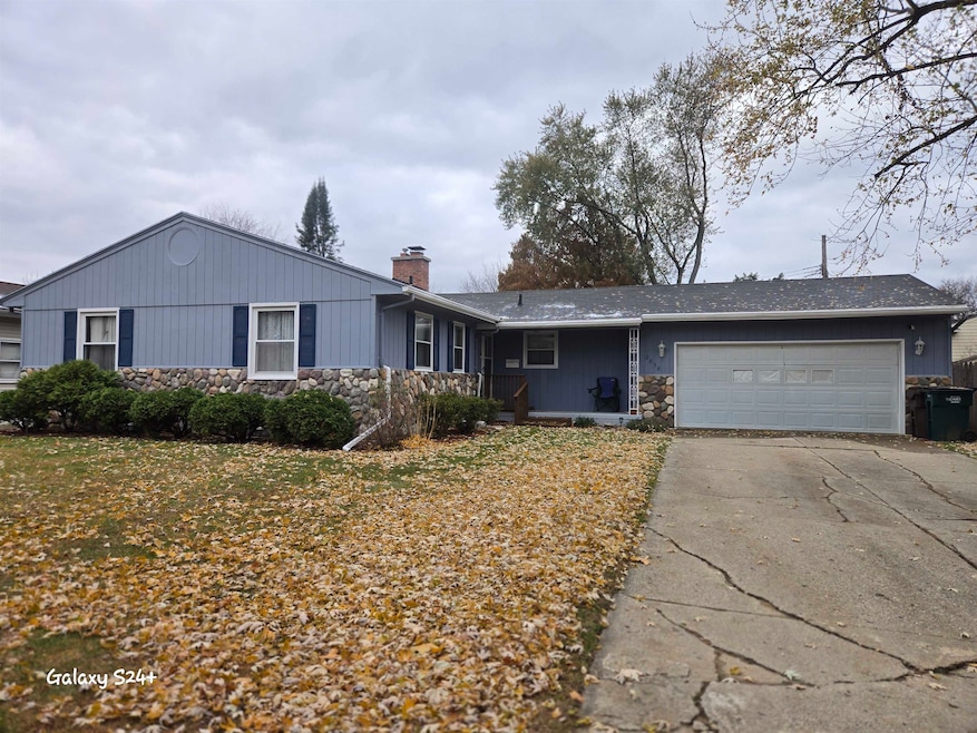
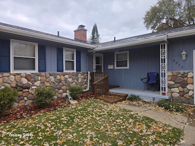
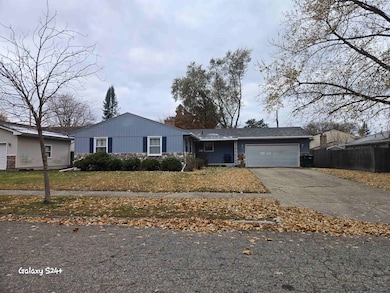
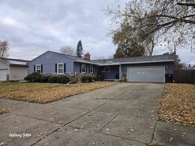
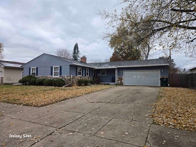
2838 Sunderland Rd Lansing, MI 48911
Averill Woods NeighborhoodEstimated payment $1,615/month
Highlights
- Traditional Architecture
- 1-Story Property
- Wood Siding
- 2 Car Attached Garage
- Forced Air Heating and Cooling System
- Gas Fireplace
About This Home
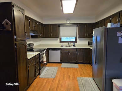
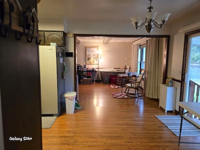
Spacious 3 bedroom, 3 bath ranch in Lansing offering a comfortable and functional layout. Home features a large family room plus a separate living room, providing ample space for daily living and entertaining. The unfinished basement includes a full bath and offers outstanding potential for additional living space or future customization. Basement refrigerator to remain with the property. Home is being sold as-is.
Home Details
Home Type
- Single Family
Est. Annual Taxes
Year Built
- Built in 1971
Lot Details
- 80 Ft Wide Lot
Parking
- 2 Car Attached Garage
Home Design
- Traditional Architecture
- Wood Siding
- Vinyl Siding
Interior Spaces
- 1,512 Sq Ft Home
- 1-Story Property
- Gas Fireplace
- Family Room with Fireplace
- Basement
Bedrooms and Bathrooms
- 3 Bedrooms
- 3 Full Bathrooms
Utilities
- Forced Air Heating and Cooling System
- Heating System Uses Natural Gas
Community Details
- Scotsdale Subdivision
Listing and Financial Details
- Assessor Parcel Number 33-01-01-30-302-111
Map
Home Values in the Area
Average Home Value in this Area
Tax History
| Year | Tax Paid | Tax Assessment Tax Assessment Total Assessment is a certain percentage of the fair market value that is determined by local assessors to be the total taxable value of land and additions on the property. | Land | Improvement |
|---|---|---|---|---|
| 2025 | $4,132 | $108,400 | $15,000 | $93,400 |
| 2024 | $33 | $94,800 | $15,000 | $79,800 |
| 2023 | $3,872 | $87,700 | $15,000 | $72,700 |
| 2022 | $3,488 | $81,600 | $13,200 | $68,400 |
| 2021 | $3,415 | $79,900 | $12,800 | $67,100 |
| 2020 | $3,395 | $77,600 | $12,800 | $64,800 |
| 2019 | $3,256 | $68,900 | $12,800 | $56,100 |
| 2018 | $3,049 | $62,500 | $12,800 | $49,700 |
| 2017 | $2,919 | $62,500 | $12,800 | $49,700 |
| 2016 | $2,792 | $55,200 | $12,800 | $42,400 |
| 2015 | $2,792 | $51,100 | $25,600 | $25,500 |
| 2014 | $2,792 | $50,100 | $25,600 | $24,500 |
Property History
| Date | Event | Price | List to Sale | Price per Sq Ft |
|---|---|---|---|---|
| 11/26/2025 11/26/25 | For Sale | $240,000 | -- | $159 / Sq Ft |
Purchase History
| Date | Type | Sale Price | Title Company |
|---|---|---|---|
| Warranty Deed | $92,800 | Bell Title Company | |
| Warranty Deed | $135,000 | Midstate Title Co |
Mortgage History
| Date | Status | Loan Amount | Loan Type |
|---|---|---|---|
| Open | $63,300 | New Conventional | |
| Previous Owner | $128,250 | Purchase Money Mortgage |
Source: Michigan Multiple Listing Service
MLS Number: 50195133
APN: 01-01-30-302-111
Disclaimer: Certain information contained herein is derived from information provided by parties other than Homes.com. All information provided is deemed reliable, but is not guaranteed to be accurate and should be independently verified.
![]() Source MLS: MiRealSource
Source MLS: MiRealSource
Provided through IDX via MiRealSource. Courtesy of MiRealSource Shareholder. Copyright MiRealSource.
The information published and disseminated by MiRealSource is communicated verbatim, without change by MiRealSource, as filed with MiRealSource by its members. The accuracy of all information, regardless of source, is not guaranteed or warranted. All information should be independently verified.
Copyright 2025 MiRealSource. All rights reserved. The information provided hereby constitutes proprietary information of MiRealSource, Inc. and its shareholders, affiliates and licensees and may not be reproduced or transmitted in any form or by any means, electronic or mechanical, including photocopy, recording, scanning or any information storage and retrieval system, without written permission from MiRealSource, Inc.
- 3510 Christine Dr
- 3600 Sandhurst Dr
- 3425 Cooley Dr
- 3421 Troon Cir Unit 29
- 2710 Bedford Rd
- 3614 Cooley Dr
- 4.5 Locust Ln
- 3200 Lawdor Rd
- 2905 S Catherine St
- 3811 Cooley Dr
- 3508 Muirfield Dr
- 2 Locust Ln
- 2800 S Waverly Hwy
- 3601 Muirfield Dr
- 0 S Deerfield Ave
- 3701 Starlight Ln
- 3700 W Holmes Rd
- 3212 Ingham St
- 2201 Pamela Place
- 2200 Rossiter Place
- 2801-2815 Mersey Ln
- 3215 W Mount Hope Ave
- 3965 Hunters Ridge Dr
- 3313 W Mount Hope Ave
- 3334 Pleasant Grove Rd
- 3601-3620 Richmond St
- 2009 W Holmes Rd
- 4709 Stillwell Ave
- 1815 Potomac Cir
- 1300 W Barnes Ave
- 1016 Kelsey Ave
- 4030 Hartford Rd
- 1856 S Rundle Ave
- 1509 W Jolly Rd
- 300 Western Ave
- 312 S Rosemary St Unit 312
- 4512 Burchfield Ave
- 221 S Rosemary Ave
- 201 S Waverly Rd
- 4137 W Michigan Ave
