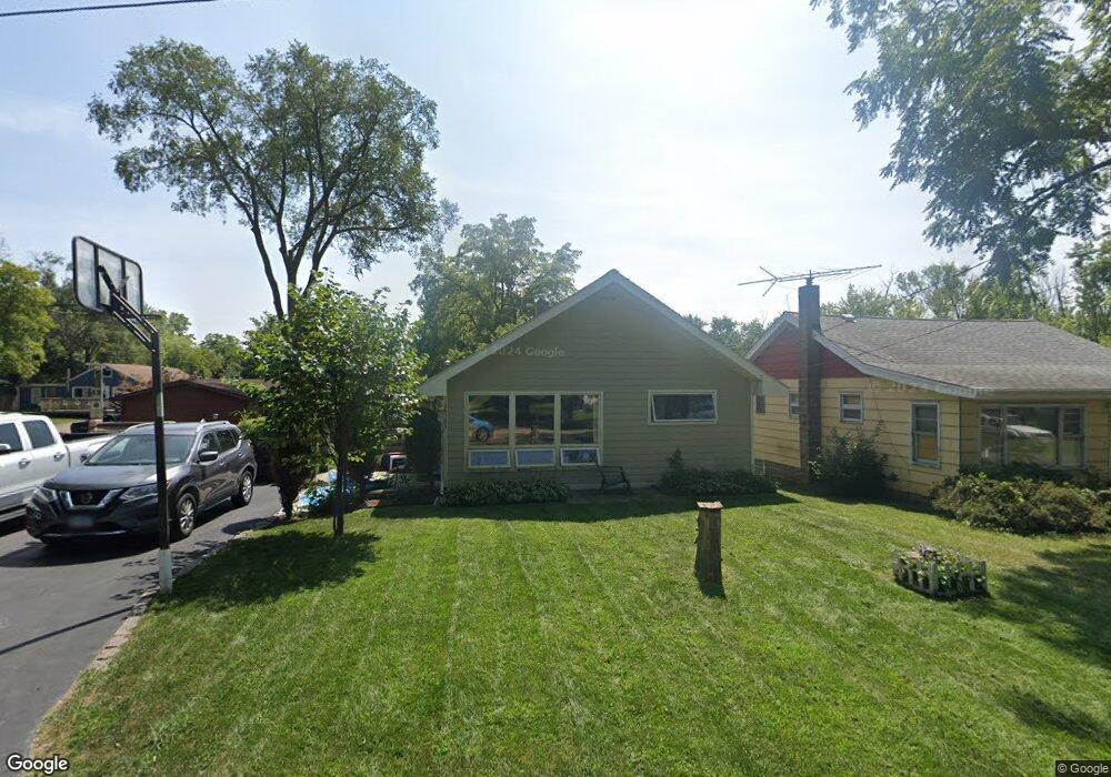
28383 W Maple Ave Wauconda, IL 60084
Slocum Lake NeighborhoodEstimated Value: $115,000 - $238,000
--
Bed
1
Bath
912
Sq Ft
$208/Sq Ft
Est. Value
About This Home
This home is located at 28383 W Maple Ave, Wauconda, IL 60084 and is currently estimated at $189,839, approximately $208 per square foot. 28383 W Maple Ave is a home located in Lake County with nearby schools including Cotton Creek School, Matthews Middle School, and Wauconda High School.
Ownership History
Date
Name
Owned For
Owner Type
Purchase Details
Closed on
Feb 8, 2022
Sold by
Henry P Harms Trust
Bought by
Duncanson Dakota
Current Estimated Value
Home Financials for this Owner
Home Financials are based on the most recent Mortgage that was taken out on this home.
Original Mortgage
$125,000
Interest Rate
3.75%
Mortgage Type
New Conventional
Purchase Details
Closed on
Sep 13, 2008
Sold by
Duncanson Richard A and Duncanson Patricia J
Bought by
Harms Henry P and The Henry P Harms Trust
Purchase Details
Closed on
Feb 3, 1999
Sold by
Duncanson James E and Duncanson Jeanne M
Bought by
Duncanson Richard A and Duncanson Patricia J
Create a Home Valuation Report for This Property
The Home Valuation Report is an in-depth analysis detailing your home's value as well as a comparison with similar homes in the area
Home Values in the Area
Average Home Value in this Area
Purchase History
| Date | Buyer | Sale Price | Title Company |
|---|---|---|---|
| Duncanson Dakota | $150,000 | Wifler Law Group Pc | |
| Harms Henry P | $152,000 | Attorneys Title Guaranty Fun | |
| Duncanson Richard A | -- | -- |
Source: Public Records
Mortgage History
| Date | Status | Borrower | Loan Amount |
|---|---|---|---|
| Previous Owner | Duncanson Dakota | $125,000 |
Source: Public Records
Tax History Compared to Growth
Tax History
| Year | Tax Paid | Tax Assessment Tax Assessment Total Assessment is a certain percentage of the fair market value that is determined by local assessors to be the total taxable value of land and additions on the property. | Land | Improvement |
|---|---|---|---|---|
| 2024 | $2,192 | $29,416 | $2,767 | $26,649 |
| 2023 | $2,047 | $26,888 | $2,529 | $24,359 |
| 2022 | $2,047 | $22,607 | $1,883 | $20,724 |
| 2021 | $1,963 | $21,361 | $1,779 | $19,582 |
| 2020 | $1,903 | $20,360 | $1,696 | $18,664 |
| 2019 | $1,669 | $19,242 | $1,603 | $17,639 |
| 2018 | $1,779 | $18,571 | $1,902 | $16,669 |
| 2017 | $1,774 | $18,356 | $1,880 | $16,476 |
| 2016 | $1,691 | $17,382 | $1,780 | $15,602 |
| 2015 | $1,624 | $15,957 | $1,634 | $14,323 |
| 2014 | $2,712 | $22,721 | $5,724 | $16,997 |
| 2012 | $2,619 | $27,626 | $5,476 | $22,150 |
Source: Public Records
Map
Nearby Homes
- 26822 N Ada St
- 26769 N Genesee St
- 26814 N Genesee St
- 26605 N Brooks St
- 28373 W Main St
- 28379 W Main St
- 28490 W Main St
- 26824 N Poplar St
- 26958 N Ellen St
- 28406 W Park Ave
- 1102 Noble Pkwy
- 28965 W Roberts Rd
- 29460 Roberts Rd
- 327 Garrison Cir
- 515 Normandy Ln
- 26215 N Geraldine Ln
- 108 Poplar St
- 27125 N Williams Park Rd
- 4410 Shooting Star Ct
- 27405 N Roberts Ln
- 28401 W Maple Ave
- 28375 W Maple Ave
- 28421 W Maple Ave
- 26757 N Bernice St
- 28367 W Maple Ave
- 28351 W Maple Ave
- 28350 W Maple Ave
- 26775 N Bernice St
- 28433 W Maple Ave
- 26781 N Bernice St
- 26780 N Bernice St
- 28329 W Maple Ave
- 28335 W Maple Ave
- 26781 N Ellen St
- 26775 N Ada St
- 26781 N Ada St
- 26803 N Ellen St
- 2620 N Wisteria Ct
- 26794 N Ellen St
- 26768 N Morey St