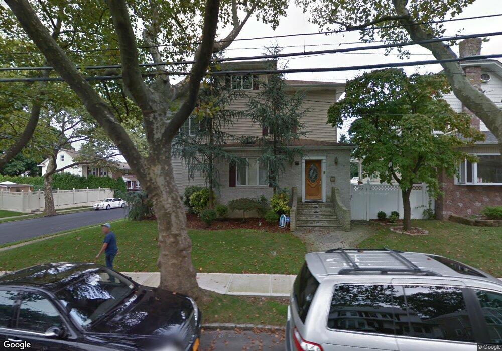
284 Edison St Staten Island, NY 10306
New Dorp NeighborhoodEstimated Value: $873,857 - $1,237,000
2
Beds
1
Bath
1,436
Sq Ft
$694/Sq Ft
Est. Value
About This Home
This home is located at 284 Edison St, Staten Island, NY 10306 and is currently estimated at $996,714, approximately $694 per square foot. 284 Edison St is a home located in Richmond County with nearby schools including P.S. 41 The Stephanie a Vierno School, Is 2 George L Egbert, and New Dorp High School.
Ownership History
Date
Name
Owned For
Owner Type
Purchase Details
Closed on
Nov 21, 2024
Sold by
Deguida Aniello
Bought by
Deguida Family Trust and Deguida
Current Estimated Value
Purchase Details
Closed on
May 19, 2004
Sold by
Dellasalla Steven and Dellasalla Lauren
Bought by
Deguida Aniello and Raffone Deguida Lisa
Home Financials for this Owner
Home Financials are based on the most recent Mortgage that was taken out on this home.
Original Mortgage
$300,000
Interest Rate
6.08%
Mortgage Type
Purchase Money Mortgage
Create a Home Valuation Report for This Property
The Home Valuation Report is an in-depth analysis detailing your home's value as well as a comparison with similar homes in the area
Home Values in the Area
Average Home Value in this Area
Purchase History
| Date | Buyer | Sale Price | Title Company |
|---|---|---|---|
| Deguida Family Trust | -- | None Listed On Document | |
| Deguida Aniello | $625,000 | -- |
Source: Public Records
Mortgage History
| Date | Status | Borrower | Loan Amount |
|---|---|---|---|
| Previous Owner | Deguida Aniello | $300,000 |
Source: Public Records
Tax History Compared to Growth
Tax History
| Year | Tax Paid | Tax Assessment Tax Assessment Total Assessment is a certain percentage of the fair market value that is determined by local assessors to be the total taxable value of land and additions on the property. | Land | Improvement |
|---|---|---|---|---|
| 2025 | $8,192 | $68,460 | $8,107 | $60,353 |
| 2024 | $8,204 | $57,000 | $9,236 | $47,764 |
| 2023 | $7,712 | $39,798 | $8,543 | $31,255 |
| 2022 | $7,242 | $55,140 | $12,480 | $42,660 |
| 2021 | $7,497 | $48,000 | $12,480 | $35,520 |
| 2020 | $7,549 | $49,260 | $12,480 | $36,780 |
| 2019 | $7,061 | $49,260 | $12,480 | $36,780 |
| 2018 | $6,463 | $33,165 | $8,666 | $24,499 |
| 2017 | $6,108 | $31,431 | $9,671 | $21,760 |
| 2016 | $5,864 | $30,885 | $11,554 | $19,331 |
| 2015 | $5,317 | $30,885 | $8,646 | $22,239 |
| 2014 | $5,317 | $29,296 | $8,475 | $20,821 |
Source: Public Records
Map
Nearby Homes
- 155 Burbank Ave
- 240 Otis Ave
- 257 Locust Ave
- 164 Burbank Ave
- 84 Bryant Ave
- 157 Clawson St
- 75 Jacques Ave
- 217 Bancroft Ave
- 297 Otis Ave
- 77 Burbank Ave
- 142 Fremont Ave
- 24 Bancroft Ave
- 86 Fremont Ave
- 20 8th St
- 79 Cloister Place
- 20 8 St
- 32 Otis Ave
- 78 Cloister Place
- 210 Lincoln Ave
- 145 Lincoln Ave Unit 4F