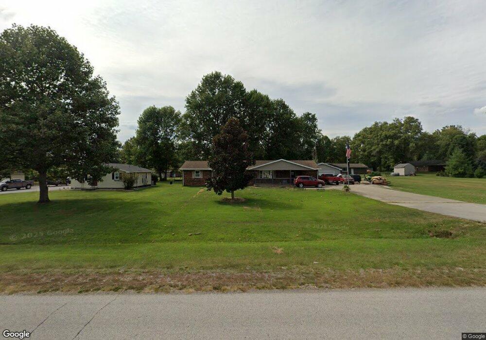
2840 Highway 69 N New Harmony, IN 47631
Estimated Value: $227,000 - $292,000
4
Beds
2
Baths
1,783
Sq Ft
$140/Sq Ft
Est. Value
About This Home
This home is located at 2840 Highway 69 N, New Harmony, IN 47631 and is currently estimated at $249,213, approximately $139 per square foot. 2840 Highway 69 N is a home located in Posey County with nearby schools including Mount Vernon Junior High School and Mount Vernon High School.
Ownership History
Date
Name
Owned For
Owner Type
Purchase Details
Closed on
Mar 11, 2019
Sold by
Spencer Frederick D and Spencer Doris Y
Bought by
Whitehead Glen E
Current Estimated Value
Home Financials for this Owner
Home Financials are based on the most recent Mortgage that was taken out on this home.
Original Mortgage
$135,800
Outstanding Balance
$119,391
Interest Rate
4.4%
Mortgage Type
New Conventional
Estimated Equity
$129,822
Create a Home Valuation Report for This Property
The Home Valuation Report is an in-depth analysis detailing your home's value as well as a comparison with similar homes in the area
Home Values in the Area
Average Home Value in this Area
Purchase History
| Date | Buyer | Sale Price | Title Company |
|---|---|---|---|
| Whitehead Glen E | -- | None Available |
Source: Public Records
Mortgage History
| Date | Status | Borrower | Loan Amount |
|---|---|---|---|
| Open | Whitehead Glen E | $135,800 |
Source: Public Records
Tax History Compared to Growth
Tax History
| Year | Tax Paid | Tax Assessment Tax Assessment Total Assessment is a certain percentage of the fair market value that is determined by local assessors to be the total taxable value of land and additions on the property. | Land | Improvement |
|---|---|---|---|---|
| 2024 | $1,298 | $176,100 | $22,500 | $153,600 |
| 2023 | $1,175 | $165,300 | $22,500 | $142,800 |
| 2022 | $1,094 | $152,000 | $20,800 | $131,200 |
| 2021 | $1,057 | $146,500 | $10,100 | $136,400 |
| 2020 | $1,029 | $142,500 | $9,900 | $132,600 |
| 2019 | $335 | $140,600 | $9,400 | $131,200 |
| 2018 | $329 | $135,300 | $9,400 | $125,900 |
| 2017 | $322 | $132,900 | $9,500 | $123,400 |
| 2016 | $316 | $129,000 | $9,500 | $119,500 |
| 2014 | $318 | $123,400 | $7,500 | $115,900 |
| 2013 | $318 | $122,700 | $7,500 | $115,200 |
Source: Public Records
Map
Nearby Homes
- 825 Steam Mill St
- 305 Steammill St
- 1202 Freeman Ln
- 518 Turner Rd
- 2829 Springfield Rd
- 5100 Haines Rd
- 4703 Romaine Rd
- 2812 Oliver Springfield Rd
- 5151 Valeah Dr
- 336 Co Rd 1980e
- 2450 Kihn Ln
- 4621 Meadow Ln
- 7346 Main St
- 4307 Blackford Rd E
- 212 S Main St
- 6401 High School Rd
- 128 S Main St
- 2000 Stierley Rd N
- 3200 Nation Rd
- 5351 Cumberland Ct
- 2840 Indiana 69
- 2830 Highway 69 N
- 200 Loren Dr
- 2820 Indiana 69
- 2819 John Ave
- 2820 Highway 69 N
- 2901 John Ave
- 2829 John Ave
- 2827 John Ave
- 218 Loren Dr
- 218 Loren Dr Unit 2
- 201 Loren Dr
- 2840 John Ave
- 2900 John Ave
- Lots 27 & 28 Loren Dr
- 301 Loren Dr
- 251 Old Sand Rd
- 2901 Loren Dr Unit 2903
- 2901 Loren Dr
- 300 Old Sand Rd