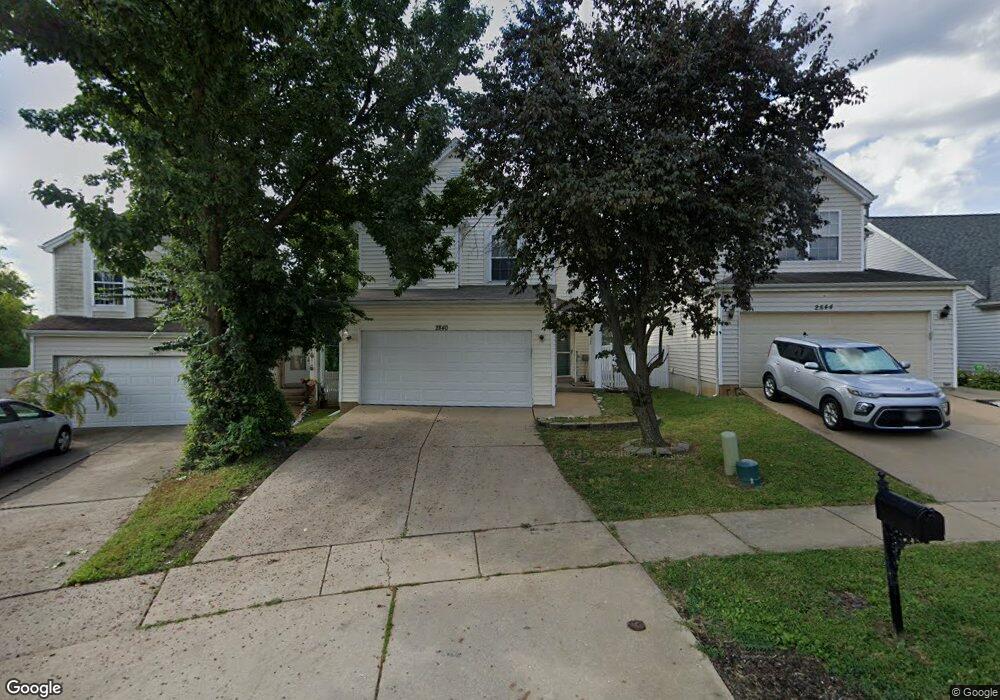
2840 Liberty Landing Ct Florissant, MO 63033
Estimated Value: $165,000 - $219,000
3
Beds
3
Baths
1,078
Sq Ft
$173/Sq Ft
Est. Value
About This Home
This home is located at 2840 Liberty Landing Ct, Florissant, MO 63033 and is currently estimated at $186,328, approximately $172 per square foot. 2840 Liberty Landing Ct is a home located in St. Louis County with nearby schools including Jury Elementary School, Central Middle School, and Hazelwood Central High School.
Ownership History
Date
Name
Owned For
Owner Type
Purchase Details
Closed on
Jan 17, 2002
Sold by
Townson Betty
Bought by
Anderson William
Current Estimated Value
Home Financials for this Owner
Home Financials are based on the most recent Mortgage that was taken out on this home.
Original Mortgage
$92,800
Interest Rate
8.37%
Purchase Details
Closed on
Sep 28, 2000
Sold by
Hud
Bought by
Anderson William and Townson Betty
Home Financials for this Owner
Home Financials are based on the most recent Mortgage that was taken out on this home.
Original Mortgage
$77,600
Interest Rate
7.99%
Purchase Details
Closed on
Jun 22, 2000
Sold by
Streeter Weldon B and Streeter Petra C
Bought by
Delmar Financial Company
Create a Home Valuation Report for This Property
The Home Valuation Report is an in-depth analysis detailing your home's value as well as a comparison with similar homes in the area
Home Values in the Area
Average Home Value in this Area
Purchase History
| Date | Buyer | Sale Price | Title Company |
|---|---|---|---|
| Anderson William | $4,500 | -- | |
| Anderson William | $80,000 | -- | |
| Delmar Financial Company | $98,194 | -- | |
| Hud | -- | -- |
Source: Public Records
Mortgage History
| Date | Status | Borrower | Loan Amount |
|---|---|---|---|
| Previous Owner | Anderson William | $92,800 | |
| Previous Owner | Anderson William | $77,600 |
Source: Public Records
Tax History Compared to Growth
Tax History
| Year | Tax Paid | Tax Assessment Tax Assessment Total Assessment is a certain percentage of the fair market value that is determined by local assessors to be the total taxable value of land and additions on the property. | Land | Improvement |
|---|---|---|---|---|
| 2025 | $2,354 | $28,720 | $1,630 | $27,090 |
| 2024 | $2,354 | $25,800 | $2,280 | $23,520 |
| 2023 | $2,346 | $25,800 | $2,280 | $23,520 |
| 2022 | $2,237 | $21,870 | $2,930 | $18,940 |
| 2021 | $2,118 | $21,870 | $2,930 | $18,940 |
| 2020 | $1,904 | $18,280 | $1,290 | $16,990 |
| 2019 | $1,873 | $18,280 | $1,290 | $16,990 |
| 2018 | $1,751 | $15,790 | $1,290 | $14,500 |
| 2017 | $1,749 | $15,790 | $1,290 | $14,500 |
| 2016 | $1,301 | $11,490 | $1,290 | $10,200 |
| 2015 | $1,272 | $11,490 | $1,290 | $10,200 |
| 2014 | $1,125 | $10,090 | $3,000 | $7,090 |
Source: Public Records
Map
Nearby Homes
- 11129 Old Halls Ferry Rd
- 11565 Mehl Ave
- 11540 Lares Dr
- 4401 Rhine Dr
- 4384 Remus Dr
- 2628 Hadden Dr
- 4461 Rhine Dr
- 4471 Rhine Dr
- 4497 Rhine Dr
- 11008 Saginaw Dr
- 1749 Foley Dr
- 11015 Landseer Dr
- 11790 New Halls Ferry Rd
- 4950 Patricia Ridge Dr
- 11100 Landseer Dr
- 11636 MacRinus Dr
- 4493 Caracalla Dr
- 2571 Burchard Dr
- 4354 Metarus Dr
- 2559 Burchard Dr
- 2844 Liberty Landing Ct
- 2836 Liberty Landing Ct
- 2848 Liberty Landing Ct
- 2832 Liberty Landing Ct
- 2852 Liberty Landing Ct
- 2824 Liberty Landing Ct
- 2856 Liberty Landing Ct
- 2845 Liberty Landing Ct
- 2849 Liberty Landing Ct
- 2820 Liberty Landing Ct
- 2860 Liberty Landing Ct
- 2853 Liberty Landing Ct
- 2817 Liberty Landing Ct
- 2857 Liberty Landing Ct
- 2864 Liberty Landing Ct
- 2816 Liberty Landing Ct
- 2812 Liberty Landing Ct
- 2861 Liberty Landing Ct
- 2870 Liberty Landing Ct
- 2813 Liberty Landing Ct