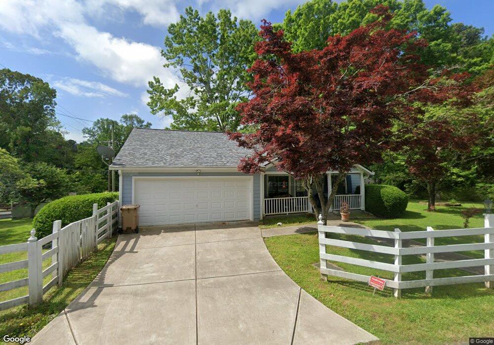
2840 Magnolia Ave Cumming, GA 30041
Lake Lanier NeighborhoodEstimated Value: $348,000 - $470,000
3
Beds
2
Baths
1,414
Sq Ft
$280/Sq Ft
Est. Value
About This Home
This home is located at 2840 Magnolia Ave, Cumming, GA 30041 and is currently estimated at $395,467, approximately $279 per square foot. 2840 Magnolia Ave is a home located in Forsyth County with nearby schools including Chattahoochee Elementary School, Little Mill Middle School, and Cornerstone Schools.
Ownership History
Date
Name
Owned For
Owner Type
Purchase Details
Closed on
Jul 27, 2006
Sold by
Johnson David
Bought by
Lequier Susan
Current Estimated Value
Purchase Details
Closed on
Dec 19, 2003
Sold by
Murray and Murray Fritts Virginia
Bought by
Johnson David
Home Financials for this Owner
Home Financials are based on the most recent Mortgage that was taken out on this home.
Original Mortgage
$141,978
Interest Rate
5.87%
Mortgage Type
VA
Purchase Details
Closed on
Nov 24, 1993
Sold by
Garrett Tony and Garrett Teresa
Bought by
Strauss Oscar R and Strauss Cheryl T
Home Financials for this Owner
Home Financials are based on the most recent Mortgage that was taken out on this home.
Original Mortgage
$75,499
Interest Rate
6.75%
Create a Home Valuation Report for This Property
The Home Valuation Report is an in-depth analysis detailing your home's value as well as a comparison with similar homes in the area
Home Values in the Area
Average Home Value in this Area
Purchase History
| Date | Buyer | Sale Price | Title Company |
|---|---|---|---|
| Lequier Susan | $171,000 | -- | |
| Johnson David | $143,100 | -- | |
| Strauss Oscar R | $37,500 | -- |
Source: Public Records
Mortgage History
| Date | Status | Borrower | Loan Amount |
|---|---|---|---|
| Previous Owner | Johnson David | $141,978 | |
| Previous Owner | Strauss Oscar R | $75,499 |
Source: Public Records
Tax History Compared to Growth
Tax History
| Year | Tax Paid | Tax Assessment Tax Assessment Total Assessment is a certain percentage of the fair market value that is determined by local assessors to be the total taxable value of land and additions on the property. | Land | Improvement |
|---|---|---|---|---|
| 2025 | $387 | $172,068 | $54,000 | $118,068 |
| 2024 | $387 | $148,524 | $48,000 | $100,524 |
| 2023 | $309 | $160,652 | $43,200 | $117,452 |
| 2022 | $395 | $94,000 | $24,000 | $70,000 |
| 2021 | $372 | $94,000 | $24,000 | $70,000 |
| 2020 | $367 | $87,932 | $18,600 | $69,332 |
| 2019 | $370 | $87,984 | $19,200 | $68,784 |
| 2018 | $357 | $65,912 | $16,000 | $49,912 |
| 2017 | $365 | $66,612 | $16,000 | $50,612 |
| 2016 | $359 | $62,612 | $12,000 | $50,612 |
| 2015 | $351 | $56,612 | $6,000 | $50,612 |
| 2014 | $322 | $51,500 | $6,000 | $45,500 |
Source: Public Records
Map
Nearby Homes
- 2730 Lakeridge Dr
- 2850 Winchester Dr
- 2675 Pilgrim Mill Rd
- 0 Capri Dr Unit 7609330
- 0 Capri Dr Unit 10557045
- 0 Capri Dr Unit 7573660
- 2590 Impala Dr
- 0 Continental Dr Unit 10620531
- 2260 Pilgrim Mill Rd
- 2570 Jaguar St
- 2310 Fleetwood Dr
- 3210 Continental Dr
- 0 Fleetwood Dr Unit 10577871
- 0 Fleetwood Dr Unit 7624025
- 2865 Imperial Dr
- 3445 Strawberry Ln
- 0 Imperial Dr Unit 10555771
- 0 Imperial Dr Unit 7608242
- 3740 Duckcove Way
- 2610 Fleetwood Dr
- 2920 Lakeside Dr
- 2850 Browne Cir
- 2810 Magnolia Ave
- 2815 Winchester Dr
- 2820 Browne Cir
- 2845 Magnolia Ave
- 2840 Browne Cir
- 2905 Lakeside Dr
- 2825 Winchester Dr
- 2930 Lakeside Dr
- 2855 Magnolia Ave
- 2925 Lakeside Dr
- 2805 Magnolia Ave
- 2905 Magnolia Ave
- 0 Magnolia Ave
- 3010 Magnolia Ave
- 2835 Winchester Dr
- 2940 Lakeside Dr
- 2810 Winchester Dr
- 2820 Winchester Dr