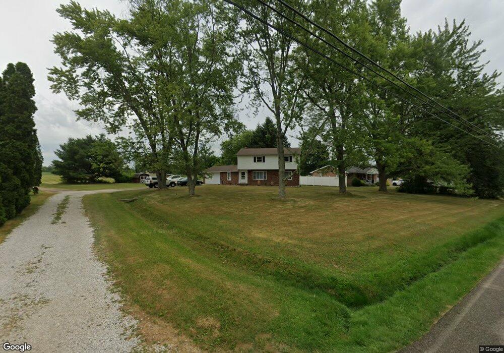
2840 S Nickelplate St Louisville, OH 44641
Estimated Value: $230,352 - $287,000
4
Beds
3
Baths
1,838
Sq Ft
$144/Sq Ft
Est. Value
About This Home
This home is located at 2840 S Nickelplate St, Louisville, OH 44641 and is currently estimated at $265,338, approximately $144 per square foot. 2840 S Nickelplate St is a home located in Stark County with nearby schools including Louisville High School and St. Thomas Aquinas High School & Middle School.
Ownership History
Date
Name
Owned For
Owner Type
Purchase Details
Closed on
Jan 9, 2020
Sold by
Ring Joyce Elaine Maynor
Bought by
Broache Daniel S and Broache Lizbeth
Current Estimated Value
Home Financials for this Owner
Home Financials are based on the most recent Mortgage that was taken out on this home.
Original Mortgage
$133,000
Outstanding Balance
$117,511
Interest Rate
3.6%
Mortgage Type
New Conventional
Estimated Equity
$147,827
Purchase Details
Closed on
Sep 26, 2006
Sold by
Estate Of Woodrow T Ring
Bought by
Ring Joyce Elaine Maynor
Create a Home Valuation Report for This Property
The Home Valuation Report is an in-depth analysis detailing your home's value as well as a comparison with similar homes in the area
Home Values in the Area
Average Home Value in this Area
Purchase History
| Date | Buyer | Sale Price | Title Company |
|---|---|---|---|
| Broache Daniel S | $140,000 | None Available | |
| Ring Joyce Elaine Maynor | -- | None Available |
Source: Public Records
Mortgage History
| Date | Status | Borrower | Loan Amount |
|---|---|---|---|
| Open | Broache Daniel S | $133,000 |
Source: Public Records
Tax History Compared to Growth
Tax History
| Year | Tax Paid | Tax Assessment Tax Assessment Total Assessment is a certain percentage of the fair market value that is determined by local assessors to be the total taxable value of land and additions on the property. | Land | Improvement |
|---|---|---|---|---|
| 2025 | -- | $70,250 | $15,750 | $54,500 |
| 2024 | -- | $70,250 | $15,750 | $54,500 |
| 2023 | $2,274 | $46,770 | $12,780 | $33,990 |
| 2022 | $2,280 | $46,770 | $12,780 | $33,990 |
| 2021 | $2,286 | $46,770 | $12,780 | $33,990 |
| 2020 | $1,296 | $36,720 | $11,520 | $25,200 |
| 2019 | $1,277 | $36,720 | $11,520 | $25,200 |
| 2018 | $1,291 | $36,720 | $11,520 | $25,200 |
| 2017 | $1,125 | $31,890 | $8,610 | $23,280 |
| 2016 | $1,100 | $31,890 | $8,610 | $23,280 |
| 2015 | $1,097 | $31,890 | $8,610 | $23,280 |
| 2014 | $1,079 | $29,690 | $8,020 | $21,670 |
| 2013 | $537 | $29,690 | $8,020 | $21,670 |
Source: Public Records
Map
Nearby Homes
- 8225 Georgetown St
- 2425 Miday Ave NE
- 908 Sand Lot Cir
- 3390 Meese Rd NE
- 1702 View Pointe Ave
- 1990 Belfort Ave
- 1639 Horizon Dr
- 6969 Georgetown St NE
- 2110 Edmar St
- 641 S Nickelplate St
- 520 S Silver St
- 1715 High St
- 728 E Broad St
- 1812 E Broad St
- 510 S Bauman Ct
- 204 E Broad St
- 308 Superior St
- 107 E Broad St
- 6416 15th St NE
- 0 Maplebrook St NE
- 2840 Nickel Plate Ave NE
- 2820 S Nickelplate St
- 2880 S Nickelplate St
- 2800 S Nickelplate St
- 2835 S Nickelplate St
- 2791 S Nickelplate St
- 2780 S Nickelplate St
- 8055 Georgetown St
- 8075 Georgetown St
- 2867 S Nickelplate St
- 2910 S Nickelplate St
- 8095 Georgetown St
- 8133 Georgetown St
- 2859 S Nickelplate St
- 8115 Georgetown St
- 7980 Georgetown St
- 8032 Georgetown St
- 8151 Georgetown St
- 8118 Georgetown St
- 8118 Georgetown St