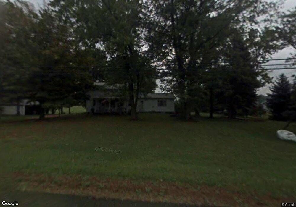
2840 State Route 44 Rootstown, OH 44272
Estimated Value: $207,438 - $315,000
3
Beds
1
Bath
1,473
Sq Ft
$169/Sq Ft
Est. Value
About This Home
This home is located at 2840 State Route 44, Rootstown, OH 44272 and is currently estimated at $248,860, approximately $168 per square foot. 2840 State Route 44 is a home located in Portage County with nearby schools including Rootstown Middle School - Schnee Building and Rootstown High School.
Ownership History
Date
Name
Owned For
Owner Type
Purchase Details
Closed on
Apr 17, 2017
Sold by
Ebie Flora Mae
Bought by
Ebie Ronald James
Current Estimated Value
Purchase Details
Closed on
Mar 25, 2004
Sold by
Wells Fargo Bank Minnesota Na
Bought by
Ebie Ray and Ebie Flora
Purchase Details
Closed on
Oct 15, 2003
Sold by
Ebie Ronald
Bought by
Wells Fargo Bank Minnesota Na and Ocwen Home Equity Loan Asset Backed Cert
Purchase Details
Closed on
Sep 13, 1985
Bought by
Ebie Ronald J
Create a Home Valuation Report for This Property
The Home Valuation Report is an in-depth analysis detailing your home's value as well as a comparison with similar homes in the area
Purchase History
| Date | Buyer | Sale Price | Title Company |
|---|---|---|---|
| Ebie Ronald James | -- | None Available | |
| Ebie Ray | $140,000 | Magee Title Agency | |
| Wells Fargo Bank Minnesota Na | $70,000 | -- | |
| Ebie Ronald J | $37,000 | -- |
Source: Public Records
Tax History
| Year | Tax Paid | Tax Assessment Tax Assessment Total Assessment is a certain percentage of the fair market value that is determined by local assessors to be the total taxable value of land and additions on the property. | Land | Improvement |
|---|---|---|---|---|
| 2025 | $1,587 | $46,900 | $22,750 | $24,150 |
| 2024 | $1,954 | $46,900 | $22,750 | $24,150 |
| 2023 | $1,634 | $34,800 | $20,060 | $14,740 |
| 2022 | $1,608 | $34,800 | $20,060 | $14,740 |
| 2021 | $1,602 | $34,800 | $20,060 | $14,740 |
| 2020 | $1,511 | $31,610 | $19,110 | $12,500 |
| 2019 | $1,516 | $31,610 | $19,110 | $12,500 |
| 2018 | $1,620 | $32,130 | $20,300 | $11,830 |
| 2017 | $1,620 | $32,130 | $20,300 | $11,830 |
| 2016 | $1,586 | $32,130 | $20,300 | $11,830 |
| 2015 | $1,604 | $32,130 | $20,300 | $11,830 |
| 2014 | $1,634 | $32,130 | $20,300 | $11,830 |
| 2013 | $1,623 | $32,130 | $20,300 | $11,830 |
Source: Public Records
Map
Nearby Homes
- 3021 Hartville Rd
- 3637 Old Forge Rd
- 3701 State Route 44
- 3689 Cherry Hill
- 4958 Bassett Rd
- 3583 Randolph Rd
- 3080 Saxe Rd
- 4324 Abbey Ln
- 0 Waterloo Rd
- 1583 Ohio 44
- 4079 Siefer Dr
- 3981 March Creek Ln Unit 37
- 4200 Hattrick Rd
- V/L 2 Lynn Rd
- V/L Lynn Rd
- 4415 Farmette Dr
- 4556 Rootstown Rd
- 1026 Hartville Rd N
- sub lot Lane Ave
- 4087 Industry
- 2824 State Route 44
- 2845 State Route 44
- 2800 State Route 44
- 2872 State Route 44
- 4193 Wilkes Rd
- 4169 Wilkes Rd
- 2887 State Route 44
- 4205 Wilkes Rd
- 2888 State Route 44
- 2892 State Route 44
- 2762 State Route 44
- 4771 Wilkes Rd
- 2905 State Route 44
- 2791 State Route 44
- 4124 Wilkes Rd
- 4178 Wilkes Rd
- 2926 State Route 44
- 4158 Wilkes Rd
- 2775 Ohio 44
- 4235 Wilkes Rd
Your Personal Tour Guide
Ask me questions while you tour the home.