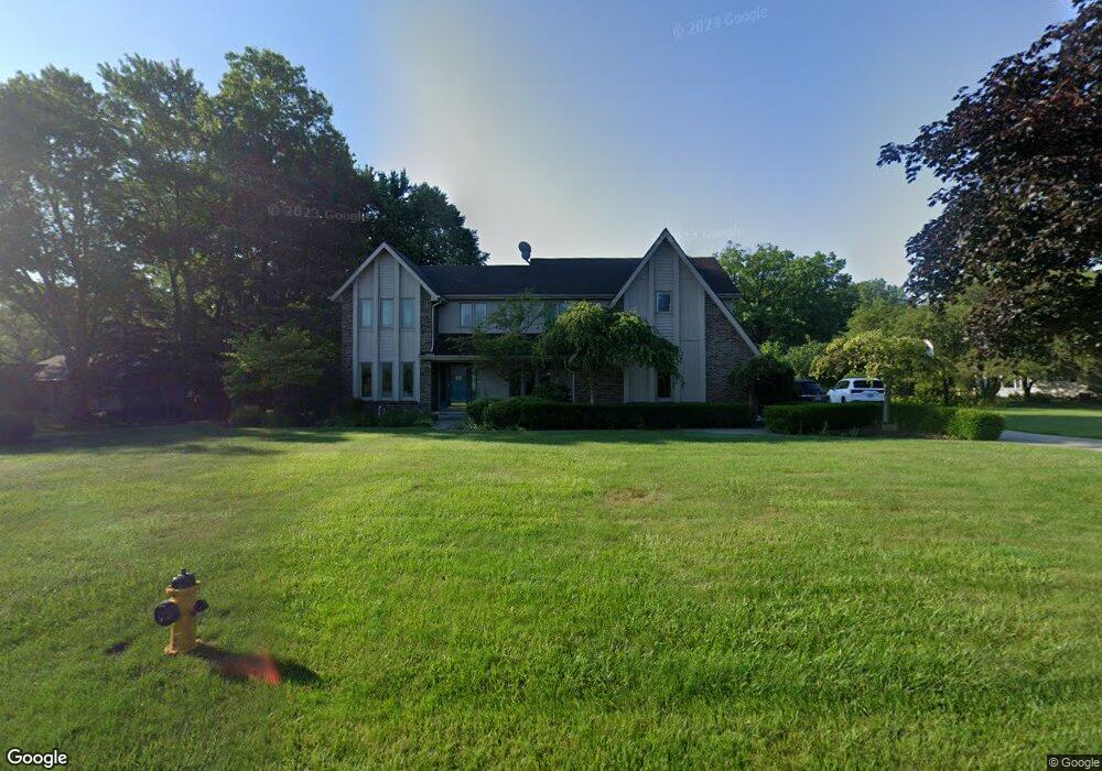
2841 Byrnwyck W Maumee, OH 43537
Estimated Value: $395,000 - $422,193
4
Beds
4
Baths
2,897
Sq Ft
$139/Sq Ft
Est. Value
About This Home
This home is located at 2841 Byrnwyck W, Maumee, OH 43537 and is currently estimated at $403,298, approximately $139 per square foot. 2841 Byrnwyck W is a home located in Lucas County with nearby schools including Holloway Elementary School, Springfield Middle School, and Springfield High School.
Ownership History
Date
Name
Owned For
Owner Type
Purchase Details
Closed on
May 10, 2001
Sold by
Ohm Bryan F & Christine E Trs
Bought by
Durrani Abdul N and Durrani Khalida
Current Estimated Value
Home Financials for this Owner
Home Financials are based on the most recent Mortgage that was taken out on this home.
Original Mortgage
$272,950
Outstanding Balance
$103,578
Interest Rate
7.25%
Estimated Equity
$299,720
Purchase Details
Closed on
May 3, 1994
Sold by
Ohm Bryan F and Ohm Christine E
Purchase Details
Closed on
May 2, 1989
Sold by
Throop Thomas J and Throop Diane B
Create a Home Valuation Report for This Property
The Home Valuation Report is an in-depth analysis detailing your home's value as well as a comparison with similar homes in the area
Home Values in the Area
Average Home Value in this Area
Purchase History
| Date | Buyer | Sale Price | Title Company |
|---|---|---|---|
| Durrani Abdul N | $265,000 | Louisville Title Agency For | |
| -- | -- | -- | |
| -- | $225,000 | -- |
Source: Public Records
Mortgage History
| Date | Status | Borrower | Loan Amount |
|---|---|---|---|
| Open | Durrani Abdul N | $272,950 |
Source: Public Records
Tax History Compared to Growth
Tax History
| Year | Tax Paid | Tax Assessment Tax Assessment Total Assessment is a certain percentage of the fair market value that is determined by local assessors to be the total taxable value of land and additions on the property. | Land | Improvement |
|---|---|---|---|---|
| 2024 | $3,942 | $131,145 | $29,050 | $102,095 |
| 2023 | $7,486 | $108,955 | $27,300 | $81,655 |
| 2022 | $7,488 | $108,955 | $27,300 | $81,655 |
| 2021 | $7,036 | $108,955 | $27,300 | $81,655 |
| 2020 | $6,747 | $94,780 | $22,820 | $71,960 |
| 2019 | $6,588 | $94,780 | $22,820 | $71,960 |
| 2018 | $6,489 | $94,780 | $22,820 | $71,960 |
| 2017 | $6,092 | $81,690 | $24,465 | $57,225 |
| 2016 | $6,148 | $233,400 | $69,900 | $163,500 |
| 2015 | $6,137 | $233,400 | $69,900 | $163,500 |
| 2014 | $5,512 | $78,540 | $23,520 | $55,020 |
| 2013 | $5,512 | $78,540 | $23,520 | $55,020 |
Source: Public Records
Map
Nearby Homes
- 6716 Embassy Ct Unit 8
- 2945 Byrnwyck W
- 6696 Embassy Ct Unit C11
- 6965 Fenwyck Rd Unit 6965
- 6627 Embassy Ct Unit I38
- 7040 Country Creek Rd
- 6652 Sue Ln
- 6705 Garden Rd Unit 6705
- 3008 Pleasant Hill Rd
- 6833 Greentree Ln
- 6917 Greentree Ln
- 6667 Echo Valley
- 3339 Swan Ridge Ln
- 2425 Winding Creek Dr
- 6524 Glenhurst Dr
- 6602 W Meadows Ln
- 6608 W Meadows Ln
- 3360 Stillwater Blvd
- 7407 Lock Mill Ct
- 2910 Setter Point Dr
- 2821 Byrnwyck W
- 2857 Byrnwyck W
- 2834 Byrnwyck W
- 2838 Byrnwyck W
- 2915 Plumbrook Dr
- 2809 Byrnwyck W
- 2865 Byrnwyck W
- 2923 Plumbrook Dr
- 2850 Byrnwyck W
- 2860 Byrnwyck W
- 2931 Plumbrook Dr
- 2757 Byrnwyck W
- 2928 Plumbrook Dr
- 2904 Plumbrook Dr
- 2914 Plumbrook Dr
- 2743 Byrnwyck W
- 2937 Plumbrook Dr
- 6744 Embassy Ct Unit A1
- 2910 Byrnwyck W
- 6740 Embassy Ct Unit A2