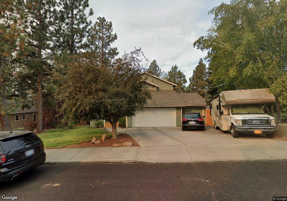
2841 NW Polarstar Ave Bend, OR 97701
Summit West NeighborhoodEstimated Value: $960,000 - $1,180,000
3
Beds
3
Baths
2,335
Sq Ft
$456/Sq Ft
Est. Value
About This Home
This home is located at 2841 NW Polarstar Ave, Bend, OR 97701 and is currently estimated at $1,065,789, approximately $456 per square foot. 2841 NW Polarstar Ave is a home located in Deschutes County with nearby schools including High Lakes Elementary School, Pacific Crest Middle School, and Summit High School.
Ownership History
Date
Name
Owned For
Owner Type
Purchase Details
Closed on
Feb 26, 2004
Sold by
Ivy Jesse K
Bought by
Bryson Robert Lyndon
Current Estimated Value
Home Financials for this Owner
Home Financials are based on the most recent Mortgage that was taken out on this home.
Original Mortgage
$244,000
Outstanding Balance
$111,888
Interest Rate
5.62%
Mortgage Type
Unknown
Estimated Equity
$953,901
Create a Home Valuation Report for This Property
The Home Valuation Report is an in-depth analysis detailing your home's value as well as a comparison with similar homes in the area
Home Values in the Area
Average Home Value in this Area
Purchase History
| Date | Buyer | Sale Price | Title Company |
|---|---|---|---|
| Bryson Robert Lyndon | $305,000 | Amerititle |
Source: Public Records
Mortgage History
| Date | Status | Borrower | Loan Amount |
|---|---|---|---|
| Open | Bryson Robert Lyndon | $244,000 | |
| Closed | Bryson Robert Lyndon | $30,500 |
Source: Public Records
Tax History Compared to Growth
Tax History
| Year | Tax Paid | Tax Assessment Tax Assessment Total Assessment is a certain percentage of the fair market value that is determined by local assessors to be the total taxable value of land and additions on the property. | Land | Improvement |
|---|---|---|---|---|
| 2025 | $6,656 | $393,960 | -- | -- |
| 2024 | $6,404 | $382,490 | -- | -- |
| 2023 | $5,937 | $371,350 | $0 | $0 |
| 2022 | $5,539 | $350,040 | $0 | $0 |
| 2021 | $5,547 | $339,850 | $0 | $0 |
| 2020 | $5,263 | $339,850 | $0 | $0 |
| 2019 | $5,116 | $329,960 | $0 | $0 |
| 2018 | $4,972 | $320,350 | $0 | $0 |
| 2017 | $4,892 | $311,020 | $0 | $0 |
| 2016 | $4,669 | $301,970 | $0 | $0 |
| 2015 | $4,541 | $293,180 | $0 | $0 |
| 2014 | $4,168 | $268,850 | $0 | $0 |
Source: Public Records
Map
Nearby Homes
- 2382 NW Summerhill Dr
- 2424 NW Summerhill Dr
- 2954 NW Wild Meadow Dr
- 3019 NW Polarstar Ave
- 2234 NW Reserve Camp Ct
- 2947 NW Polarstar Ave
- 2414 NW Brickyard St
- 2927 NW Celilo Ln
- 2631 Waymaker Ct Unit Lot 3
- 2992 NW Polarstar Ave Unit 23
- 2627 NW Rainbow Ridge Dr
- 2996 NW Polarstar Ave Unit Lot 24
- 2999 NW Polarstar Ave Unit 45
- 3000 NW Polarstar Ave Unit Lot 25
- The Merrifield Plan at Treeline
- 3024 NW Polarstar Ave
- 2227 NW Brickyard St
- 3023 NW Polarstar Ave
- 3032 NW Polarstar Ave Unit Lot 33
- 1183 NW Skyline Ranch Rd
- 2855 NW Polarstar Ave
- 2833 NW Polarstar Ave
- 2861 NW Polarstar Ave
- 2827 NW Polarstar Ave
- 2360 NW Summerhill Dr
- 2354 NW Summerhill Dr
- 2370 NW Summerhill Dr
- 2348 NW Summerhill Dr
- 2883 NW Polarstar Ave
- 2832 NW Polarstar Ave
- 2342 NW Summerhill Dr
- 15 NW Summerhill Dr
- 14 NW Summerhill Dr
- 2815 NW Polarstar Ave
- 2820 NW Polarstar Ave
- 2336 NW Summerhill Dr
- 2388 NW Summerhill Dr
- 2936 NW Shevlin Meadows Dr
- 2897 NW Polarstar Ave
- 2929 NW Shevlin Meadows Dr