Estimated Value: $113,407 - $125,000
2
Beds
1
Bath
784
Sq Ft
$151/Sq Ft
Est. Value
About This Home
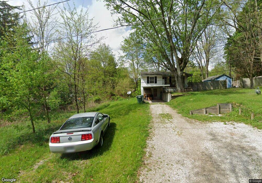
This home is located at 2841 Pomatan Ave, Akron, OH 44312 and is currently estimated at $118,602, approximately $151 per square foot. 2841 Pomatan Ave is a home located in Summit County with nearby schools including Springfield High School, Summit Academy Akron Elementary School, and Chapel Hill Christian School-Green Campus.
Ownership History
Date
Name
Owned For
Owner Type
Purchase Details
Closed on
Apr 19, 2011
Sold by
Us Bank National Association
Bought by
Fox Andrew K
Current Estimated Value
Purchase Details
Closed on
Sep 21, 2010
Sold by
Burris Scott R
Bought by
Us Bank National Association
Purchase Details
Closed on
Aug 30, 2002
Sold by
Harvey Timothy S and Harvey Deanna J
Bought by
Burris Scott R
Purchase Details
Closed on
Nov 13, 1998
Sold by
Kirby Jeff and Kirby Jeffrey P
Bought by
Harvey Timothy S and Harvey Deana J
Create a Home Valuation Report for This Property
The Home Valuation Report is an in-depth analysis detailing your home's value as well as a comparison with similar homes in the area
Home Values in the Area
Average Home Value in this Area
Purchase History
| Date | Buyer | Sale Price | Title Company |
|---|---|---|---|
| Fox Andrew K | $20,000 | Accutitle Agency Inc | |
| Us Bank National Association | $38,000 | None Available | |
| Burris Scott R | $66,000 | Midland Commerce Group | |
| Harvey Timothy S | $20,000 | Midland Commerce Group |
Source: Public Records
Tax History Compared to Growth
Tax History
| Year | Tax Paid | Tax Assessment Tax Assessment Total Assessment is a certain percentage of the fair market value that is determined by local assessors to be the total taxable value of land and additions on the property. | Land | Improvement |
|---|---|---|---|---|
| 2025 | $1,597 | $27,227 | $5,775 | $21,452 |
| 2024 | $1,597 | $27,227 | $5,775 | $21,452 |
| 2023 | $1,597 | $27,227 | $5,775 | $21,452 |
| 2022 | $1,399 | $20,556 | $4,344 | $16,212 |
| 2021 | $1,371 | $20,556 | $4,344 | $16,212 |
| 2020 | $1,353 | $20,550 | $4,340 | $16,210 |
| 2019 | $591 | $7,820 | $2,390 | $5,430 |
| 2018 | $571 | $7,820 | $2,390 | $5,430 |
| 2017 | $582 | $7,820 | $2,390 | $5,430 |
| 2016 | $587 | $7,670 | $2,390 | $5,280 |
| 2015 | $582 | $7,670 | $2,390 | $5,280 |
| 2014 | $575 | $7,670 | $2,390 | $5,280 |
| 2013 | $606 | $8,090 | $2,280 | $5,810 |
Source: Public Records
Map
Nearby Homes
- 1605 Pawnee Blvd
- 2851 Roanoke Ave
- 1553 Pawnee Blvd
- 2765 Oneida Ave
- 1441 Pawnee Blvd
- 0 Grace Rd
- V/L Sanitarium Rd
- 1341 Valley Dr
- 2643 Monroe St
- 3134 Shelton Ct
- 3191 Castleton Ct
- 839 Bristol Dr Unit 78
- 847 Bristol Dr
- 2645 Hayne Rd
- 2923 Hayne Rd
- 1504 3rd St
- 1466 3rd St
- 900 Bristol Dr Unit 63
- 1534 Front St
- 1376 Catherine Extension Ave
- 2841 Pomatan Ave
- 2841 Pomatan Ave
- 2847 Pomatan Ave
- 2846 Roanoke Ave
- 2834 Pomatan Ave
- 1585 Pawnee Blvd
- 1585 Pawnee Blvd
- 2858 Roanoke Ave
- 2862 Pomatan Ave
- 2866 Roanoke Ave
- 2835 Roanoke Ave
- 2847 Roanoke Ave
- 2851 Roanoke Ave
- 2843 Roanoke Ave
- 1640 Pawnee Blvd
- 2861 Roanoke Ave
- 1590 Pawnee Blvd
- 2813 Pomatan Ave
- 1657 Pawnee Blvd
- 2806 Pomatan Ave