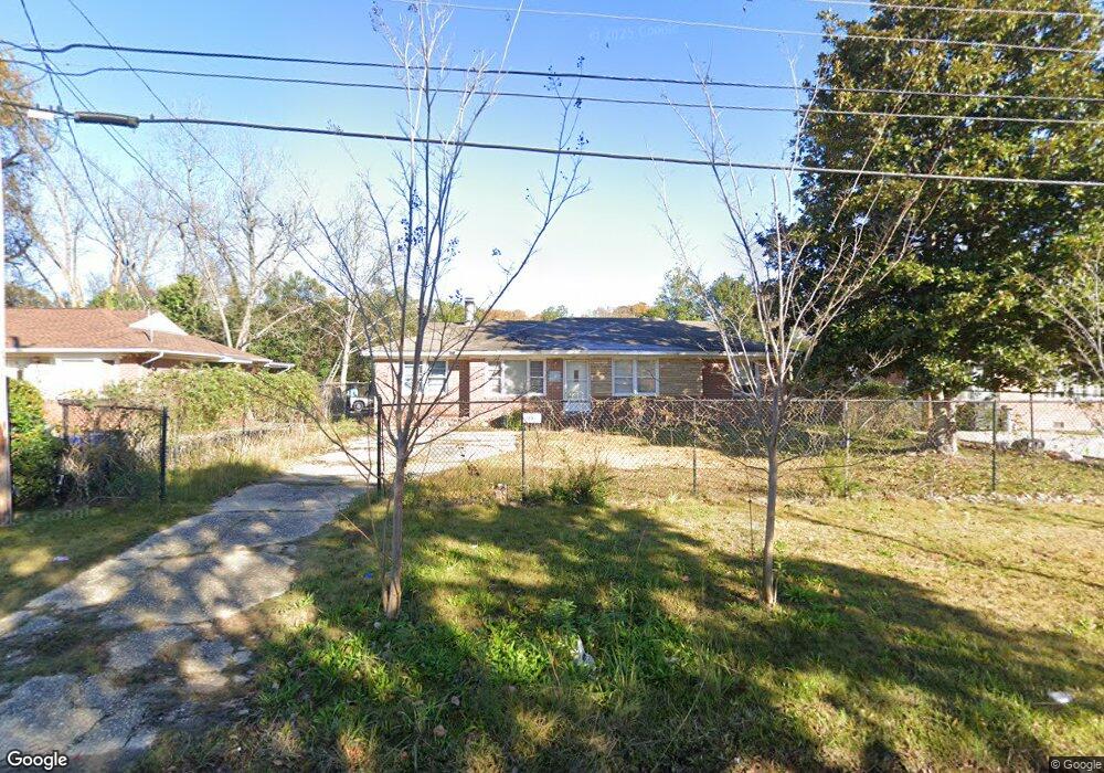
2841 Ramsey Rd Columbus, GA 31903
Southern Columbus NeighborhoodEstimated Value: $37,000 - $84,000
4
Beds
2
Baths
1,314
Sq Ft
$54/Sq Ft
Est. Value
About This Home
This home is located at 2841 Ramsey Rd, Columbus, GA 31903 and is currently estimated at $70,559, approximately $53 per square foot. 2841 Ramsey Rd is a home located in Muscogee County with nearby schools including South Columbus Elementary School, Eddy Middle School, and Spencer High School.
Ownership History
Date
Name
Owned For
Owner Type
Purchase Details
Closed on
Jun 7, 2023
Sold by
Dellascio Joseph
Bought by
Strickland Don J
Current Estimated Value
Purchase Details
Closed on
Apr 25, 2023
Sold by
Dellascio Joseph
Bought by
Dellascio Joseph
Purchase Details
Closed on
Jul 27, 2020
Sold by
3 Port Investments Llc
Bought by
Dellascio Joseph
Purchase Details
Closed on
Nov 6, 2018
Sold by
Muscogee County Tax Comm
Bought by
3 Part Investments Llc
Create a Home Valuation Report for This Property
The Home Valuation Report is an in-depth analysis detailing your home's value as well as a comparison with similar homes in the area
Home Values in the Area
Average Home Value in this Area
Purchase History
| Date | Buyer | Sale Price | Title Company |
|---|---|---|---|
| Strickland Don J | $30,000 | None Listed On Document | |
| Dellascio Joseph | -- | None Listed On Document | |
| Dellascio Joseph | -- | -- | |
| 3 Part Investments Llc | $11,000 | -- |
Source: Public Records
Tax History Compared to Growth
Tax History
| Year | Tax Paid | Tax Assessment Tax Assessment Total Assessment is a certain percentage of the fair market value that is determined by local assessors to be the total taxable value of land and additions on the property. | Land | Improvement |
|---|---|---|---|---|
| 2025 | $470 | $12,000 | $3,920 | $8,080 |
| 2024 | $470 | $12,000 | $3,920 | $8,080 |
| 2023 | $1,239 | $31,452 | $4,232 | $27,220 |
| 2022 | $827 | $20,252 | $4,232 | $16,020 |
| 2021 | $261 | $6,000 | $1,440 | $4,560 |
| 2020 | $963 | $23,580 | $4,232 | $19,348 |
| 2019 | $966 | $23,580 | $4,232 | $19,348 |
| 2018 | $966 | $23,580 | $4,232 | $19,348 |
| 2017 | $2,615 | $23,580 | $4,232 | $19,348 |
| 2016 | $771 | $18,693 | $2,940 | $15,753 |
| 2015 | $309 | $18,693 | $2,940 | $15,753 |
| 2014 | -- | $18,693 | $2,940 | $15,753 |
| 2013 | -- | $18,693 | $2,940 | $15,753 |
Source: Public Records
Map
Nearby Homes
- 3009 Plantation Rd
- 2973 Hawthorne Dr
- 2451 Brownie Ln
- 1274 Providence Ln
- 2463 Brownie Ln
- 2463 Brownie St
- 2102 Somerset Ave
- 3042 Colonial Dr
- 3015 Hendrix St
- 2203 Simmons Ave
- 2333 Bruce Ave
- 3135 Baker Cir
- 3110 Victory Dr
- 2309 Ginny Ave
- 1029 Harbison Dr
- 2313 Dorothy Ave
- 2404 Bruce Ave
- 2425 Howe Ave
- 3310 Albert St
- 2417 Manning Ave
- 2847 Ramsey Rd
- 2835 Ramsey Rd
- 2842 Hawthorne Dr
- 2851 Ramsey Rd
- 2829 Ramsey Rd
- 2836 Hawthorne Dr
- 2848 Hawthorne Dr
- 2852 Hawthorne Dr
- 2848 Ramsey Rd
- 2836 Ramsey Rd
- 2857 Ramsey Rd
- 2823 Ramsey Rd
- 2852 Ramsey Rd
- 2830 Ramsey Rd
- 2824 Hawthorne Dr
- 2858 Hawthorne Dr
- 2863 Ramsey Rd
- 2819 Ramsey Rd
- 2858 Ramsey Rd
- 2824 Ramsey Rd