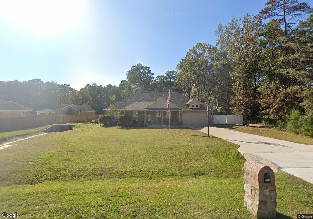
28419 Lazy Rock Dr Huffman, TX 77336
Estimated Value: $449,000 - $483,000
3
Beds
2
Baths
2,141
Sq Ft
$214/Sq Ft
Est. Value
About This Home
This home is located at 28419 Lazy Rock Dr, Huffman, TX 77336 and is currently estimated at $458,019, approximately $213 per square foot. 28419 Lazy Rock Dr is a home located in Harris County with nearby schools including Huffman Elementary School, Huffman Middle School, and Hargrave High School.
Ownership History
Date
Name
Owned For
Owner Type
Purchase Details
Closed on
Sep 21, 2015
Sold by
Legend Classic Homes Ltd
Bought by
Quere Paul D
Current Estimated Value
Home Financials for this Owner
Home Financials are based on the most recent Mortgage that was taken out on this home.
Original Mortgage
$261,000
Outstanding Balance
$205,557
Interest Rate
3.99%
Mortgage Type
New Conventional
Estimated Equity
$252,462
Create a Home Valuation Report for This Property
The Home Valuation Report is an in-depth analysis detailing your home's value as well as a comparison with similar homes in the area
Home Values in the Area
Average Home Value in this Area
Purchase History
| Date | Buyer | Sale Price | Title Company |
|---|---|---|---|
| Quere Paul D | -- | Lch Title Co |
Source: Public Records
Mortgage History
| Date | Status | Borrower | Loan Amount |
|---|---|---|---|
| Open | Quere Paul D | $261,000 |
Source: Public Records
Tax History Compared to Growth
Tax History
| Year | Tax Paid | Tax Assessment Tax Assessment Total Assessment is a certain percentage of the fair market value that is determined by local assessors to be the total taxable value of land and additions on the property. | Land | Improvement |
|---|---|---|---|---|
| 2025 | $5,406 | $404,086 | $83,554 | $320,532 |
| 2024 | $5,406 | $390,186 | $83,554 | $306,632 |
| 2023 | $5,406 | $383,000 | $64,986 | $318,014 |
| 2022 | $5,817 | $328,077 | $64,986 | $263,091 |
| 2021 | $5,951 | $335,712 | $63,130 | $272,582 |
| 2020 | $5,701 | $269,356 | $63,130 | $206,226 |
| 2019 | $5,862 | $280,560 | $63,130 | $217,430 |
| 2018 | $3,145 | $249,656 | $53,426 | $196,230 |
| 2017 | $5,384 | $252,160 | $53,426 | $198,734 |
| 2016 | $5,545 | $259,702 | $45,569 | $214,133 |
| 2015 | $440 | $185,335 | $45,569 | $139,766 |
| 2014 | $440 | $45,569 | $45,569 | $0 |
Source: Public Records
Map
Nearby Homes
- 28510 Lazy Rock Dr
- 1114 Commons Waterway
- 1018 Winchester Bend
- 1057 Magnolia Point Dr
- 1018 N Commons View Dr
- 1003 Commons Waterway
- 1309 Magnolia Point Dr
- TBD White Oak Dr
- 3707 Old Atascocita Rd
- 0 Pin Oak Ln Unit 13263497
- 0 Pin Oak Ln Unit 66676449
- TBD Fm 2100 Rd
- 731 Magnolia Point Dr
- 729 Magnolia Point Dr
- 1135 Magnolia Point Dr
- 576 Magnolia Point Dr
- 320 Emerald Thicket Ln
- 524 Echo Ln
- TBD Echo Ln
- 18515 Juniper Haven Ct
- 0 Lazy Rock Dr Unit 70073585
- 0 Lazy Rock Dr Unit 4795136
- 0 Lazy Rock Dr Unit 80399157
- 0 Lazy Rock Dr Unit 64040794
- 0 Lazy Rock Dr Unit 58536221
- 0 Lazy Rock Dr Unit 39319795
- 0 Lazy Rock Dr Unit 74564351
- 0 Lazy Rock Dr Unit 26929449
- 0 Lazy Rock Dr Unit 94674626
- 0 Lazy Rock Dr Unit 74304462
- 0 Lazy Rock Dr Unit 43830844
- 0 Lazy Rock Dr Unit 76564652
- 0 Lazy Rock Dr Unit 21076247
- 0 Lazy Rock Dr Unit 26950104
- 0 Lazy Rock Dr Unit 75685551
- 0 Lazy Rock Dr Unit 23528334
- 0 Lazy Rock Dr Unit 97742213
- 0 Lazy Rock Dr Unit 91823602
- 0 Lazy Rock Dr Unit 80550844
- 0 Lazy Rock Dr Unit 47557759