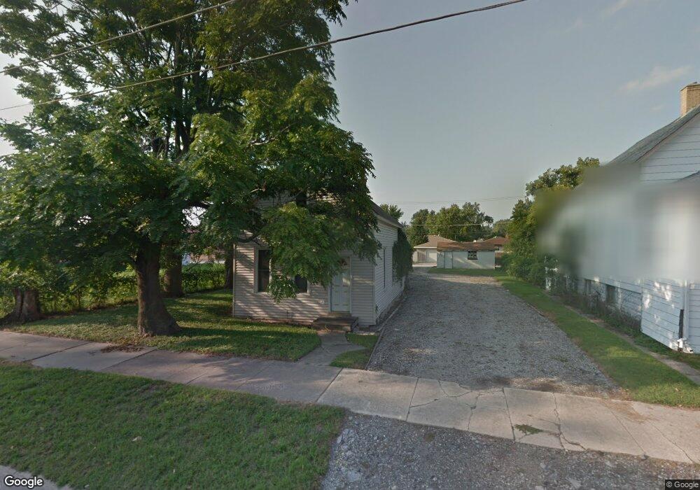
2844 Bernice Rd Lansing, IL 60438
Estimated Value: $77,332
2
Beds
1
Bath
720
Sq Ft
$107/Sq Ft
Est. Value
About This Home
This home is located at 2844 Bernice Rd, Lansing, IL 60438 and is currently estimated at $77,332, approximately $107 per square foot. 2844 Bernice Rd is a home located in Cook County with nearby schools including Reavis Elementary School, Memorial Jr High School, and Thornton Fractnl So High School.
Ownership History
Date
Name
Owned For
Owner Type
Purchase Details
Closed on
Dec 21, 2021
Sold by
Flanagin Ryan
Bought by
Village Of Lansing
Current Estimated Value
Purchase Details
Closed on
Nov 3, 2005
Sold by
Flanagin Dennis G and Flanagin Barbara A
Bought by
Flanagin Ryan
Home Financials for this Owner
Home Financials are based on the most recent Mortgage that was taken out on this home.
Original Mortgage
$48,000
Interest Rate
6.04%
Mortgage Type
Fannie Mae Freddie Mac
Purchase Details
Closed on
Nov 13, 1997
Sold by
Sons Myrtle A
Bought by
Flanagan Dennis G and Flanagin Barbara A
Create a Home Valuation Report for This Property
The Home Valuation Report is an in-depth analysis detailing your home's value as well as a comparison with similar homes in the area
Home Values in the Area
Average Home Value in this Area
Purchase History
| Date | Buyer | Sale Price | Title Company |
|---|---|---|---|
| Village Of Lansing | -- | Old Republic Title | |
| Flanagin Ryan | $60,000 | Cti | |
| Flanagan Dennis G | $23,333 | -- |
Source: Public Records
Mortgage History
| Date | Status | Borrower | Loan Amount |
|---|---|---|---|
| Previous Owner | Flanagin Ryan | $48,000 |
Source: Public Records
Tax History
| Year | Tax Paid | Tax Assessment Tax Assessment Total Assessment is a certain percentage of the fair market value that is determined by local assessors to be the total taxable value of land and additions on the property. | Land | Improvement |
|---|---|---|---|---|
| 2025 | $4,187 | -- | -- | -- |
| 2024 | $4,187 | -- | -- | -- |
| 2023 | $4,187 | -- | -- | -- |
| 2022 | $4,187 | $6,626 | $3,063 | $3,563 |
| 2021 | $4,187 | $6,624 | $3,062 | $3,562 |
| 2020 | $3,886 | $6,624 | $3,062 | $3,562 |
| 2019 | $3,510 | $6,165 | $2,843 | $3,322 |
| 2018 | $3,445 | $6,165 | $2,843 | $3,322 |
| 2017 | $3,478 | $6,165 | $2,843 | $3,322 |
| 2016 | $2,860 | $5,231 | $2,625 | $2,606 |
| 2015 | $2,658 | $5,231 | $2,625 | $2,606 |
| 2014 | $2,621 | $5,231 | $2,625 | $2,606 |
| 2013 | $2,758 | $6,125 | $2,625 | $3,500 |
Source: Public Records
Map
Nearby Homes
- 2938 173rd Place
- 3018 Bernice Rd Unit 205
- 3425 Bernice Ave
- 17303 Chicago Ave
- 2937 172nd St
- 3045 Bernice Rd
- 3061 Bernice Rd
- 3069 Bernice Rd
- 3127 Bernice Rd Unit 5
- 17303 Greenbay Ave
- 17115 Park Ave
- 17246 Burnham Ave
- 17057 Park Ave
- 3137 176th St
- 17318 Walter St
- 2736 178th St
- 17002 Lorenz Ave
- 17617 Burnham Ave
- 17816 Commercial Ave
- 17056 Burnham Ave
- 2850 Bernice Rd
- 2854 Bernice Rd
- 2860 Bernice Rd
- 2869 173rd Place
- 2875 173rd Place
- 2861 173rd Place
- 2843 Bernice Rd
- 2830 Bernice Rd
- 2851 Bernice Rd
- 2851 Bernice Rd
- 2864 Bernice Rd
- 2824 Bernice Rd
- 2895 173rd Place
- 17417 Railroad Ave
- 17414 Railroad Ave
- 2903 Bernice Rd
- 2870 173rd Place
- 2862 173rd Place
- 2876 173rd Place
- 2915 173rd Place
Your Personal Tour Guide
Ask me questions while you tour the home.