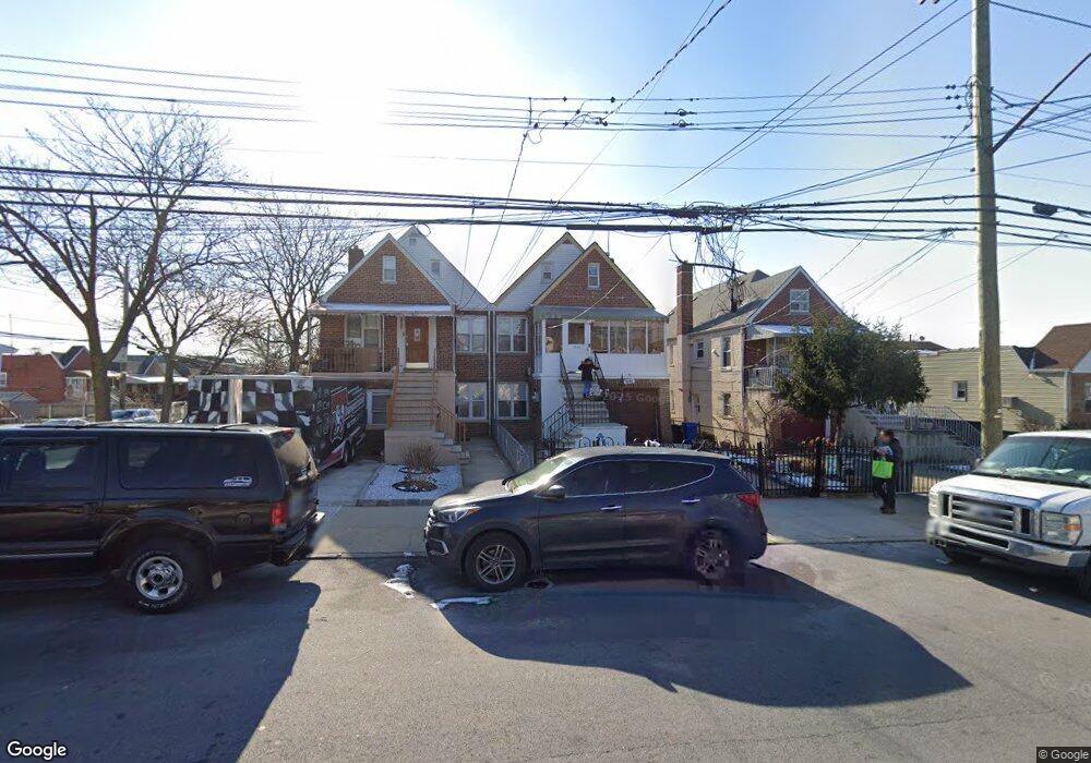
2844 Philip Ave Bronx, NY 10465
Throgs Neck-Edgewater Park NeighborhoodEstimated Value: $670,175 - $843,000
--
Bed
--
Bath
1,932
Sq Ft
$401/Sq Ft
Est. Value
About This Home
This home is located at 2844 Philip Ave, Bronx, NY 10465 and is currently estimated at $774,294, approximately $400 per square foot. 2844 Philip Ave is a home located in Bronx County with nearby schools including P.S. 14 Senator John Calandra, Herbert H Lehman High School, and St Benedict School.
Ownership History
Date
Name
Owned For
Owner Type
Purchase Details
Closed on
Sep 17, 2022
Sold by
Rodriguez Martha and Rodriguez Miguel E
Bought by
Rodriguez Family Living Trust and Rodriguez, Ttee, Martha
Current Estimated Value
Purchase Details
Closed on
Mar 19, 2002
Sold by
Rodriguez Miguel E and Rodriguez Martha
Bought by
Rodriguez Miguel E and Rodriguez Martha
Home Financials for this Owner
Home Financials are based on the most recent Mortgage that was taken out on this home.
Original Mortgage
$1,098
Interest Rate
7.05%
Purchase Details
Closed on
Apr 10, 1996
Sold by
Egede Piscitelli Lorenzo C and Egede Piscitelli
Bought by
Rodriguez Miguel E and Rodriguez Martha
Home Financials for this Owner
Home Financials are based on the most recent Mortgage that was taken out on this home.
Original Mortgage
$150,000
Interest Rate
7.82%
Create a Home Valuation Report for This Property
The Home Valuation Report is an in-depth analysis detailing your home's value as well as a comparison with similar homes in the area
Home Values in the Area
Average Home Value in this Area
Purchase History
| Date | Buyer | Sale Price | Title Company |
|---|---|---|---|
| Rodriguez Family Living Trust | -- | -- | |
| Rodriguez Miguel E | -- | -- | |
| Rodriguez Miguel E | $188,000 | Commonwealth Land Title Ins |
Source: Public Records
Mortgage History
| Date | Status | Borrower | Loan Amount |
|---|---|---|---|
| Previous Owner | Rodriguez Miguel E | $1,098 | |
| Previous Owner | Rodriguez Miguel E | $150,000 |
Source: Public Records
Tax History Compared to Growth
Tax History
| Year | Tax Paid | Tax Assessment Tax Assessment Total Assessment is a certain percentage of the fair market value that is determined by local assessors to be the total taxable value of land and additions on the property. | Land | Improvement |
|---|---|---|---|---|
| 2025 | $7,045 | $35,856 | $8,017 | $27,839 |
| 2024 | $7,045 | $35,078 | $8,192 | $26,886 |
| 2023 | $6,979 | $34,363 | $9,351 | $25,012 |
| 2022 | $6,472 | $35,460 | $9,780 | $25,680 |
| 2021 | $6,437 | $36,060 | $9,780 | $26,280 |
| 2020 | $6,325 | $35,640 | $9,780 | $25,860 |
| 2019 | $6,115 | $35,580 | $9,780 | $25,800 |
| 2018 | $5,837 | $28,636 | $8,365 | $20,271 |
| 2017 | $5,507 | $27,016 | $8,601 | $18,415 |
| 2016 | $5,095 | $25,488 | $8,858 | $16,630 |
| 2015 | $2,854 | $24,900 | $10,860 | $14,040 |
| 2014 | $2,854 | $24,360 | $10,860 | $13,500 |
Source: Public Records
Map
Nearby Homes
- - Ave
- 2808 Philip Ave
- 710 Revere Ave
- 836 Revere Ave
- 815 Swinton Ave
- 831 Swinton Ave
- 837 Swinton Ave
- 2916 Sullivan Place
- 755 Logan Ave
- 730 Logan Ave
- 731 Hollywood Ave
- 819 Hollywood Ave
- 854 Logan Ave
- 724 Hollywood Ave
- 636 Logan Ave
- 945 Swinton Ave
- 840 Hollywood Ave
- 946 Balcom Ave
- 1009 Brinsmade Ave
- 1032 Swinton Ave
- 2846 Philip Ave
- 2840 Philip Ave
- 2834 Philip Ave
- 2832 Philip Ave
- 2850 Philip Ave
- 2830 Philip Ave
- 2852 Philip Ave
- 758 Quincy Ave
- 2826 Philip Ave
- 758A Quincy Ave
- 758A Quincy Ave
- 758A Quincy Ave
- 2854 Philip Ave
- 749 Calhoun Ave
- 758 Quincy Ave Unit 758B
- 758 Quincy Ave Unit 758A
- 758 Quincy Ave
- 758 Quincy Ave
- 758 Quincy Ave Unit 1
- 758 Quincy Ave Unit 2