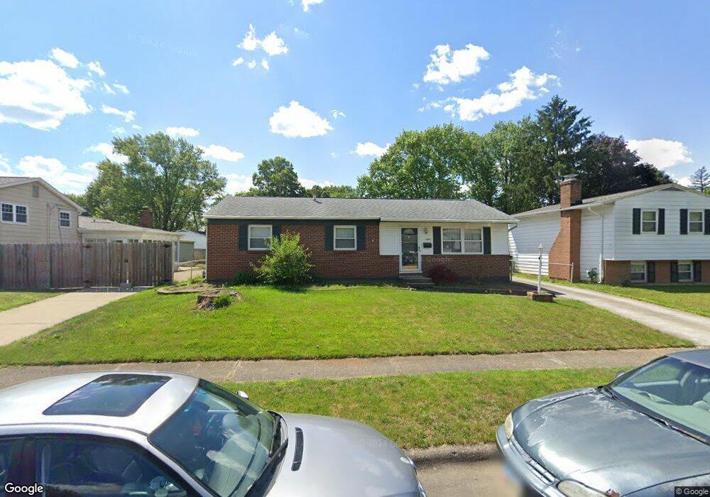
2847 Fareham Ct Columbus, OH 43232
Walnut Heights NeighborhoodEstimated Value: $227,449 - $236,000
3
Beds
2
Baths
1,342
Sq Ft
$173/Sq Ft
Est. Value
About This Home
This home is located at 2847 Fareham Ct, Columbus, OH 43232 and is currently estimated at $232,612, approximately $173 per square foot. 2847 Fareham Ct is a home located in Franklin County with nearby schools including Groveport Madison High School, A+ Arts Academy, and Eastland Preparatory Academy.
Ownership History
Date
Name
Owned For
Owner Type
Purchase Details
Closed on
May 1, 1998
Sold by
Mcclure Mark R
Bought by
Mcclure Mark R and Mcclure Barbara A
Current Estimated Value
Purchase Details
Closed on
Sep 28, 1992
Purchase Details
Closed on
Jun 1, 1985
Create a Home Valuation Report for This Property
The Home Valuation Report is an in-depth analysis detailing your home's value as well as a comparison with similar homes in the area
Home Values in the Area
Average Home Value in this Area
Purchase History
| Date | Buyer | Sale Price | Title Company |
|---|---|---|---|
| Mcclure Mark R | -- | -- | |
| -- | $66,500 | -- | |
| -- | -- | -- |
Source: Public Records
Tax History Compared to Growth
Tax History
| Year | Tax Paid | Tax Assessment Tax Assessment Total Assessment is a certain percentage of the fair market value that is determined by local assessors to be the total taxable value of land and additions on the property. | Land | Improvement |
|---|---|---|---|---|
| 2024 | $2,732 | $64,440 | $17,820 | $46,620 |
| 2023 | $2,706 | $64,435 | $17,815 | $46,620 |
| 2022 | $1,785 | $35,350 | $6,300 | $29,050 |
| 2021 | $1,790 | $35,350 | $6,300 | $29,050 |
| 2020 | $1,793 | $35,350 | $6,300 | $29,050 |
| 2019 | $1,689 | $29,790 | $5,250 | $24,540 |
| 2018 | $1,782 | $29,790 | $5,250 | $24,540 |
| 2017 | $1,705 | $29,790 | $5,250 | $24,540 |
| 2016 | $1,844 | $29,440 | $4,340 | $25,100 |
| 2015 | $1,864 | $29,440 | $4,340 | $25,100 |
| 2014 | $1,325 | $29,440 | $4,340 | $25,100 |
| 2013 | $643 | $32,725 | $4,830 | $27,895 |
Source: Public Records
Map
Nearby Homes
- 2901 Renfro Rd
- 5125 Upton Rd N
- 5024 Refugee Rd
- 4906 Refugee Rd
- 4974 Silverton Dr
- 2900 Ronda Rd
- 4953 Silverton Dr
- 5111 Holbrook Dr
- 5137 Holbrook Dr
- 2615 Carbondale Place
- 5143 Tuxworth Ct
- 2998 Osgood Rd E
- 3000 Whitlow Rd
- 5373 Spire Ln
- 2627 Hubbell Rd
- 5401 Spire Ln
- 2342 Noe Bixby Rd
- 2336 Noe Bixby Rd
- 2360 Noe Bixby Rd
- 2354 Noe Bixby Rd
- 2839 Fareham Ct
- 5024 Chingford Rd
- 2838 Maywood Rd
- 2831 Fareham Ct
- 5010 Chingford Rd
- 2832 Maywood Rd
- 2856 Fareham Ct
- 2824 Maywood Rd
- 2844 Fareham Ct
- 2825 Fareham Ct
- 2836 Fareham Ct
- 5027 Chingford Rd
- 5052 Chingford Rd
- 2816 Maywood Rd
- 5035 Chingford Rd
- 5019 Chingford Rd
- 2815 Fareham Ct
- 2828 Fareham Ct
- 5043 Chingford Rd
- 5007 Chingford Rd