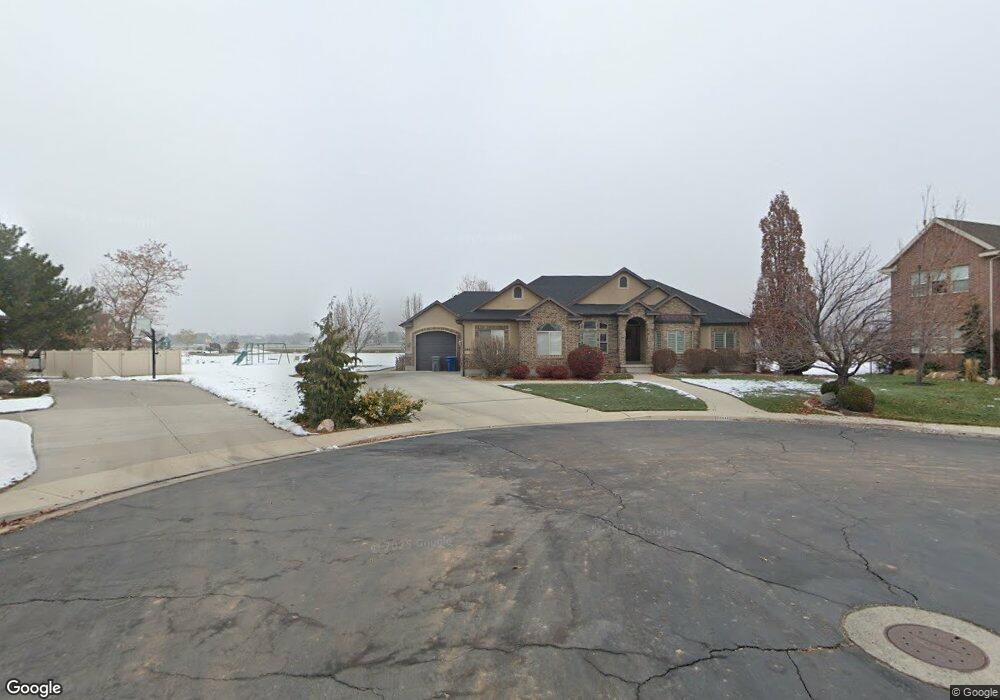
2848 N 1020 W Pleasant Grove, UT 84062
Estimated Value: $980,000 - $1,147,908
3
Beds
3
Baths
4,182
Sq Ft
$257/Sq Ft
Est. Value
About This Home
This home is located at 2848 N 1020 W, Pleasant Grove, UT 84062 and is currently estimated at $1,074,977, approximately $257 per square foot. 2848 N 1020 W is a home located in Utah County with nearby schools including Deerfield Elementary School, Mountain Ridge Junior High School, and American Fork High School.
Ownership History
Date
Name
Owned For
Owner Type
Purchase Details
Closed on
Oct 26, 2021
Sold by
Hasleton Richard
Bought by
Hasleton Richard and Hasleton Lisa W
Current Estimated Value
Home Financials for this Owner
Home Financials are based on the most recent Mortgage that was taken out on this home.
Original Mortgage
$380,000
Outstanding Balance
$346,926
Interest Rate
2.88%
Mortgage Type
New Conventional
Estimated Equity
$728,051
Purchase Details
Closed on
Aug 26, 2005
Sold by
Hasleton Richard
Bought by
Hasleton Ii Richard and Hasleton Lisa W
Home Financials for this Owner
Home Financials are based on the most recent Mortgage that was taken out on this home.
Original Mortgage
$35,000
Interest Rate
5.64%
Mortgage Type
Credit Line Revolving
Create a Home Valuation Report for This Property
The Home Valuation Report is an in-depth analysis detailing your home's value as well as a comparison with similar homes in the area
Home Values in the Area
Average Home Value in this Area
Purchase History
| Date | Buyer | Sale Price | Title Company |
|---|---|---|---|
| Hasleton Richard | -- | Servicelink | |
| Hasleton Ii Richard | -- | Integrated Title Insurance |
Source: Public Records
Mortgage History
| Date | Status | Borrower | Loan Amount |
|---|---|---|---|
| Open | Hasleton Richard | $380,000 | |
| Previous Owner | Hasleton Ii Richard | $35,000 | |
| Previous Owner | Hasleton Ii Richard | $377,600 |
Source: Public Records
Tax History Compared to Growth
Tax History
| Year | Tax Paid | Tax Assessment Tax Assessment Total Assessment is a certain percentage of the fair market value that is determined by local assessors to be the total taxable value of land and additions on the property. | Land | Improvement |
|---|---|---|---|---|
| 2025 | $4,132 | $546,425 | $458,600 | $534,900 |
| 2024 | $4,132 | $492,745 | $0 | $0 |
| 2023 | $3,898 | $476,190 | $0 | $0 |
| 2022 | $3,969 | $482,460 | $0 | $0 |
| 2021 | $3,320 | $614,500 | $261,000 | $353,500 |
| 2020 | $3,136 | $569,000 | $241,700 | $327,300 |
| 2019 | $2,940 | $551,700 | $224,400 | $327,300 |
| 2018 | $2,919 | $517,900 | $207,100 | $310,800 |
| 2017 | $2,940 | $277,750 | $0 | $0 |
| 2016 | $2,663 | $242,880 | $0 | $0 |
| 2015 | $2,582 | $222,970 | $0 | $0 |
| 2014 | $2,254 | $192,830 | $0 | $0 |
Source: Public Records
Map
Nearby Homes
- 2969 N 1350 W
- 2837 N 550 W
- 636 N 1280 E
- 598 N 1280 E
- 649 N 1280 E
- 1228 E 1030 N
- 2254 N 1560 W
- 9078 Renaissance Dr
- 3810 W Valley View Dr
- 1243 N 1270 E
- 8923 N Cottage Canyon Dr
- 1121 E 580 N
- 9506 N 4000 W
- 1897 N 900 W
- 532 W 2000 N
- 1162 E 1180 N
- 9481 N 3830 W
- 9157 N Canyon Heights Dr
- 980 W 1800 N
- 9547 N Canyon Rd
- 2841 N 1020 W
- 2841 N 1020 W Unit 28
- 2842 N 1020 W
- 2897 N 900 W
- 2816 N 1020 W
- 2815 N 1020 W
- 2874 N 1130 W
- 2844 N 1130 W
- 2844 N 1130 W Unit 23
- 2902 N 1130 W
- 2873 N 900 W
- 2845 N 900 W
- 2784 N 1020 W
- 1048 W 2760 N
- 2814 N 1130 W
- 2932 N 1130 W
- 658 W 2760 N Unit 18
- 525 W 2760 N Unit 12
- 771 W 2760 N
- 525 W 2760 N