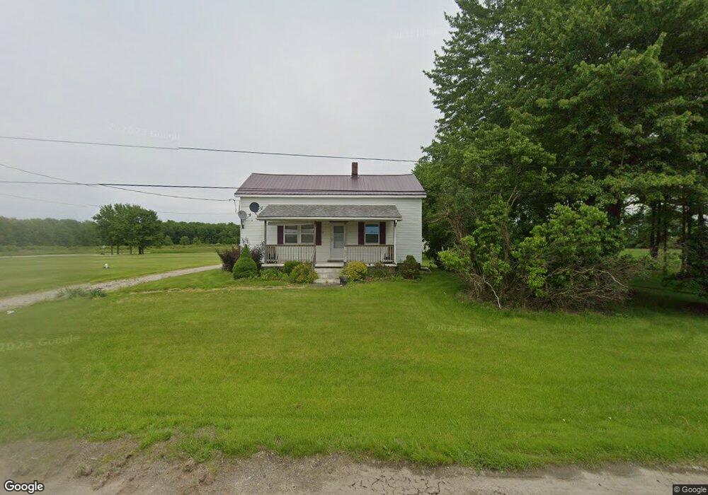
2848 State Route 7 N Pierpont, OH 44082
Estimated Value: $149,676 - $226,000
2
Beds
1
Bath
1,296
Sq Ft
$146/Sq Ft
Est. Value
About This Home
This home is located at 2848 State Route 7 N, Pierpont, OH 44082 and is currently estimated at $188,919, approximately $145 per square foot. 2848 State Route 7 N is a home located in Ashtabula County with nearby schools including Lakeshore Primary Elementary School, Gateway Elementary School, and Conneaut Middle School.
Ownership History
Date
Name
Owned For
Owner Type
Purchase Details
Closed on
Mar 15, 2005
Sold by
Carson Charles D and Weller Sandra J
Bought by
Carson Charles D and Carson Sandra J
Current Estimated Value
Home Financials for this Owner
Home Financials are based on the most recent Mortgage that was taken out on this home.
Original Mortgage
$98,000
Outstanding Balance
$49,881
Interest Rate
5.67%
Mortgage Type
New Conventional
Estimated Equity
$139,038
Purchase Details
Closed on
Sep 27, 2000
Sold by
Frey David
Bought by
Carson Charles D and Weller Sandra J
Home Financials for this Owner
Home Financials are based on the most recent Mortgage that was taken out on this home.
Original Mortgage
$88,000
Interest Rate
7.98%
Mortgage Type
New Conventional
Purchase Details
Closed on
Oct 5, 1995
Sold by
John J Kuzma Est
Bought by
Frye David C
Create a Home Valuation Report for This Property
The Home Valuation Report is an in-depth analysis detailing your home's value as well as a comparison with similar homes in the area
Home Values in the Area
Average Home Value in this Area
Purchase History
| Date | Buyer | Sale Price | Title Company |
|---|---|---|---|
| Carson Charles D | -- | -- | |
| Carson Charles D | $73,000 | -- | |
| Frye David C | $65,000 | -- |
Source: Public Records
Mortgage History
| Date | Status | Borrower | Loan Amount |
|---|---|---|---|
| Open | Carson Charles D | $98,000 | |
| Closed | Carson Charles D | $88,000 |
Source: Public Records
Tax History Compared to Growth
Tax History
| Year | Tax Paid | Tax Assessment Tax Assessment Total Assessment is a certain percentage of the fair market value that is determined by local assessors to be the total taxable value of land and additions on the property. | Land | Improvement |
|---|---|---|---|---|
| 2024 | $2,708 | $39,450 | $10,750 | $28,700 |
| 2023 | $1,708 | $39,450 | $10,750 | $28,700 |
| 2022 | $1,411 | $28,740 | $8,260 | $20,480 |
| 2021 | $1,447 | $28,740 | $8,260 | $20,480 |
| 2020 | $1,447 | $28,740 | $8,260 | $20,480 |
| 2019 | $1,636 | $31,710 | $8,260 | $23,450 |
| 2018 | $1,579 | $31,710 | $8,260 | $23,450 |
| 2017 | $1,454 | $31,710 | $8,260 | $23,450 |
| 2016 | $1,334 | $29,050 | $7,560 | $21,490 |
| 2015 | $1,332 | $29,050 | $7,560 | $21,490 |
| 2014 | $1,286 | $29,050 | $7,560 | $21,490 |
| 2013 | $1,285 | $28,320 | $7,070 | $21,250 |
Source: Public Records
Map
Nearby Homes
- 5011 Beckwith Rd
- 5024 Hilldom Rd
- 0 Root Rd
- 0 Middle Rd
- 2608 Stanhope Kelloggsville Rd
- 0 Lewis Rd
- 1148 Lewis Rd
- 350 Ohio 7
- 5051 Center Rd
- 2342 & 2412 Artman Rd
- 5958 Weaver Rd
- 6232 Weaver Rd
- 6421 Weaver Rd
- 0 Gageville-Monroe Rd
- 3037 Philadelphia Rd
- 627 State Line Rd
- 5581 Hatches Corners Rd
- 9455 State Line Rd
- Tracy Rd
- V/L State Route 167
- 2907 State Route 7 N
- 2963 State Route 7 N
- 2710 State Route 7 N
- 2681 State Route 7 N
- 0 Hammond Corners Rd Unit 3606762
- 2650 State Route 7 N
- 3050 State Route 7 N
- 3099 State Route 7 N
- 3066 E Center St
- 2601 State Route 7 N
- 6211 Hammond Corners Rd
- 2555 State Route 7 N
- 2558 State Route 7 N
- 3134 State Route 7 N
- 5890 Scribner Rd
- 5616 Scribner Rd
- 5852 Scribner Rd
- 2528 State Route 7 N
- 0 Sweet Rd Unit 3981009
- 0 Sweet Rd Unit 4150397