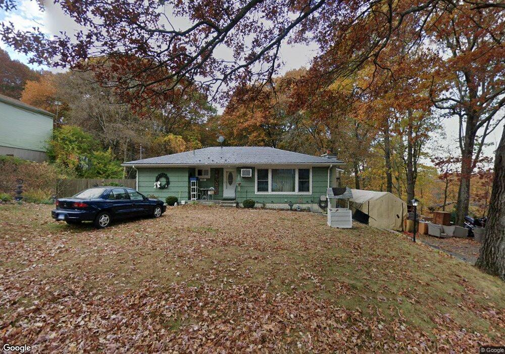
285 Andrews Rd Wolcott, CT 06716
Estimated Value: $350,000 - $436,000
3
Beds
2
Baths
1,188
Sq Ft
$328/Sq Ft
Est. Value
About This Home
This home is located at 285 Andrews Rd, Wolcott, CT 06716 and is currently estimated at $389,184, approximately $327 per square foot. 285 Andrews Rd is a home located in New Haven County with nearby schools including Tyrrell Middle School and Wolcott High School.
Ownership History
Date
Name
Owned For
Owner Type
Purchase Details
Closed on
Sep 8, 2016
Sold by
Mallon Thomas D and Mallon Heather A
Bought by
Messer-Dodd Judith
Current Estimated Value
Purchase Details
Closed on
Dec 12, 2001
Sold by
George Arthur
Bought by
Mallon Thomas D and Mallon Heather A
Home Financials for this Owner
Home Financials are based on the most recent Mortgage that was taken out on this home.
Original Mortgage
$131,000
Interest Rate
6.6%
Create a Home Valuation Report for This Property
The Home Valuation Report is an in-depth analysis detailing your home's value as well as a comparison with similar homes in the area
Home Values in the Area
Average Home Value in this Area
Purchase History
| Date | Buyer | Sale Price | Title Company |
|---|---|---|---|
| Messer-Dodd Judith | $200,000 | -- | |
| Mallon Thomas D | $138,900 | -- |
Source: Public Records
Mortgage History
| Date | Status | Borrower | Loan Amount |
|---|---|---|---|
| Previous Owner | Mallon Thomas D | $200,000 | |
| Previous Owner | Mallon Thomas D | $131,000 |
Source: Public Records
Tax History
| Year | Tax Paid | Tax Assessment Tax Assessment Total Assessment is a certain percentage of the fair market value that is determined by local assessors to be the total taxable value of land and additions on the property. | Land | Improvement |
|---|---|---|---|---|
| 2025 | $5,629 | $156,670 | $41,090 | $115,580 |
| 2024 | $5,181 | $156,670 | $41,090 | $115,580 |
| 2023 | $4,993 | $156,670 | $41,090 | $115,580 |
| 2022 | $4,825 | $156,670 | $41,090 | $115,580 |
| 2021 | $3,480 | $138,060 | $38,990 | $99,070 |
| 2020 | $4,575 | $138,060 | $38,990 | $99,070 |
| 2019 | $4,575 | $138,060 | $38,990 | $99,070 |
| 2018 | $3,454 | $138,060 | $38,990 | $99,070 |
| 2017 | $3,362 | $138,060 | $38,990 | $99,070 |
| 2016 | $4,251 | $147,030 | $39,760 | $107,270 |
| 2015 | $4,129 | $147,030 | $39,760 | $107,270 |
| 2014 | $3,995 | $147,030 | $39,760 | $107,270 |
Source: Public Records
Map
Nearby Homes
- 226 Clinton Hill Rd
- 32 Sandy Ln
- Lots 70B and 71B Spindle Hill Rd
- 138 Wolcott Rd
- 1 Winfield Ave
- 353 Allentown Rd
- 43 Williams Ct
- 701 Bucks Hill Rd
- 0 Grassy Hill Rd Unit 24070167
- 17 Forestview Dr
- 19 Running Brook Dr
- 40 Running Brook Dr
- 75 Forestview Dr
- 16 Oakengate Rd
- 20 Greystone Road Extension
- 0 Spindle Hill Rd Unit 24062265
- 8 Oakengate Rd
- 24 Granada Dr
- 22 Pembroke Hill Rd
- 228 Chipper Rd
Your Personal Tour Guide
Ask me questions while you tour the home.