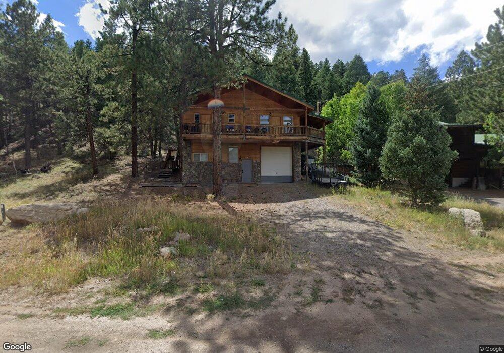
285 Aspen Dr South Fork, CO 81154
Estimated Value: $404,000 - $611,000
3
Beds
2
Baths
2,173
Sq Ft
$230/Sq Ft
Est. Value
About This Home
This home is located at 285 Aspen Dr, South Fork, CO 81154 and is currently estimated at $500,137, approximately $230 per square foot. 285 Aspen Dr is a home located in Rio Grande County with nearby schools including Del Norte K-8 School and Del Norte High School.
Ownership History
Date
Name
Owned For
Owner Type
Purchase Details
Closed on
Jun 22, 2016
Sold by
285 Aspen Llc
Bought by
Strong Michael D and Strong Shelly
Current Estimated Value
Home Financials for this Owner
Home Financials are based on the most recent Mortgage that was taken out on this home.
Original Mortgage
$30,279
Outstanding Balance
$19,205
Interest Rate
3.99%
Mortgage Type
Purchase Money Mortgage
Estimated Equity
$480,932
Purchase Details
Closed on
Apr 29, 2015
Sold by
Gerbrandt Marcia Gay
Bought by
285 Aspen Llc
Purchase Details
Closed on
Feb 10, 2012
Sold by
Underwood Micci Gerbrandt
Bought by
Garbrandt Marcia Gay
Purchase Details
Closed on
Feb 14, 2011
Sold by
Gerbrandt Builders Inc
Bought by
Gerbrandt Richard T
Create a Home Valuation Report for This Property
The Home Valuation Report is an in-depth analysis detailing your home's value as well as a comparison with similar homes in the area
Home Values in the Area
Average Home Value in this Area
Purchase History
| Date | Buyer | Sale Price | Title Company |
|---|---|---|---|
| Strong Michael D | $240,000 | None Available | |
| 285 Aspen Llc | -- | None Available | |
| Garbrandt Marcia Gay | -- | None Available | |
| Gerbrandt Richard T | -- | None Available |
Source: Public Records
Mortgage History
| Date | Status | Borrower | Loan Amount |
|---|---|---|---|
| Open | Strong Michael D | $30,279 |
Source: Public Records
Tax History Compared to Growth
Tax History
| Year | Tax Paid | Tax Assessment Tax Assessment Total Assessment is a certain percentage of the fair market value that is determined by local assessors to be the total taxable value of land and additions on the property. | Land | Improvement |
|---|---|---|---|---|
| 2024 | $1,319 | $20,338 | $2,717 | $17,621 |
| 2023 | $1,319 | $20,338 | $2,717 | $17,621 |
| 2022 | $1,329 | $20,431 | $2,850 | $17,581 |
| 2021 | $1,345 | $21,019 | $2,932 | $18,087 |
| 2020 | $1,103 | $17,174 | $2,932 | $14,242 |
| 2019 | $1,105 | $17,174 | $2,932 | $14,242 |
| 2018 | $982 | $15,186 | $0 | $0 |
| 2017 | $991 | $15,186 | $0 | $0 |
| 2016 | $772 | $15,279 | $0 | $0 |
| 2015 | $789 | $15,279 | $0 | $0 |
| 2014 | $789 | $15,573 | $0 | $0 |
| 2013 | $912 | $15,573 | $0 | $0 |
Source: Public Records
Map
Nearby Homes
- 186 Aspen Dr
- 328 Fir Dr
- 59 Spruce Dr W
- 0 Aspen Dr
- 0253 Aspen Cir
- 7 Cottonwood Dr
- 152 Conifer Dr
- TBD Colorado 149
- 97 Doe Cir
- 222 Bristle Cone Dr
- 22 Cedar Dr
- 38 Cedar Dr
- 58 Cedar Dr
- 120 East St
- 0 Ellingwood Dr Unit 814728
- TBD Little Bear Circle Lot 55
- 59 Willow St
- tbd Pinon Hills Rd
- TBD Little Bear Circle Lot 54
- TBD Little Bear Circle Lot 41