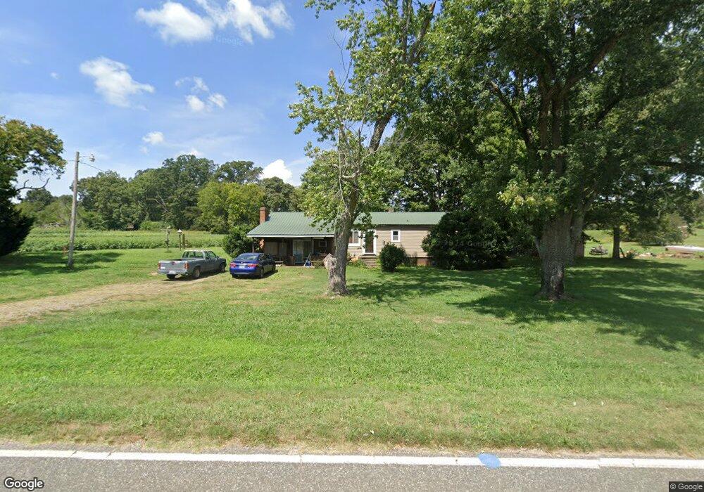
285 Branchwood Rd Statesville, NC 28625
Estimated Value: $187,000 - $298,000
3
Beds
2
Baths
1,500
Sq Ft
$159/Sq Ft
Est. Value
About This Home
This home is located at 285 Branchwood Rd, Statesville, NC 28625 and is currently estimated at $238,641, approximately $159 per square foot. 285 Branchwood Rd is a home located in Iredell County with nearby schools including Central Elementary School, North Iredell Middle School, and North Iredell High School.
Ownership History
Date
Name
Owned For
Owner Type
Purchase Details
Closed on
Jan 31, 2002
Sold by
Moss Alvin Lynn and Moss Linda Ann Phillips
Bought by
Moss Alvin Lynn
Current Estimated Value
Home Financials for this Owner
Home Financials are based on the most recent Mortgage that was taken out on this home.
Original Mortgage
$57,800
Interest Rate
7.02%
Purchase Details
Closed on
Nov 1, 1995
Purchase Details
Closed on
May 1, 1987
Purchase Details
Closed on
Dec 1, 1984
Purchase Details
Closed on
Aug 1, 1984
Create a Home Valuation Report for This Property
The Home Valuation Report is an in-depth analysis detailing your home's value as well as a comparison with similar homes in the area
Home Values in the Area
Average Home Value in this Area
Purchase History
| Date | Buyer | Sale Price | Title Company |
|---|---|---|---|
| Moss Alvin Lynn | -- | -- | |
| -- | $66,000 | -- | |
| -- | $6,000 | -- | |
| -- | -- | -- | |
| -- | $40,000 | -- |
Source: Public Records
Mortgage History
| Date | Status | Borrower | Loan Amount |
|---|---|---|---|
| Closed | Moss Alvin Lynn | $57,800 |
Source: Public Records
Tax History Compared to Growth
Tax History
| Year | Tax Paid | Tax Assessment Tax Assessment Total Assessment is a certain percentage of the fair market value that is determined by local assessors to be the total taxable value of land and additions on the property. | Land | Improvement |
|---|---|---|---|---|
| 2024 | $723 | $112,350 | $19,850 | $92,500 |
| 2023 | $723 | $112,350 | $19,850 | $92,500 |
| 2022 | $642 | $92,760 | $17,010 | $75,750 |
| 2021 | $620 | $89,880 | $17,010 | $72,870 |
| 2020 | $620 | $89,880 | $17,010 | $72,870 |
| 2019 | $611 | $89,880 | $17,010 | $72,870 |
| 2018 | $581 | $88,530 | $17,010 | $71,520 |
| 2017 | $581 | $88,530 | $17,010 | $71,520 |
| 2016 | $581 | $88,530 | $17,010 | $71,520 |
| 2015 | $581 | $88,530 | $17,010 | $71,520 |
| 2014 | $578 | $94,760 | $17,010 | $77,750 |
Source: Public Records
Map
Nearby Homes
- 203 Grassy Meadow Ln
- 154 Windy Hill Rd
- 3050 Wilkesboro Hwy
- 107 Porter Rd
- 3359 Wilkesboro Hwy
- 111 Mallory Ln
- 179 Foy Ln
- 133 Bluegill Ln
- 223 Bluegill Ln
- 137 Bluegill Ln
- 354 Bluegill Ln Unit 23
- 000 Cove Gap Rd
- 204 Harriet Ln
- 103 Roseman Ln
- 202 Deitz Rd
- Winslow Plan at Heritage Hall
- Riley Plan at Heritage Hall
- Hudson Plan at Heritage Hall
- Wayne Plan at Heritage Hall
- Kensington Plan at Heritage Hall
- 91 Riverfield Dr Unit 91
- 103 Riverfield Dr
- 107 Riverfield Dr
- Lot100 Riverfield Dr Unit 100
- 113 Riverfield Dr
- 100 Riverfield Dr Unit 100
- 303 Branchwood Rd
- 272 Branchwood Rd
- 286 Branchwood Rd
- 119 Riverfield Dr
- 116 Riverfield Dr Unit 58
- 116 Riverfield Dr
- 309 Branchwood Rd
- 239 Grassy Meadow Ln
- 125 Riverfield Dr
- 306 Branchwood Rd
- 233 Grassy Meadow Ln Unit 60
- 233 Grassy Meadow Ln
- 315 Branchwood Rd
- 126 Riverfield Dr