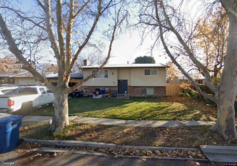
285 Clegg Cir American Fork, UT 84003
Estimated Value: $461,000 - $537,000
4
Beds
2
Baths
1,840
Sq Ft
$269/Sq Ft
Est. Value
About This Home
This home is located at 285 Clegg Cir, American Fork, UT 84003 and is currently estimated at $495,317, approximately $269 per square foot. 285 Clegg Cir is a home located in Utah County with nearby schools including Greenwood Elementary School, American Fork Junior High School, and American Fork High School.
Ownership History
Date
Name
Owned For
Owner Type
Purchase Details
Closed on
May 17, 2023
Sold by
Amundsen Cory L
Bought by
Flores Roxana Carina and Videla Agustina A
Current Estimated Value
Home Financials for this Owner
Home Financials are based on the most recent Mortgage that was taken out on this home.
Original Mortgage
$444,600
Outstanding Balance
$431,988
Interest Rate
6.28%
Mortgage Type
New Conventional
Estimated Equity
$63,329
Purchase Details
Closed on
Dec 1, 2005
Sold by
Amundson Cory L and Amundson Kristin
Bought by
Amundsen Cory L and Amundsen Kristin K
Home Financials for this Owner
Home Financials are based on the most recent Mortgage that was taken out on this home.
Original Mortgage
$120,000
Interest Rate
6.62%
Mortgage Type
Fannie Mae Freddie Mac
Purchase Details
Closed on
Jan 15, 2003
Sold by
Fracasso Angela M
Bought by
Amundson Cory L and Amundson Kristin
Home Financials for this Owner
Home Financials are based on the most recent Mortgage that was taken out on this home.
Original Mortgage
$106,800
Interest Rate
6%
Purchase Details
Closed on
Nov 27, 2002
Sold by
Amundsen Cory L
Bought by
Amundsen Cory L and Amundsen Kristin
Home Financials for this Owner
Home Financials are based on the most recent Mortgage that was taken out on this home.
Original Mortgage
$106,800
Interest Rate
6%
Purchase Details
Closed on
Sep 23, 2002
Sold by
Fracasso Leandro G
Bought by
Fracasso Leandro G and Fracasso Angela M
Purchase Details
Closed on
Mar 9, 2001
Sold by
Griffin Roylen J
Bought by
Fracasso Leandro G
Home Financials for this Owner
Home Financials are based on the most recent Mortgage that was taken out on this home.
Original Mortgage
$130,452
Interest Rate
7.12%
Mortgage Type
FHA
Purchase Details
Closed on
Mar 8, 2001
Sold by
Griffin Jeri L
Bought by
Fracasso Leandro G
Home Financials for this Owner
Home Financials are based on the most recent Mortgage that was taken out on this home.
Original Mortgage
$130,452
Interest Rate
7.12%
Mortgage Type
FHA
Create a Home Valuation Report for This Property
The Home Valuation Report is an in-depth analysis detailing your home's value as well as a comparison with similar homes in the area
Home Values in the Area
Average Home Value in this Area
Purchase History
| Date | Buyer | Sale Price | Title Company |
|---|---|---|---|
| Flores Roxana Carina | -- | Greenbrier Title | |
| Amundsen Cory L | -- | First American Title Agency | |
| Amundson Cory L | -- | Empire Land Title Company | |
| Amundsen Cory L | -- | Empire Land Title Company | |
| Amundsen Cory L | -- | Empire Land Title Company | |
| Fracasso Leandro G | -- | Mountain Land Title | |
| Fracasso Leandro G | -- | Title One | |
| Fracasso Leandro G | -- | Title One |
Source: Public Records
Mortgage History
| Date | Status | Borrower | Loan Amount |
|---|---|---|---|
| Open | Flores Roxana Carina | $444,600 | |
| Previous Owner | Amundsen Cory L | $120,000 | |
| Previous Owner | Amundsen Cory L | $106,800 | |
| Previous Owner | Fracasso Leandro G | $130,452 | |
| Closed | Amundsen Cory L | $26,700 |
Source: Public Records
Tax History Compared to Growth
Tax History
| Year | Tax Paid | Tax Assessment Tax Assessment Total Assessment is a certain percentage of the fair market value that is determined by local assessors to be the total taxable value of land and additions on the property. | Land | Improvement |
|---|---|---|---|---|
| 2025 | $1,833 | $230,835 | $193,300 | $226,400 |
| 2024 | $1,833 | $203,665 | $0 | $0 |
| 2023 | $1,687 | $198,715 | $0 | $0 |
| 2022 | $1,939 | $225,445 | $0 | $0 |
| 2021 | $1,611 | $292,600 | $121,300 | $171,300 |
| 2020 | $1,516 | $266,900 | $108,300 | $158,600 |
| 2019 | $1,296 | $236,100 | $98,200 | $137,900 |
| 2018 | $1,213 | $211,300 | $91,400 | $119,900 |
| 2017 | $1,164 | $109,450 | $0 | $0 |
| 2016 | $1,079 | $94,270 | $0 | $0 |
| 2015 | $1,119 | $92,730 | $0 | $0 |
| 2014 | $1,057 | $86,405 | $0 | $0 |
Source: Public Records
Map
Nearby Homes
- 271 S Barratt Cir
- 382 W 330 S
- 365 W 370 S
- 391 W 370 S
- 316 W 390 S
- 412 S 390 W
- 424 S 340 W
- 351 Washington Ave
- 82 S Lincoln Ave
- 429 S Storrs Ave
- 368 S Storrs Ct Unit 107
- 55 Roosevelt Ave
- 55 S 200 W
- 217 W Main St
- 195 S Center St
- 326 S 650 W
- 120 N 350 W Unit 127
- 120 N 350 W Unit 133
- 120 N 350 W Unit 130
- 304 S 680 W