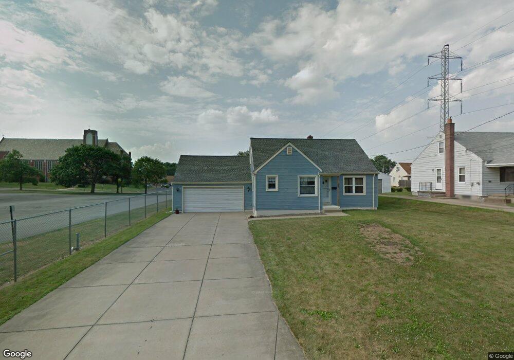
285 Como St Struthers, OH 44471
Estimated Value: $129,000 - $174,000
3
Beds
1
Bath
1,248
Sq Ft
$120/Sq Ft
Est. Value
About This Home
This home is located at 285 Como St, Struthers, OH 44471 and is currently estimated at $149,351, approximately $119 per square foot. 285 Como St is a home located in Mahoning County with nearby schools including Struthers Elementary School, Struthers Middle School, and Struthers High School.
Ownership History
Date
Name
Owned For
Owner Type
Purchase Details
Closed on
May 24, 2017
Sold by
Hardy Robert James
Bought by
Weamer Roy H
Current Estimated Value
Home Financials for this Owner
Home Financials are based on the most recent Mortgage that was taken out on this home.
Original Mortgage
$30,000
Outstanding Balance
$24,616
Interest Rate
3.97%
Mortgage Type
New Conventional
Estimated Equity
$124,735
Purchase Details
Closed on
Nov 13, 2008
Sold by
Grover Dorothy M
Bought by
Weamer Roy H
Home Financials for this Owner
Home Financials are based on the most recent Mortgage that was taken out on this home.
Original Mortgage
$58,500
Interest Rate
6.09%
Mortgage Type
New Conventional
Purchase Details
Closed on
Mar 14, 2008
Sold by
Fortunato Bridget A
Bought by
Grover Dorothy M
Create a Home Valuation Report for This Property
The Home Valuation Report is an in-depth analysis detailing your home's value as well as a comparison with similar homes in the area
Home Values in the Area
Average Home Value in this Area
Purchase History
| Date | Buyer | Sale Price | Title Company |
|---|---|---|---|
| Weamer Roy H | $52,000 | None Available | |
| Weamer Roy H | $61,600 | Reliable Title | |
| Grover Dorothy M | -- | Attorney |
Source: Public Records
Mortgage History
| Date | Status | Borrower | Loan Amount |
|---|---|---|---|
| Open | Weamer Roy H | $30,000 | |
| Previous Owner | Weamer Roy H | $58,500 |
Source: Public Records
Tax History
| Year | Tax Paid | Tax Assessment Tax Assessment Total Assessment is a certain percentage of the fair market value that is determined by local assessors to be the total taxable value of land and additions on the property. | Land | Improvement |
|---|---|---|---|---|
| 2025 | $1,669 | $40,090 | $4,190 | $35,900 |
| 2024 | $1,669 | $40,090 | $4,190 | $35,900 |
| 2023 | $1,641 | $40,090 | $4,190 | $35,900 |
| 2022 | $1,536 | $28,420 | $3,940 | $24,480 |
| 2021 | $1,522 | $28,420 | $3,940 | $24,480 |
| 2020 | $1,529 | $28,420 | $3,940 | $24,480 |
| 2019 | $1,464 | $24,720 | $3,430 | $21,290 |
| 2018 | $1,397 | $24,720 | $3,430 | $21,290 |
| 2017 | $1,425 | $24,720 | $3,430 | $21,290 |
| 2016 | $1,456 | $26,420 | $4,000 | $22,420 |
| 2015 | $1,422 | $26,420 | $4,000 | $22,420 |
| 2014 | $1,427 | $26,420 | $4,000 | $22,420 |
| 2013 | $1,326 | $26,420 | $4,000 | $22,420 |
Source: Public Records
Map
Nearby Homes
Your Personal Tour Guide
Ask me questions while you tour the home.