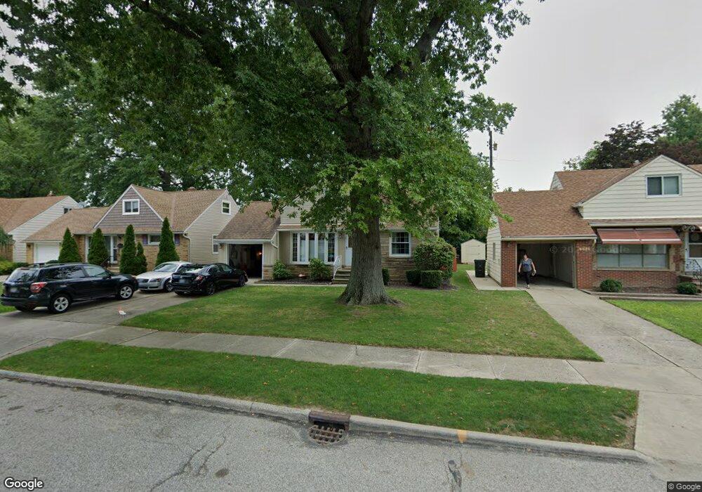
285 E 262nd St Euclid, OH 44132
Estimated Value: $128,000 - $156,000
3
Beds
1
Bath
1,215
Sq Ft
$115/Sq Ft
Est. Value
About This Home
This home is located at 285 E 262nd St, Euclid, OH 44132 and is currently estimated at $140,220, approximately $115 per square foot. 285 E 262nd St is a home located in Cuyahoga County with nearby schools including Shoreview Elementary School, Euclid High School, and Ss Robert & William Catholic School.
Ownership History
Date
Name
Owned For
Owner Type
Purchase Details
Closed on
Sep 19, 2023
Sold by
Shay Karen M and Direnzo Karen M
Bought by
Shay Karen M and Shay Ronald E
Current Estimated Value
Purchase Details
Closed on
May 23, 1991
Sold by
Direnzo Katherine
Bought by
Direnzo Karen M
Purchase Details
Closed on
Jan 12, 1977
Sold by
Direnzo Godfrey J and Direnzo Katherine
Bought by
Direnzo Richard and Direnzo Katherine
Purchase Details
Closed on
Jan 1, 1975
Bought by
Direnzo Godfrey J and Direnzo Katherine
Create a Home Valuation Report for This Property
The Home Valuation Report is an in-depth analysis detailing your home's value as well as a comparison with similar homes in the area
Home Values in the Area
Average Home Value in this Area
Purchase History
| Date | Buyer | Sale Price | Title Company |
|---|---|---|---|
| Shay Karen M | -- | None Listed On Document | |
| Direnzo Karen M | -- | -- | |
| Direnzo Katherine | -- | -- | |
| Direnzo Richard | -- | -- | |
| Direnzo Godfrey J | -- | -- |
Source: Public Records
Tax History
| Year | Tax Paid | Tax Assessment Tax Assessment Total Assessment is a certain percentage of the fair market value that is determined by local assessors to be the total taxable value of land and additions on the property. | Land | Improvement |
|---|---|---|---|---|
| 2025 | $2,822 | $43,260 | $8,715 | $34,545 |
| 2024 | $2,915 | $43,260 | $8,715 | $34,545 |
| 2023 | $2,635 | $30,320 | $6,620 | $23,700 |
| 2022 | $2,576 | $30,310 | $6,615 | $23,695 |
| 2021 | $2,868 | $30,310 | $6,620 | $23,700 |
| 2020 | $2,721 | $26,150 | $5,710 | $20,440 |
| 2019 | $2,446 | $74,700 | $16,300 | $58,400 |
| 2018 | $2,469 | $26,150 | $5,710 | $20,440 |
| 2017 | $2,614 | $23,140 | $4,730 | $18,410 |
| 2016 | $2,620 | $23,140 | $4,730 | $18,410 |
| 2015 | $2,385 | $23,140 | $4,730 | $18,410 |
| 2014 | $2,385 | $23,140 | $4,730 | $18,410 |
Source: Public Records
Map
Nearby Homes
- 325 E 264th St
- 25801 Lakeshore Blvd Unit 42
- 298 E 270th St
- 25801 Lake Shore Blvd Unit 29
- 25801 Lake Shore Blvd Unit 112
- 257 E 270th St
- 325 E 257th St
- 411 E 270th St
- 355 E 257th St
- 25591 Forestview Ave
- 440 E 271st St
- 110 E 252nd St
- 406 E 274th St
- 26171 Shoreview Ave
- 26831 Shoreview Ave
- 427 E 275th St
- 610 E 266th St
- 26530 Shoreview Ave
- 26931 Shoreview Ave
- 25731 Zeman Ave
Your Personal Tour Guide
Ask me questions while you tour the home.