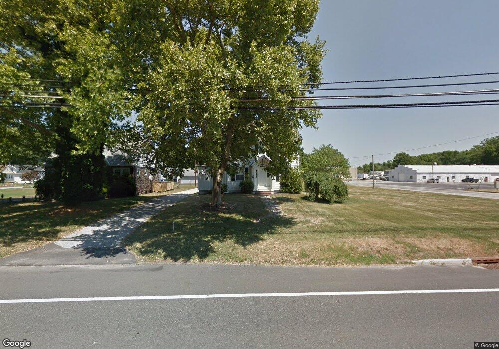
285 Harding Hwy Penns Grove, NJ 08069
Estimated Value: $204,774 - $313,000
--
Bed
--
Bath
1,568
Sq Ft
$160/Sq Ft
Est. Value
About This Home
This home is located at 285 Harding Hwy, Penns Grove, NJ 08069 and is currently estimated at $250,194, approximately $159 per square foot. 285 Harding Hwy is a home located in Salem County with nearby schools including Lafayette-Pershing Elementary School, Field Street Elementary School, and Paul W. Carleton Elementary School.
Ownership History
Date
Name
Owned For
Owner Type
Purchase Details
Closed on
Sep 12, 2017
Sold by
Buckelew Roger C
Bought by
Us Bank Trust National Association and Lsf9 Master Participation Trust
Current Estimated Value
Purchase Details
Closed on
Jun 14, 1996
Sold by
Stidham Rita N
Bought by
Buckelew Roger C and Buckelew Frances R
Home Financials for this Owner
Home Financials are based on the most recent Mortgage that was taken out on this home.
Original Mortgage
$93,405
Interest Rate
7.97%
Mortgage Type
FHA
Create a Home Valuation Report for This Property
The Home Valuation Report is an in-depth analysis detailing your home's value as well as a comparison with similar homes in the area
Home Values in the Area
Average Home Value in this Area
Purchase History
| Date | Buyer | Sale Price | Title Company |
|---|---|---|---|
| Us Bank Trust National Association | -- | Foundation Title | |
| Buckelew Roger C | $94,000 | Intercoastal Title |
Source: Public Records
Mortgage History
| Date | Status | Borrower | Loan Amount |
|---|---|---|---|
| Previous Owner | Buckelew Roger C | $93,405 |
Source: Public Records
Tax History Compared to Growth
Tax History
| Year | Tax Paid | Tax Assessment Tax Assessment Total Assessment is a certain percentage of the fair market value that is determined by local assessors to be the total taxable value of land and additions on the property. | Land | Improvement |
|---|---|---|---|---|
| 2025 | $5,247 | $249,100 | $61,100 | $188,000 |
| 2024 | $5,066 | $142,300 | $36,800 | $105,500 |
| 2023 | $5,066 | $142,300 | $36,800 | $105,500 |
| 2022 | $4,767 | $142,300 | $36,800 | $105,500 |
| 2021 | $4,722 | $142,300 | $36,800 | $105,500 |
| 2020 | $4,763 | $142,300 | $36,800 | $105,500 |
| 2019 | $4,803 | $142,300 | $36,800 | $105,500 |
| 2018 | $4,982 | $158,200 | $40,700 | $117,500 |
| 2017 | $4,645 | $158,200 | $40,700 | $117,500 |
| 2016 | $4,857 | $171,700 | $40,700 | $131,000 |
| 2015 | $4,631 | $171,700 | $40,700 | $131,000 |
| 2014 | $4,384 | $171,700 | $40,700 | $131,000 |
Source: Public Records
Map
Nearby Homes
- 279 Logwood Ave
- 15 1/2 N Miller Ave
- 65 S Miller Ave
- 253 Dixie Dr
- 45 S Virginia Ave
- 5 Dixie Dr
- 243 Wintergreen Ln
- 83 Willis St
- 114 Deming Ave
- 150 Penns Grove Auburn Rd
- 62 E End Ave
- 113 Primrose Ln
- 0 Park Ave Unit NJSA2013690
- 210 Penns Grove Auburn Rd
- 39 41 Cumberland Ave
- 32 Walnut St
- 55 57 Walnut St
- 59-61 Walnut St
- 34 38 Cumberland Ave
- 0 Lincoln Avenue & Cumberland
- 283 Harding Hwy
- 10 Rosewood Ave
- 9 N Elmwood Ave
- 284 Harding Hwy
- 288 Harding Hwy
- 280 Harding Hwy
- 294 Harding Hwy
- 273 Harding Hwy
- 8 N Elmwood Ave
- 10 N Elmwood Ave
- 281 Logwood Ave
- 9 S Elmwood Ave
- 274 Logwood Ave
- 274 Harding Hwy
- 277 Logwood Ave
- 19 N Elmwood Ave
- 267 Harding Hwy
- 15 S Elmwood Ave
- 270 Harding Hwy
- 268 Logwood Ave