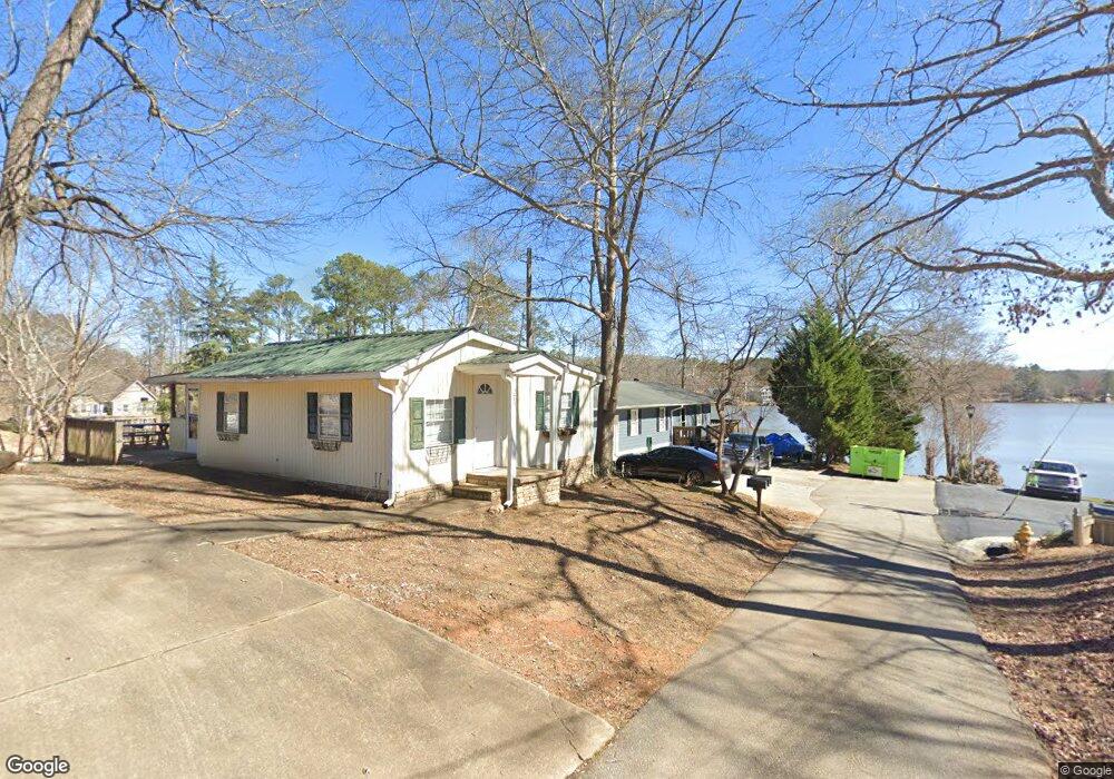
285 Norman Rd Covington, GA 30014
Estimated Value: $326,000 - $441,000
Studio
1
Bath
1,718
Sq Ft
$218/Sq Ft
Est. Value
About This Home
This home is located at 285 Norman Rd, Covington, GA 30014 and is currently estimated at $374,429, approximately $217 per square foot. 285 Norman Rd is a home located in Newton County with nearby schools including Heard-Mixon Elementary School, Indian Creek Middle School, and Alcovy High School.
Ownership History
Date
Name
Owned For
Owner Type
Purchase Details
Closed on
Nov 17, 2023
Sold by
Bruno John B
Bought by
Whitehead Drive 50 Llc
Current Estimated Value
Purchase Details
Closed on
May 30, 2001
Sold by
Maddox Michael H
Bought by
Bruno John B
Home Financials for this Owner
Home Financials are based on the most recent Mortgage that was taken out on this home.
Original Mortgage
$101,085
Interest Rate
7.11%
Mortgage Type
New Conventional
Create a Home Valuation Report for This Property
The Home Valuation Report is an in-depth analysis detailing your home's value as well as a comparison with similar homes in the area
Home Values in the Area
Average Home Value in this Area
Purchase History
| Date | Buyer | Sale Price | Title Company |
|---|---|---|---|
| Whitehead Drive 50 Llc | -- | -- | |
| Bruno John B | $127,200 | -- |
Source: Public Records
Mortgage History
| Date | Status | Borrower | Loan Amount |
|---|---|---|---|
| Previous Owner | Bruno John B | $101,085 |
Source: Public Records
Tax History
| Year | Tax Paid | Tax Assessment Tax Assessment Total Assessment is a certain percentage of the fair market value that is determined by local assessors to be the total taxable value of land and additions on the property. | Land | Improvement |
|---|---|---|---|---|
| 2025 | $3,701 | $148,720 | $48,000 | $100,720 |
| 2024 | $3,288 | $129,800 | $48,000 | $81,800 |
| 2023 | $3,186 | $117,400 | $48,000 | $69,400 |
| 2022 | $2,714 | $100,040 | $48,000 | $52,040 |
| 2021 | $2,852 | $94,040 | $48,000 | $46,040 |
| 2020 | $2,934 | $87,320 | $32,000 | $55,320 |
| 2019 | $2,981 | $87,400 | $32,000 | $55,400 |
| 2018 | $2,940 | $85,640 | $32,000 | $53,640 |
| 2017 | $2,752 | $80,160 | $32,000 | $48,160 |
| 2016 | $2,469 | $71,920 | $32,000 | $39,920 |
| 2015 | $2,438 | $71,000 | $32,000 | $39,000 |
| 2014 | $1,975 | $57,720 | $0 | $0 |
Source: Public Records
Map
Nearby Homes
- 70 Birch Rd
- 50 Birch Rd
- 205 Yancey Rd
- 217 Yancey Rd
- 229 Yancey Rd
- 125 Yancey Rd
- 335 Yancey Rd
- 250 Rainbow Dr
- 477 Alcovy North Dr
- 475 Alcovy North Dr
- 393 Templeton Cir
- 6 Bear Creek Marina Rd
- 4444 County Line Rd
- LOTS 48,49,50 Doe Ln
- 660 Doe Ln
- 334 County Line Rd
- 0 Highway 212 Unit Parcel 5
- 0 Highway 212 Unit 10632274
- 0 Highway 212 Unit Parcel 4
- 0 Highway 212 Unit 10632256
Your Personal Tour Guide
Ask me questions while you tour the home.