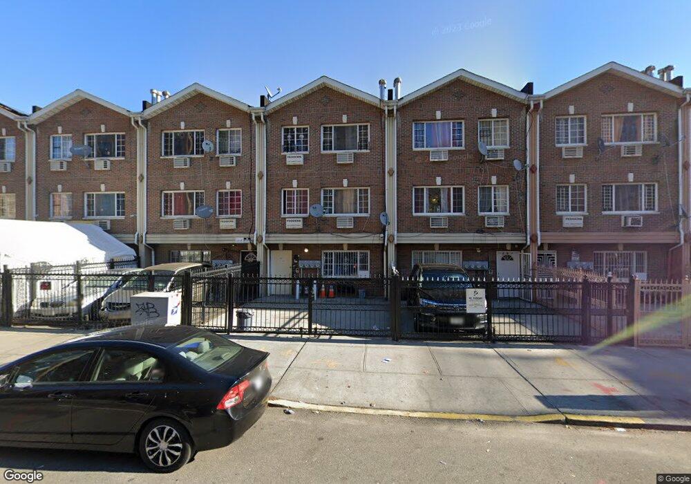
285 Powell St Unit 2F Brooklyn, NY 11212
Brownsville NeighborhoodEstimated Value: $846,000 - $967,000
3
Beds
2
Baths
900
Sq Ft
$1,028/Sq Ft
Est. Value
About This Home
This home is located at 285 Powell St Unit 2F, Brooklyn, NY 11212 and is currently estimated at $925,333, approximately $1,028 per square foot. 285 Powell St Unit 2F is a home located in Kings County with nearby schools including P.S. 150 - Christopher, P.S. 156 Waverly, and P.S. Is 155 Nicholas Herkimer.
Ownership History
Date
Name
Owned For
Owner Type
Purchase Details
Closed on
Jun 19, 2018
Sold by
Gregory T Cerchione Esq
Bought by
285 Powell Mnbd 2019 Llc
Current Estimated Value
Purchase Details
Closed on
Jan 31, 2008
Sold by
Rdg Powell Llc
Bought by
Delacruz Carlos D
Home Financials for this Owner
Home Financials are based on the most recent Mortgage that was taken out on this home.
Original Mortgage
$624,000
Interest Rate
6.14%
Purchase Details
Closed on
Feb 8, 2006
Sold by
Legano Debra
Bought by
925 Dumont Inc
Create a Home Valuation Report for This Property
The Home Valuation Report is an in-depth analysis detailing your home's value as well as a comparison with similar homes in the area
Home Values in the Area
Average Home Value in this Area
Purchase History
| Date | Buyer | Sale Price | Title Company |
|---|---|---|---|
| 285 Powell Mnbd 2019 Llc | $682,228 | -- | |
| 285 Powell Mnbd 2019 Llc | $682,228 | -- | |
| Delacruz Carlos D | $780,000 | -- | |
| Delacruz Carlos D | $780,000 | -- | |
| Delacruz Carlos D | $780,000 | -- | |
| 925 Dumont Inc | $460,000 | -- | |
| 925 Dumont Inc | $460,000 | -- |
Source: Public Records
Mortgage History
| Date | Status | Borrower | Loan Amount |
|---|---|---|---|
| Previous Owner | Delacruz Carlos D | $624,000 |
Source: Public Records
Tax History
| Year | Tax Paid | Tax Assessment Tax Assessment Total Assessment is a certain percentage of the fair market value that is determined by local assessors to be the total taxable value of land and additions on the property. | Land | Improvement |
|---|---|---|---|---|
| 2025 | $8,257 | $64,380 | $22,380 | $42,000 |
| 2024 | $8,257 | $55,200 | $22,380 | $32,820 |
| 2023 | $8,349 | $48,780 | $22,380 | $26,400 |
| 2022 | $6,438 | $42,960 | $22,380 | $20,580 |
| 2021 | $4,906 | $41,880 | $22,380 | $19,500 |
| 2020 | $1,554 | $42,960 | $22,380 | $20,580 |
| 2019 | $1,524 | $34,260 | $22,380 | $11,880 |
| 2018 | $110 | $35,488 | $19,046 | $16,442 |
| 2017 | $110 | $33,480 | $22,380 | $11,100 |
| 2016 | $108 | $36,000 | $22,380 | $13,620 |
| 2015 | $4,509 | $39,328 | $23,839 | $15,489 |
| 2014 | $4,509 | $37,102 | $22,489 | $14,613 |
Source: Public Records
Map
Nearby Homes
- 472 Sutter Ave
- 440 Blake Ave
- 297 Hinsdale St
- 105 Belmont Ave
- 1782 Pitkin Ave
- 406 Hinsdale St
- 117 Osborn St
- 637 Blake Ave
- 317 Pennsylvania Ave
- 353 Pennsylvania Ave
- 548 Rockaway Ave
- 45 Hinsdale St
- 392 New Jersey Ave Unit 3921
- 444 New Jersey Ave
- 195 Chester St
- 502 Powell St
- 67 Chester St Unit 3
- 533 Snediker Ave
- 51 Chester St
- 486 Vermont St
- 285 Powell St
- 283 Powell St
- 287 Powell St
- 281 Powell St
- 289 Powell St
- 279 Powell St
- 291 Powell St
- 291 Powell St Unit 3rd Fl
- 293 Powell St
- 293 Powell St Unit 1
- 271 Powell St
- 301 Powell St
- 284 Junius St
- 303 Powell St
- 301A Powell St
- 280 Junius St
- 294 Junius St
- 424 Sutter Ave
- 276 Junius St
- 436-444 Sutter Ave
Your Personal Tour Guide
Ask me questions while you tour the home.