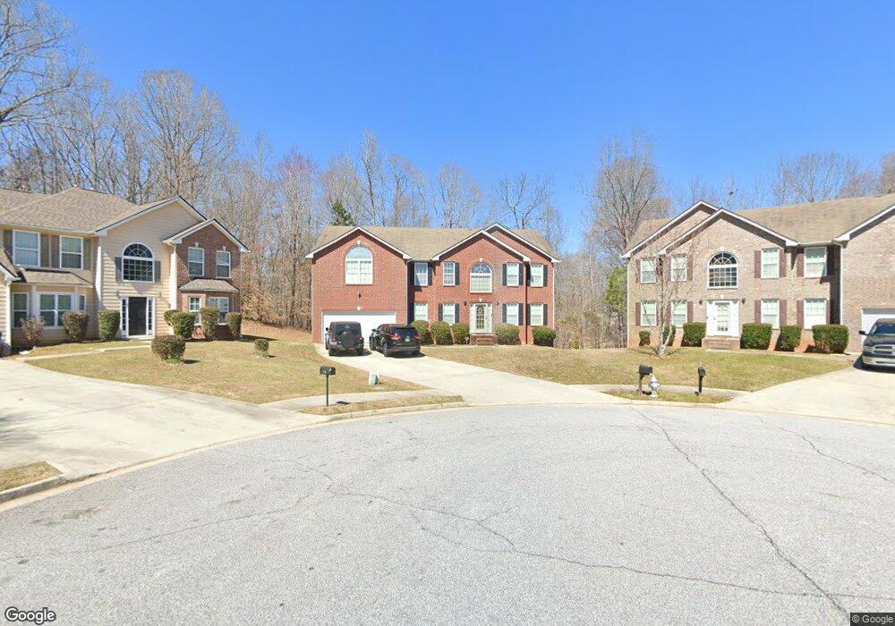
285 Redding Ridge Atlanta, GA 30349
Estimated Value: $359,000 - $428,000
4
Beds
3
Baths
3,552
Sq Ft
$110/Sq Ft
Est. Value
About This Home
This home is located at 285 Redding Ridge, Atlanta, GA 30349 and is currently estimated at $389,000, approximately $109 per square foot. 285 Redding Ridge is a home located in Fulton County with nearby schools including Cliftondale Elementary School, Renaissance Middle School, and Langston Hughes High School.
Ownership History
Date
Name
Owned For
Owner Type
Purchase Details
Closed on
May 12, 2008
Sold by
Suntrust Mortgage Inc
Bought by
Berry Cedric
Current Estimated Value
Home Financials for this Owner
Home Financials are based on the most recent Mortgage that was taken out on this home.
Original Mortgage
$177,395
Outstanding Balance
$112,226
Interest Rate
5.86%
Mortgage Type
FHA
Estimated Equity
$276,774
Purchase Details
Closed on
Mar 4, 2008
Sold by
Reese Douglas
Bought by
Suntrust Mortgage Inc
Purchase Details
Closed on
Oct 13, 2006
Sold by
Reese Douglas
Bought by
Reese Douglas and Green Remonia
Home Financials for this Owner
Home Financials are based on the most recent Mortgage that was taken out on this home.
Original Mortgage
$208,650
Interest Rate
6.39%
Mortgage Type
New Conventional
Create a Home Valuation Report for This Property
The Home Valuation Report is an in-depth analysis detailing your home's value as well as a comparison with similar homes in the area
Home Values in the Area
Average Home Value in this Area
Purchase History
| Date | Buyer | Sale Price | Title Company |
|---|---|---|---|
| Berry Cedric | $180,200 | -- | |
| Suntrust Mortgage Inc | $216,453 | -- | |
| Reese Douglas | -- | -- | |
| Reese Douglas | $260,900 | -- |
Source: Public Records
Mortgage History
| Date | Status | Borrower | Loan Amount |
|---|---|---|---|
| Open | Berry Cedric | $177,395 | |
| Previous Owner | Reese Douglas | $208,650 | |
| Previous Owner | Reese Douglas | $52,150 |
Source: Public Records
Tax History Compared to Growth
Tax History
| Year | Tax Paid | Tax Assessment Tax Assessment Total Assessment is a certain percentage of the fair market value that is determined by local assessors to be the total taxable value of land and additions on the property. | Land | Improvement |
|---|---|---|---|---|
| 2025 | $2,268 | $167,760 | $33,320 | $134,440 |
| 2023 | $4,794 | $169,840 | $34,160 | $135,680 |
| 2022 | $2,080 | $107,760 | $20,320 | $87,440 |
| 2021 | $2,026 | $101,640 | $18,720 | $82,920 |
| 2020 | $2,038 | $100,440 | $18,520 | $81,920 |
| 2019 | $2,273 | $89,840 | $15,560 | $74,280 |
| 2018 | $2,080 | $69,560 | $11,320 | $58,240 |
| 2017 | $1,657 | $57,720 | $10,840 | $46,880 |
| 2016 | $1,508 | $54,120 | $10,840 | $43,280 |
| 2015 | $1,513 | $54,120 | $10,840 | $43,280 |
| 2014 | $1,569 | $54,120 | $10,840 | $43,280 |
Source: Public Records
Map
Nearby Homes
- 275 Redding Ridge
- 260 Redding Ridge
- 7198 Glaspie Way
- 2970 Oxford Rd
- 3198 Redwood Run
- 2980 Oxford Rd
- 7250 Old Chapel
- 0 W Stubbs Rd Unit (11.4 ACRES)
- 0 W Stubbs Rd Unit 7487198
- 450 Pinevale Ct
- 440 Pinevale Ct
- 315 Amhurst Pkwy
- 7459 Old Chapel
- 3185 Highgreen Trail
- 7425 Thoreau Cir
- 7648 Cole Ln Unit 1C
- 7656 Cole Ln
- 2765 Elkmont Ridge SW
- 3245 Lions Ruby Ln
- 280 Redding Ridge
- 275 Redding Ridge Unit 388
- 275 Riggins Ridge
- 270 Redding Ridge
- 265 Redding Ridge
- 235 Redding Ridge
- 250 Redding Ridge
- 205 Redding Ridge
- 240 Redding Ridge
- 3396 Amhurst Pkwy Unit 3
- 3412 Amhurst Pkwy Unit 3
- 3392 Amhurst Pkwy
- 3416 Amhurst Pkwy
- 3420 Amhurst Pkwy
- 3400 Amhurst Pkwy
- 230 Redding Ridge
- 230 Redding Ridge Unit 230
- 230 Redding Ridge Unit 3
- 230 Redding Ridge
- 0 Redding Ridge Unit 8481215