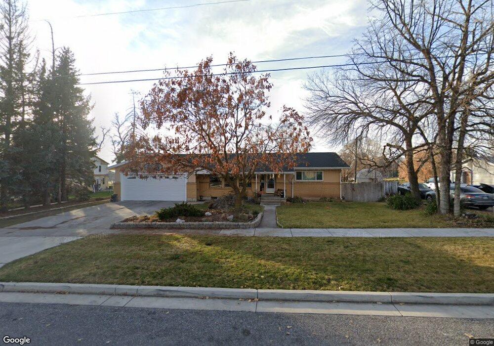
285 S 100 E Smithfield, UT 84335
Estimated Value: $444,000 - $485,497
5
Beds
3
Baths
3,056
Sq Ft
$151/Sq Ft
Est. Value
About This Home
This home is located at 285 S 100 E, Smithfield, UT 84335 and is currently estimated at $460,624, approximately $150 per square foot. 285 S 100 E is a home located in Cache County with nearby schools including Summit School, Cedar Ridge School, and North Cache Middle School.
Ownership History
Date
Name
Owned For
Owner Type
Purchase Details
Closed on
Nov 16, 2011
Sold by
Tyler Roger A
Bought by
Tyler Roger A and Tyler Tamsin Kay
Current Estimated Value
Home Financials for this Owner
Home Financials are based on the most recent Mortgage that was taken out on this home.
Original Mortgage
$173,367
Outstanding Balance
$116,924
Interest Rate
3.87%
Mortgage Type
New Conventional
Estimated Equity
$343,700
Purchase Details
Closed on
Nov 14, 2011
Sold by
Graves Kenneth and Graves Nina
Bought by
Tyler Roger A
Home Financials for this Owner
Home Financials are based on the most recent Mortgage that was taken out on this home.
Original Mortgage
$173,367
Outstanding Balance
$116,924
Interest Rate
3.87%
Mortgage Type
New Conventional
Estimated Equity
$343,700
Purchase Details
Closed on
Oct 24, 2005
Sold by
Atkinson Bracken John
Bought by
Graves Kenneth and Graves Nina
Create a Home Valuation Report for This Property
The Home Valuation Report is an in-depth analysis detailing your home's value as well as a comparison with similar homes in the area
Home Values in the Area
Average Home Value in this Area
Purchase History
| Date | Buyer | Sale Price | Title Company |
|---|---|---|---|
| Tyler Roger A | -- | Hickman Land Title Company | |
| Tyler Roger A | -- | Hickman Land Title Company | |
| Graves Kenneth | -- | Heritage West Title |
Source: Public Records
Mortgage History
| Date | Status | Borrower | Loan Amount |
|---|---|---|---|
| Open | Tyler Roger A | $173,367 |
Source: Public Records
Tax History
| Year | Tax Paid | Tax Assessment Tax Assessment Total Assessment is a certain percentage of the fair market value that is determined by local assessors to be the total taxable value of land and additions on the property. | Land | Improvement |
|---|---|---|---|---|
| 2025 | $1,935 | $259,030 | $0 | $0 |
| 2024 | $1,887 | $237,025 | $0 | $0 |
| 2023 | $1,965 | $233,355 | $0 | $0 |
| 2022 | $1,997 | $233,355 | $0 | $0 |
| 2021 | $1,937 | $341,920 | $75,500 | $266,420 |
| 2020 | $1,814 | $298,300 | $75,500 | $222,800 |
| 2019 | $1,507 | $237,688 | $50,600 | $187,088 |
| 2018 | $1,374 | $209,424 | $50,600 | $158,824 |
| 2017 | $1,273 | $106,740 | $0 | $0 |
| 2016 | $1,295 | $106,740 | $0 | $0 |
| 2015 | $1,300 | $106,740 | $0 | $0 |
| 2014 | $1,192 | $99,810 | $0 | $0 |
| 2013 | -- | $99,810 | $0 | $0 |
Source: Public Records
Map
Nearby Homes
Your Personal Tour Guide
Ask me questions while you tour the home.