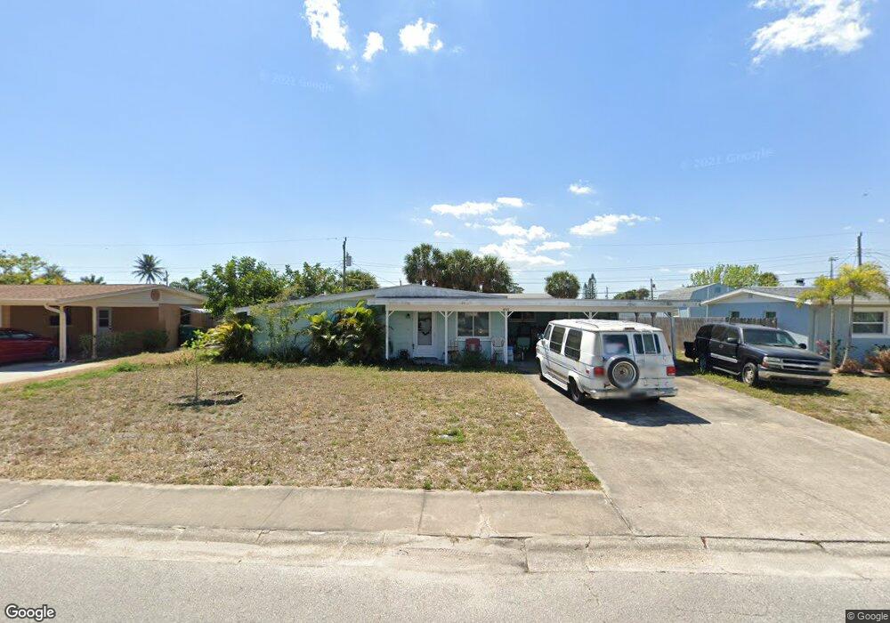
285 Sabal Ave Merritt Island, FL 32953
Estimated Value: $288,000 - $386,000
4
Beds
2
Baths
1,758
Sq Ft
$187/Sq Ft
Est. Value
About This Home
This home is located at 285 Sabal Ave, Merritt Island, FL 32953 and is currently estimated at $328,000, approximately $186 per square foot. 285 Sabal Ave is a home located in Brevard County with nearby schools including Mila Elementary School, Thomas Jefferson Middle School, and Merritt Island High School.
Ownership History
Date
Name
Owned For
Owner Type
Purchase Details
Closed on
Jun 13, 2023
Sold by
Boyd Carol A
Bought by
Owens Donna C and Owens Allan C
Current Estimated Value
Create a Home Valuation Report for This Property
The Home Valuation Report is an in-depth analysis detailing your home's value as well as a comparison with similar homes in the area
Home Values in the Area
Average Home Value in this Area
Purchase History
| Date | Buyer | Sale Price | Title Company |
|---|---|---|---|
| Owens Donna C | $183,700 | -- |
Source: Public Records
Tax History Compared to Growth
Tax History
| Year | Tax Paid | Tax Assessment Tax Assessment Total Assessment is a certain percentage of the fair market value that is determined by local assessors to be the total taxable value of land and additions on the property. | Land | Improvement |
|---|---|---|---|---|
| 2025 | $3,528 | $235,250 | -- | -- |
| 2024 | $3,375 | $244,230 | -- | -- |
| 2023 | $3,375 | $258,580 | $0 | $0 |
| 2022 | $2,871 | $215,890 | $0 | $0 |
| 2021 | $2,624 | $157,520 | $75,000 | $82,520 |
| 2020 | $512 | $61,330 | $0 | $0 |
| 2019 | $454 | $59,960 | $0 | $0 |
| 2018 | $447 | $58,850 | $0 | $0 |
| 2017 | $433 | $57,640 | $0 | $0 |
| 2016 | $427 | $56,460 | $34,000 | $22,460 |
| 2015 | $415 | $56,070 | $28,000 | $28,070 |
| 2014 | $415 | $55,630 | $23,000 | $32,630 |
Source: Public Records
Map
Nearby Homes
- 290 Patrick Ave
- 320 Alabama Ave
- 380 Sabal Ave
- 240 Belair Ave
- 421 4th St
- 145 Needle Blvd
- 240 Riverside Ave
- 324 3rd St
- 225 Richland Ave
- 410 4th St
- 450 Patrick Ave
- 904 Westwood Dr
- 455 Riverside Ave
- 135 Richland Ave
- 819 9th St
- 755 Larkview St
- 495 Belair Ave
- 800 Del Rio Way Unit 401
- 300 Enola Place
- 821 Del Rio Way Unit 504