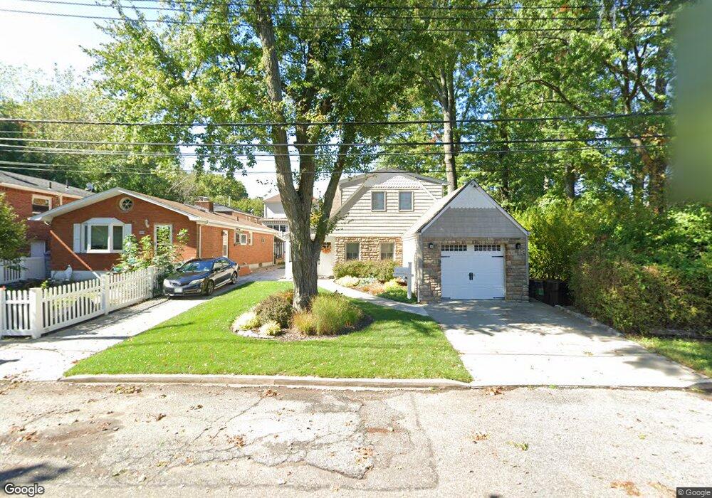
285 Stafford Ave Staten Island, NY 10312
Arden Heights NeighborhoodEstimated Value: $609,133 - $753,000
--
Bed
4
Baths
780
Sq Ft
$889/Sq Ft
Est. Value
About This Home
This home is located at 285 Stafford Ave, Staten Island, NY 10312 and is currently estimated at $693,283, approximately $888 per square foot. 285 Stafford Ave is a home located in Richmond County with nearby schools including P.S. 36 - J.C. Drumgoole, I.S. 075 Frank D. Paulo, and Tottenville High School.
Ownership History
Date
Name
Owned For
Owner Type
Purchase Details
Closed on
Jul 15, 1999
Sold by
Prevete Philip and Prevete Susan
Bought by
Block 6016 Realty Corp
Current Estimated Value
Home Financials for this Owner
Home Financials are based on the most recent Mortgage that was taken out on this home.
Original Mortgage
$110,000
Outstanding Balance
$31,031
Interest Rate
7.65%
Mortgage Type
Seller Take Back
Estimated Equity
$662,252
Create a Home Valuation Report for This Property
The Home Valuation Report is an in-depth analysis detailing your home's value as well as a comparison with similar homes in the area
Home Values in the Area
Average Home Value in this Area
Purchase History
| Date | Buyer | Sale Price | Title Company |
|---|---|---|---|
| Block 6016 Realty Corp | $110,000 | Title Insurance Of Ny Inc |
Source: Public Records
Mortgage History
| Date | Status | Borrower | Loan Amount |
|---|---|---|---|
| Open | Block 6016 Realty Corp | $110,000 |
Source: Public Records
Tax History Compared to Growth
Tax History
| Year | Tax Paid | Tax Assessment Tax Assessment Total Assessment is a certain percentage of the fair market value that is determined by local assessors to be the total taxable value of land and additions on the property. | Land | Improvement |
|---|---|---|---|---|
| 2025 | $2,542 | $33,600 | $13,824 | $19,776 |
| 2024 | $2,646 | $33,780 | $13,093 | $20,687 |
| 2023 | $2,494 | $31,046 | $10,473 | $20,573 |
| 2022 | $2,265 | $36,480 | $13,440 | $23,040 |
| 2021 | $2,352 | $30,300 | $13,440 | $16,860 |
| 2020 | $3,608 | $30,600 | $13,440 | $17,160 |
| 2019 | $3,357 | $31,320 | $13,440 | $17,880 |
| 2018 | $4,351 | $25,872 | $12,765 | $13,107 |
| 2017 | $4,330 | $24,408 | $11,657 | $12,751 |
| 2016 | $4,230 | $24,264 | $11,663 | $12,601 |
| 2015 | $4,081 | $24,000 | $12,360 | $11,640 |
| 2014 | $4,081 | $22,853 | $11,769 | $11,084 |
Source: Public Records
Map
Nearby Homes
- 262 Stafford Ave
- 17 Holcomb Ave
- 716 Woodrow Rd
- 308 Sheldon Ave
- 287 Rensselaer Ave
- 525 Sinclair Ave
- 291 Rensselaer Ave
- 295 Rensselaer Ave
- 242 Rathbun Ave
- 191 Rensselaer Ave Unit 198
- 62 Ruxton Ave
- 452 Rensselaer Ave
- 22 Belfield Ave
- 43 Everton Ave
- 42 Everton Ave
- 480 Sheldon Ave
- 160 Rathbun Ave
- 610 Woodrow Rd
- 9 Sperry Place
- 138 Rathbun Ave
- 289 Stafford Ave
- 291 Stafford Ave
- 273 Stafford Ave
- 312 Vineland Ave
- 312 Vineland Ave Unit 2
- 316 Vineland Ave
- 320 Vineland Ave
- 304 Vineland Ave
- 286 Stafford Ave
- 282 Stafford Ave
- 290 Stafford Ave
- 278 Stafford Ave
- 267 Stafford Ave
- 294 Vineland Ave
- 274 Stafford Ave
- 290 Vineland Ave
- 270 Stafford Ave
- 266 Stafford Ave
- 309 Vineland Ave
- 235 Sinclair Ave