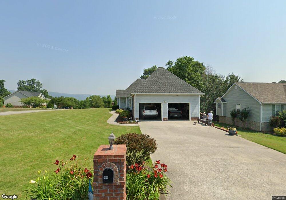
285 Stanford Dr Flintstone, GA 30725
High Point NeighborhoodEstimated Value: $335,929 - $403,000
3
Beds
3
Baths
1,730
Sq Ft
$207/Sq Ft
Est. Value
About This Home
This home is located at 285 Stanford Dr, Flintstone, GA 30725 and is currently estimated at $357,982, approximately $206 per square foot. 285 Stanford Dr is a home located in Walker County with nearby schools including Chattanooga Valley Elementary School, Chattanooga Valley Middle School, and Ridgeland High School.
Ownership History
Date
Name
Owned For
Owner Type
Purchase Details
Closed on
Mar 30, 2006
Sold by
Perkins Wallace F
Bought by
Little Margaret
Current Estimated Value
Purchase Details
Closed on
Dec 15, 2005
Sold by
Forrester Garnett L
Bought by
Perkins Wallace F and Perkins Lenore K
Home Financials for this Owner
Home Financials are based on the most recent Mortgage that was taken out on this home.
Original Mortgage
$95,000
Interest Rate
6.28%
Mortgage Type
New Conventional
Purchase Details
Closed on
Sep 22, 2004
Sold by
Baker & Summers Construction
Bought by
Forrester Garnett L and Forrester Mary K
Purchase Details
Closed on
Feb 14, 2003
Bought by
Baker & Summers Construction
Create a Home Valuation Report for This Property
The Home Valuation Report is an in-depth analysis detailing your home's value as well as a comparison with similar homes in the area
Home Values in the Area
Average Home Value in this Area
Purchase History
| Date | Buyer | Sale Price | Title Company |
|---|---|---|---|
| Little Margaret | $35,000 | -- | |
| Perkins Wallace F | $178,000 | -- | |
| Forrester Garnett L | $22,000 | -- | |
| Baker & Summers Construction | $456,000 | -- |
Source: Public Records
Mortgage History
| Date | Status | Borrower | Loan Amount |
|---|---|---|---|
| Previous Owner | Perkins Wallace F | $95,000 |
Source: Public Records
Tax History Compared to Growth
Tax History
| Year | Tax Paid | Tax Assessment Tax Assessment Total Assessment is a certain percentage of the fair market value that is determined by local assessors to be the total taxable value of land and additions on the property. | Land | Improvement |
|---|---|---|---|---|
| 2024 | $257 | $134,626 | $16,000 | $118,626 |
| 2023 | $257 | $128,574 | $16,000 | $112,574 |
| 2022 | $1,057 | $113,240 | $16,000 | $97,240 |
| 2021 | $678 | $88,370 | $10,000 | $78,370 |
| 2020 | $442 | $74,828 | $10,000 | $64,828 |
| 2019 | $441 | $74,828 | $10,000 | $64,828 |
| 2018 | $1,980 | $74,828 | $10,000 | $64,828 |
| 2017 | $2,078 | $70,135 | $8,000 | $62,135 |
| 2016 | $1,648 | $70,135 | $8,000 | $62,135 |
| 2015 | $1,658 | $66,796 | $9,600 | $57,196 |
| 2014 | $1,693 | $66,796 | $9,600 | $57,196 |
| 2013 | -- | $66,796 | $9,600 | $57,196 |
Source: Public Records
Map
Nearby Homes
- 433 Stanford Dr
- 0 Roundtree Ct Unit 1514898
- 0 Roundtree Ct Unit RTC2914889
- 144 N Victor Dr
- 3509 N Highway N 341
- 301 Hidden Oaks Dr
- 3269 N Highway 341
- 1080 Harp Switch Rd
- 2751 N Highway 341
- 12 Mark Cir
- 757 W Schmitt Rd
- 221 Highland Dr
- 426 Simmons Tawzer Rd
- 201 Laurelwood Cir
- 413 Harp Switch Rd
- 404 W Schmitt Rd
- 16 Japonica St
- 58 Japonica St
- 244 Haven Hill
- 157 W Lewis St
- 303 Stanford Dr
- 9 Zackry Trace
- 32 Zackry Trace
- 284 Stanford Dr
- 284 Stanford Dr Unit 2
- 284 Stanford Dr
- 302 Stanford Dr
- 39 Zackry Trace
- 323 Stanford Dr
- 268 Stanford Dr
- 57 Zachry Trace
- 50 Zackry Trace
- 320 Stanford Dr
- 57 Zackry Trace
- 252 Stanford Dr
- 75 Elaine Dr
- 55 Elaine Dr
- 29 Elaine Dr
- 340 Stanford Dr
- 225 Stanford Dr