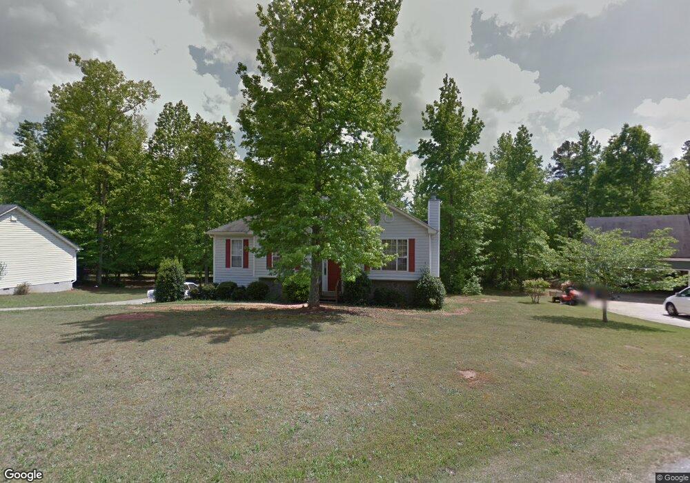
285 Travis Dr Athens, GA 30606
Estimated Value: $347,000 - $377,000
4
Beds
3
Baths
2,247
Sq Ft
$161/Sq Ft
Est. Value
About This Home
This home is located at 285 Travis Dr, Athens, GA 30606 and is currently estimated at $361,260, approximately $160 per square foot. 285 Travis Dr is a home located in Clarke County with nearby schools including Oglethorpe Avenue Elementary School, Burney-Harris-Lyons Middle School, and Clarke Central High School.
Ownership History
Date
Name
Owned For
Owner Type
Purchase Details
Closed on
Jul 31, 1997
Sold by
Byrd Ray
Bought by
Bond Connie Epps
Current Estimated Value
Purchase Details
Closed on
Sep 12, 1996
Sold by
Rawind Inc
Bought by
Byrd Ray
Create a Home Valuation Report for This Property
The Home Valuation Report is an in-depth analysis detailing your home's value as well as a comparison with similar homes in the area
Home Values in the Area
Average Home Value in this Area
Purchase History
| Date | Buyer | Sale Price | Title Company |
|---|---|---|---|
| Bond Connie Epps | $111,000 | -- | |
| Byrd Ray | $15,000 | -- |
Source: Public Records
Tax History Compared to Growth
Tax History
| Year | Tax Paid | Tax Assessment Tax Assessment Total Assessment is a certain percentage of the fair market value that is determined by local assessors to be the total taxable value of land and additions on the property. | Land | Improvement |
|---|---|---|---|---|
| 2024 | $2,110 | $107,507 | $12,000 | $95,507 |
| 2023 | $1,046 | $100,393 | $12,000 | $88,393 |
| 2022 | $2,117 | $87,716 | $12,000 | $75,716 |
| 2021 | $2,084 | $76,724 | $12,000 | $64,724 |
| 2020 | $2,071 | $75,780 | $12,000 | $63,780 |
| 2019 | $2,060 | $73,871 | $12,000 | $61,871 |
| 2018 | $1,806 | $63,199 | $12,000 | $51,199 |
| 2017 | $1,551 | $55,697 | $12,000 | $43,697 |
| 2016 | $1,508 | $54,413 | $12,000 | $42,413 |
| 2015 | $1,421 | $51,846 | $12,000 | $39,846 |
| 2014 | $1,584 | $56,652 | $12,000 | $44,652 |
Source: Public Records
Map
Nearby Homes
- 360 Heather Cove
- 530 Rustwood Dr
- 145 Rustwood Dr
- 139 Lake Forest Dr
- 0 Tallassee Rd Unit 1022503
- 0 Tallassee Rd Unit 10415955
- 192 Lakeover Cir
- 435 Rustwood Dr
- 115 Melbourne Dr
- 240 Deerfield Rd
- 247 Jasmine Trail
- 390 Lakeland Dr
- 556 Fuller Rd
- 290 Westwood Dr
- 283 Lake Vista Way
- 555 Red Bluff Dr
- 185 Boundary St
- 215 Claystone Trace
- 295 Travis Dr
- 275 Travis Dr
- 290 Travis Dr
- 260 Travis Dr
- 265 Travis Dr
- 280 Travis Dr
- 270 Travis Dr
- 255 Travis Dr
- 230 Travis Dr
- 220 Travis Dr
- 165 Christa Ln
- 155 Christa Ln
- 175 Christa Ln
- 0 Travis Dr Unit 7567738
- 517 Randy Point Unit 1
- 517 Randy Point
- 511 Randy Pointe Dr
- 235 Travis Dr
- 225 Travis Dr
- 516 Randy Point