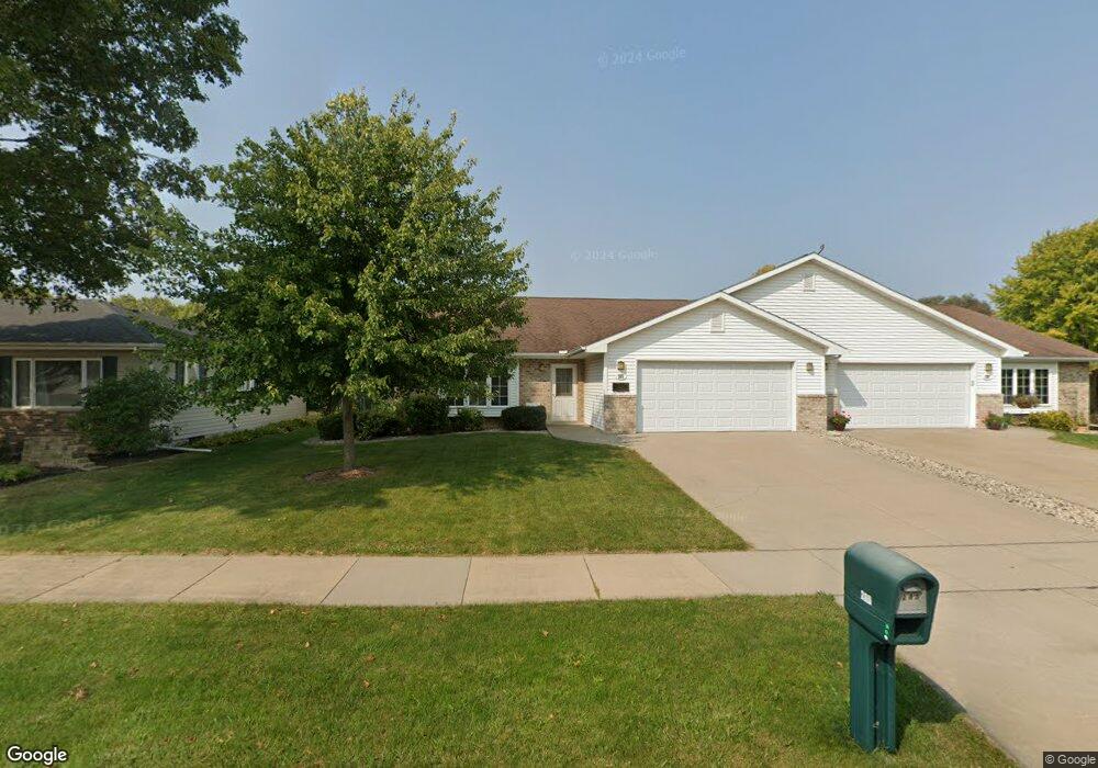
285 Westbrook Dr Oshkosh, WI 54904
Estimated Value: $271,000 - $364,178
2
Beds
3
Baths
1,393
Sq Ft
$228/Sq Ft
Est. Value
About This Home
This home is located at 285 Westbrook Dr, Oshkosh, WI 54904 and is currently estimated at $317,045, approximately $227 per square foot. 285 Westbrook Dr is a home located in Winnebago County with nearby schools including Franklin Elementary School, Tipler Middle School, and West High School.
Ownership History
Date
Name
Owned For
Owner Type
Purchase Details
Closed on
Sep 15, 2025
Sold by
Ostwald Ronald J and Ostwald Marlyn A
Bought by
Taylor House Of Waupaca Llc
Current Estimated Value
Purchase Details
Closed on
Feb 14, 2006
Sold by
Moe Dennis K and Monday Tammy R
Bought by
Ostwald Ronald J and Ostwald Marlyn A
Home Financials for this Owner
Home Financials are based on the most recent Mortgage that was taken out on this home.
Original Mortgage
$50,000
Interest Rate
6.3%
Mortgage Type
New Conventional
Create a Home Valuation Report for This Property
The Home Valuation Report is an in-depth analysis detailing your home's value as well as a comparison with similar homes in the area
Purchase History
| Date | Buyer | Sale Price | Title Company |
|---|---|---|---|
| Taylor House Of Waupaca Llc | $260,000 | None Listed On Document | |
| Ostwald Ronald J | $161,000 | None Available |
Source: Public Records
Mortgage History
| Date | Status | Borrower | Loan Amount |
|---|---|---|---|
| Previous Owner | Ostwald Ronald J | $50,000 |
Source: Public Records
Tax History
| Year | Tax Paid | Tax Assessment Tax Assessment Total Assessment is a certain percentage of the fair market value that is determined by local assessors to be the total taxable value of land and additions on the property. | Land | Improvement |
|---|---|---|---|---|
| 2024 | $3,720 | $246,500 | $33,500 | $213,000 |
| 2023 | $3,720 | $246,500 | $33,500 | $213,000 |
| 2022 | $3,657 | $159,400 | $25,600 | $133,800 |
| 2021 | $3,710 | $159,400 | $25,600 | $133,800 |
| 2020 | $3,957 | $159,400 | $25,600 | $133,800 |
| 2019 | $3,542 | $159,400 | $25,600 | $133,800 |
| 2018 | $3,619 | $159,400 | $25,600 | $133,800 |
| 2017 | $4,298 | $159,400 | $25,600 | $133,800 |
| 2016 | $4,206 | $164,100 | $24,200 | $139,900 |
| 2015 | $3,960 | $164,100 | $24,200 | $139,900 |
| 2014 | $3,988 | $164,100 | $24,200 | $139,900 |
| 2013 | $4,001 | $164,100 | $24,200 | $139,900 |
Source: Public Records
Map
Nearby Homes
- 340 Westbrook Dr
- 215 Lake Pointe Dr
- 363 Sunnybrook Dr
- 2290 Patriot Ln Unit B
- 2456 Blake Ct
- 2457 Blake Ct
- 765 N Washburn St
- 855 Greenfield Trail
- 1753 W 5th Ave
- 3009 Omro Rd
- 1615 W 6th Ave
- 1422 W 2nd Ave
- 1519 Adams Ave
- 1875 Rath Ln
- 154 N Lark St
- 1520 W 9th Ave
- 1322 W 5th Ave
- 926 Dove St
- 1430 W 9th Ave
- 0 Josslyn St
- 287 Westbrook Dr
- 275 Westbrook Dr
- 265 Westbrook Dr
- 280 Westbrook Dr
- 270 Westbrook Dr
- 2202 Brookview Ct
- 2200 Brookview Ct
- 303 Westbrook Dr
- 290 Westbrook Dr
- 260 Westbrook Dr
- 300 Westbrook Dr
- 310 Westbrook Dr
- 255 Westbrook Dr
- 240 Westbrook Dr
- 250 Westbrook Dr
- 325 Westbrook Dr
- 325 Westbrook Dr Unit The Westbrook Pentho
- 325 Westbrook Dr Unit Executive Airplane S
- 325 Westbrook Dr Unit Scandinavian Ski Cha
- 325c Westbrook Dr Unit Westbrook Penthouse