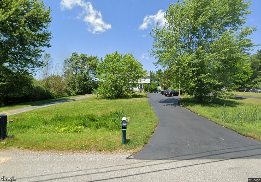
285 Whitman St Bridgewater, MA 02324
Estimated Value: $457,272 - $468,000
3
Beds
2
Baths
1,392
Sq Ft
$334/Sq Ft
Est. Value
About This Home
This home is located at 285 Whitman St, Bridgewater, MA 02324 and is currently estimated at $464,318, approximately $333 per square foot. 285 Whitman St is a home located in Plymouth County with nearby schools including Mitchell Elementary School, Williams Intermediate School, and Bridgewater Middle School.
Ownership History
Date
Name
Owned For
Owner Type
Purchase Details
Closed on
Mar 29, 2021
Sold by
Turenne Lisa I
Bought by
Lisa I Turenne Ft
Current Estimated Value
Purchase Details
Closed on
Sep 8, 2009
Sold by
Turenne Lisa I and Stocker Lisa I
Bought by
Turenne Lisa I
Purchase Details
Closed on
Oct 24, 1995
Sold by
Turenne Theodore J and Turenne Midlred L
Bought by
Stocker Michael D and Stocker Lisa I
Create a Home Valuation Report for This Property
The Home Valuation Report is an in-depth analysis detailing your home's value as well as a comparison with similar homes in the area
Home Values in the Area
Average Home Value in this Area
Purchase History
| Date | Buyer | Sale Price | Title Company |
|---|---|---|---|
| Lisa I Turenne Ft | -- | None Available | |
| Turenne Lisa I | -- | -- | |
| Stocker Michael D | $102,000 | -- |
Source: Public Records
Mortgage History
| Date | Status | Borrower | Loan Amount |
|---|---|---|---|
| Previous Owner | Stocker Michael D | $200,000 | |
| Previous Owner | Stocker Michael D | $25,000 | |
| Previous Owner | Stocker Michael D | $178,000 |
Source: Public Records
Tax History Compared to Growth
Tax History
| Year | Tax Paid | Tax Assessment Tax Assessment Total Assessment is a certain percentage of the fair market value that is determined by local assessors to be the total taxable value of land and additions on the property. | Land | Improvement |
|---|---|---|---|---|
| 2025 | $4,785 | $404,500 | $0 | $404,500 |
| 2024 | $4,438 | $365,600 | $0 | $365,600 |
| 2023 | $4,200 | $327,100 | $0 | $327,100 |
| 2022 | $4,083 | $285,100 | $0 | $285,100 |
| 2021 | $3,970 | $274,200 | $0 | $274,200 |
| 2020 | $3,878 | $263,300 | $0 | $263,300 |
| 2019 | $3,688 | $248,700 | $0 | $248,700 |
| 2018 | $3,568 | $234,900 | $0 | $234,900 |
| 2017 | $3,291 | $210,800 | $0 | $210,800 |
| 2016 | $3,181 | $204,700 | $0 | $204,700 |
| 2015 | $3,199 | $197,000 | $0 | $197,000 |
| 2014 | $3,205 | $197,200 | $0 | $197,200 |
Source: Public Records
Map
Nearby Homes
- 81 Arrowhead Dr
- 20 Prattown Ln
- 398 Plymouth St
- 45 Edge Hill Dr Unit 47
- 827 High St
- 55 Edge Hill Dr
- 865 Plymouth St Unit 865
- 0 Three Rivers Dr
- 12 Bridge St
- 49 Orange St
- 125 Walnut St
- 1141 Plymouth St
- 167 Spring St
- 317 Water St
- 114 Plain St
- 36 Michael Rd
- 201 Comfort St
- 52 Cottage St
- 128 Broad St
- 12 Perkins St
- 287 Whitman St
- 275 Whitman St
- 277 Whitman St
- 295 Whitman St
- 290 Whitman St
- 280 Whitman St
- 265 Whitman St
- 165 Hayward St
- 163 Hayward St
- 163 Hayward St Unit 163
- 163 Hayward St Unit 163,163
- 165 Hayward St Unit A
- 135 Hayward St
- 270 Whitman St
- 207 Hayward St
- 205 Hayward St
- 0 Pheasant Lane-Lot 21 Unit 60030223
- 185 Hayward St
- 55 Pheasant Ln
- 255 Whitman St