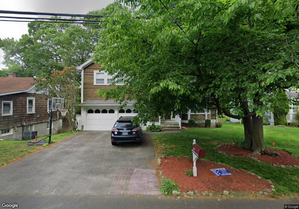
285 Woodrow Ave Southport, CT 06890
Southport NeighborhoodEstimated Value: $1,043,000 - $1,329,696
4
Beds
4
Baths
2,240
Sq Ft
$511/Sq Ft
Est. Value
About This Home
This home is located at 285 Woodrow Ave, Southport, CT 06890 and is currently estimated at $1,144,924, approximately $511 per square foot. 285 Woodrow Ave is a home located in Fairfield County with nearby schools including Mill Hill School, Roger Ludlowe Middle School, and Fairfield Ludlowe High School.
Ownership History
Date
Name
Owned For
Owner Type
Purchase Details
Closed on
Jan 30, 2008
Sold by
Kelly Patricia M
Bought by
Messina Michael D and Messina Shannon K
Current Estimated Value
Home Financials for this Owner
Home Financials are based on the most recent Mortgage that was taken out on this home.
Original Mortgage
$200,000
Interest Rate
6.18%
Purchase Details
Closed on
Aug 12, 1994
Sold by
Keak K Christer and Sabre Robert S
Bought by
Kelly Patricia M
Create a Home Valuation Report for This Property
The Home Valuation Report is an in-depth analysis detailing your home's value as well as a comparison with similar homes in the area
Home Values in the Area
Average Home Value in this Area
Purchase History
| Date | Buyer | Sale Price | Title Company |
|---|---|---|---|
| Messina Michael D | $665,000 | -- | |
| Messina Michael D | $665,000 | -- | |
| Kelly Patricia M | $322,000 | -- | |
| Kelly Patricia M | $322,000 | -- |
Source: Public Records
Mortgage History
| Date | Status | Borrower | Loan Amount |
|---|---|---|---|
| Open | Kelly Patricia M | $150,000 | |
| Closed | Kelly Patricia M | $200,000 | |
| Closed | Kelly Patricia M | $75,000 |
Source: Public Records
Tax History Compared to Growth
Tax History
| Year | Tax Paid | Tax Assessment Tax Assessment Total Assessment is a certain percentage of the fair market value that is determined by local assessors to be the total taxable value of land and additions on the property. | Land | Improvement |
|---|---|---|---|---|
| 2025 | $12,913 | $454,860 | $237,230 | $217,630 |
| 2024 | $12,691 | $454,860 | $237,230 | $217,630 |
| 2023 | $12,513 | $454,860 | $237,230 | $217,630 |
| 2022 | $12,390 | $454,860 | $237,230 | $217,630 |
| 2021 | $12,272 | $454,860 | $237,230 | $217,630 |
| 2020 | $12,898 | $481,460 | $234,640 | $246,820 |
| 2019 | $12,898 | $481,460 | $234,640 | $246,820 |
| 2018 | $12,691 | $481,460 | $234,640 | $246,820 |
| 2017 | $12,431 | $481,460 | $234,640 | $246,820 |
| 2016 | $12,253 | $481,460 | $234,640 | $246,820 |
| 2015 | $11,481 | $463,120 | $258,300 | $204,820 |
| 2014 | $11,300 | $463,120 | $258,300 | $204,820 |
Source: Public Records
Map
Nearby Homes
- 153 Pease Ave
- 56 Southport Woods Dr
- 60 Hulls Hwy Unit 60
- 2 Elmwood Dr Unit 2
- 844 Mill Hill Terrace
- 478 Hulls Hwy
- 74 Westford Dr
- 260 Range Rd
- 53 Hilltop Dr
- 6 Sunny Acres Ln
- 944 Pequot Ave
- 305 S Gate Ln
- 400 Bronson Rd
- 1135 Mill Hill Rd
- 125 Old Rd
- 260 Willow St
- 647 Bronson Rd
- 88 Overhill Rd
- 144 Lansdowne Unit 144
- 365 Greens Farms Rd
- 271 Woodrow Ave
- 295 Woodrow Ave
- 272 Woodrow Ave
- 160 Southport Woods Dr
- 305 Woodrow Ave
- 7 Sherwood Place
- 7 Sherwood Place Unit A
- 152 Southport Woods Dr
- 152 Southport Woods Dr Unit 152
- 255 Woodrow Ave Unit 2
- 154 Southport Woods Dr
- 154 Southport Woods Dr Unit 154
- 298 Woodrow Ave
- 298 Woodrow Ave Unit A
- 253 Woodrow Ave
- 253 Woodrow Ave Unit 1
- 11 Sherwood Place
- 318 Woodrow Ave
- 158 Southport Woods Dr
- 146 Southport Woods Dr