Estimated Value: $407,000 - $465,000
4
Beds
3
Baths
2,964
Sq Ft
$148/Sq Ft
Est. Value
About This Home
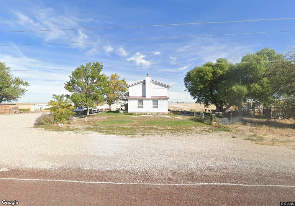
This home is located at 2850 W 2500 S, Delta, UT 84624 and is currently estimated at $438,123, approximately $147 per square foot. 2850 W 2500 S is a home located in Millard County.
Ownership History
Date
Name
Owned For
Owner Type
Purchase Details
Closed on
Dec 1, 2014
Sold by
Jade Jade
Bought by
Rowley Stanton and Rowley Misty
Current Estimated Value
Home Financials for this Owner
Home Financials are based on the most recent Mortgage that was taken out on this home.
Original Mortgage
$167,142
Outstanding Balance
$127,427
Interest Rate
3.95%
Mortgage Type
Stand Alone First
Estimated Equity
$310,696
Purchase Details
Closed on
Jun 14, 2010
Sold by
Skeem Sheldon Lee and Skeem Deborah E
Bought by
Skeem Sheldon and Skeem Deborah E
Purchase Details
Closed on
Dec 24, 2009
Sold by
Crapo Shayne
Bought by
Taylor Jade
Home Financials for this Owner
Home Financials are based on the most recent Mortgage that was taken out on this home.
Original Mortgage
$110,700
Interest Rate
4.77%
Mortgage Type
New Conventional
Create a Home Valuation Report for This Property
The Home Valuation Report is an in-depth analysis detailing your home's value as well as a comparison with similar homes in the area
Home Values in the Area
Average Home Value in this Area
Purchase History
| Date | Buyer | Sale Price | Title Company |
|---|---|---|---|
| Rowley Stanton | -- | First American Title Insur | |
| Skeem Sheldon | -- | -- | |
| Taylor Jade | -- | -- | |
| Taylor Jade | -- | -- |
Source: Public Records
Mortgage History
| Date | Status | Borrower | Loan Amount |
|---|---|---|---|
| Open | Rowley Stanton | $167,142 | |
| Previous Owner | Taylor Jade | $110,700 |
Source: Public Records
Tax History Compared to Growth
Tax History
| Year | Tax Paid | Tax Assessment Tax Assessment Total Assessment is a certain percentage of the fair market value that is determined by local assessors to be the total taxable value of land and additions on the property. | Land | Improvement |
|---|---|---|---|---|
| 2025 | $1,996 | $246,150 | $19,852 | $226,298 |
| 2024 | $1,996 | $208,194 | $15,625 | $192,569 |
| 2023 | $2,423 | $208,194 | $15,625 | $192,569 |
| 2022 | $1,535 | $135,452 | $14,250 | $121,202 |
| 2021 | $1,163 | $98,854 | $12,600 | $86,254 |
| 2020 | $1,119 | $96,252 | $12,600 | $83,652 |
| 2019 | $1,044 | $90,675 | $12,600 | $78,075 |
| 2018 | $981 | $87,550 | $12,600 | $74,950 |
| 2017 | $944 | $80,681 | $9,300 | $71,381 |
| 2016 | $902 | $80,681 | $9,300 | $71,381 |
| 2015 | $902 | $80,681 | $9,300 | $71,381 |
| 2014 | -- | $79,180 | $9,300 | $69,880 |
| 2013 | -- | $69,544 | $9,300 | $60,244 |
Source: Public Records
Map
Nearby Homes
- 0 Tbd 3000 Rd S Unit LotWP001
- 17000 W 2500 Rd S
- 16700 W 2500 South Rd
- 16800 W 2500 South Rd
- 6177 S 3000 Rd W
- 3480 S 4000 W
- 6500 W 2000 S
- 3770 S 4000 Rd W
- 470 S 2750 W Unit 6
- 460 S 2750 W Unit 7
- 490 S 2750 W Unit 5
- 465 S 2750 W Unit 4
- 6500 S 3000 West Rd
- 3885 W 4500 S
- 168 N 100 Rd W
- 289 W Center St S
- 700 Acres
- 1500 S 10000 W
- 6000 N 10000 W
- 700 Acres Hwy 6 & Main St (Hwy 50)