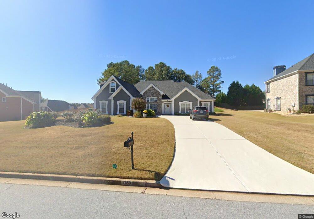
2850 Weatherstone Cir SE Conyers, GA 30094
Estimated Value: $355,759 - $457,000
4
Beds
3
Baths
2,602
Sq Ft
$155/Sq Ft
Est. Value
About This Home
This home is located at 2850 Weatherstone Cir SE, Conyers, GA 30094 and is currently estimated at $403,190, approximately $154 per square foot. 2850 Weatherstone Cir SE is a home located in Rockdale County with nearby schools including Flat Shoals Elementary School, Edwards Middle School, and Rockdale County High School.
Ownership History
Date
Name
Owned For
Owner Type
Purchase Details
Closed on
Mar 26, 2010
Sold by
Federal Home Loan Mortgage Corporation
Bought by
Parland Rosa T
Current Estimated Value
Home Financials for this Owner
Home Financials are based on the most recent Mortgage that was taken out on this home.
Original Mortgage
$142,373
Outstanding Balance
$97,144
Interest Rate
5.5%
Mortgage Type
FHA
Estimated Equity
$306,046
Purchase Details
Closed on
Jan 5, 2010
Sold by
Central Mortgage Co
Bought by
Federal Home Loan Mortgage Corporation
Purchase Details
Closed on
Feb 21, 2003
Sold by
Greenwood Hms Inc
Bought by
Wade Joyce
Home Financials for this Owner
Home Financials are based on the most recent Mortgage that was taken out on this home.
Original Mortgage
$201,750
Interest Rate
5.95%
Mortgage Type
New Conventional
Create a Home Valuation Report for This Property
The Home Valuation Report is an in-depth analysis detailing your home's value as well as a comparison with similar homes in the area
Home Values in the Area
Average Home Value in this Area
Purchase History
| Date | Buyer | Sale Price | Title Company |
|---|---|---|---|
| Parland Rosa T | $145,000 | -- | |
| Federal Home Loan Mortgage Corporation | $190,000 | -- | |
| Central Mortgage Co | $190,000 | -- | |
| Wade Joyce | $212,400 | -- |
Source: Public Records
Mortgage History
| Date | Status | Borrower | Loan Amount |
|---|---|---|---|
| Open | Parland Rosa T | $142,373 | |
| Previous Owner | Wade Joyce | $201,750 |
Source: Public Records
Tax History Compared to Growth
Tax History
| Year | Tax Paid | Tax Assessment Tax Assessment Total Assessment is a certain percentage of the fair market value that is determined by local assessors to be the total taxable value of land and additions on the property. | Land | Improvement |
|---|---|---|---|---|
| 2024 | $3,269 | $159,000 | $30,920 | $128,080 |
| 2023 | $2,664 | $141,880 | $30,800 | $111,080 |
| 2022 | $2,331 | $116,640 | $24,960 | $91,680 |
| 2021 | $1,974 | $97,920 | $20,800 | $77,120 |
| 2020 | $1,671 | $86,160 | $17,760 | $68,400 |
| 2019 | $1,508 | $79,200 | $10,800 | $68,400 |
| 2018 | $1,212 | $69,360 | $10,800 | $58,560 |
| 2017 | $1,119 | $65,920 | $10,800 | $55,120 |
| 2016 | $995 | $65,920 | $10,800 | $55,120 |
| 2015 | $765 | $57,960 | $9,320 | $48,640 |
| 2014 | $466 | $51,652 | $8,000 | $43,652 |
| 2013 | -- | $81,184 | $13,600 | $67,584 |
Source: Public Records
Map
Nearby Homes
- 2464 Lennox Rd SE
- Boston Plan at Millers Pointe
- Atlanta Plan at Millers Pointe
- Columbus Plan at Millers Pointe
- 2608 Downing Park Dr SE
- 784 Stieff Ct SE
- 2537 Lennox Rd SE
- 1420 Hillside Place SE
- 2197 Boxwood Cir
- 1508 Hillside Dr SE
- 1511 Hillside Dr SE
- 340 Windsor Walk SE
- 2631 Rolling Hills Way SE
- Astrid Plan at Alder Park
- Harrison Plan at Alder Park
- Baker Plan at Alder Park
- Oliver Plan at Alder Park
- 2617 Laurel Woods Ln SE Unit 3
- 1920 Logan Ln
- 2717 Stanton Woods Dr SE
- 2860 Weatherstone Cir SE
- 2830 Weatherstone Cir SE
- 2790 Weatherstone Cir SE Unit 7
- 2870 Weatherstone Cir SE Unit 7
- 3281 Liberty Ct SE Unit 7
- 3291 Liberty Ct SE Unit 7
- 2780 Weatherstone Cir SE
- 2841 Weatherstone Cir SE
- 2861 Weatherstone Cir SE Unit 7
- 2821 Weatherstone Cir SE Unit 7
- 2770 Weatherstone Cir SE
- 2871 Weatherstone Cir SE
- 2831 Weatherstone Cir SE
- 2880 Weatherstone Cir SE Unit 7
- 2811 Weatherstone Cir SE
- 3271 Liberty Ct SE Unit 7
- 3290 Liberty Ct SE
- 2801 Weatherstone Cir SE Unit 7
- 2760 Weatherstone Cir SE Unit 7
- 2890 Weatherstone Cir SE Unit 5