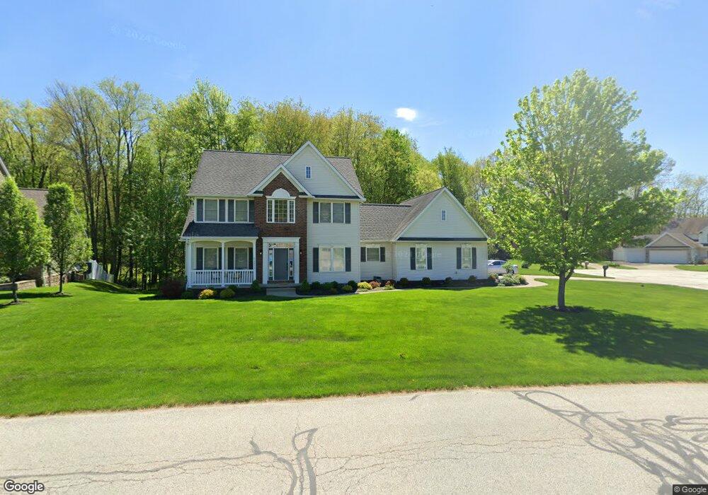
2852 Crows Nest Cir Uniontown, OH 44685
Estimated Value: $408,000 - $437,201
4
Beds
3
Baths
1,998
Sq Ft
$211/Sq Ft
Est. Value
About This Home
This home is located at 2852 Crows Nest Cir, Uniontown, OH 44685 and is currently estimated at $421,550, approximately $210 per square foot. 2852 Crows Nest Cir is a home located in Summit County with nearby schools including Greenwood Elementary School, Green Primary School, and Green Intermediate Elementary School.
Ownership History
Date
Name
Owned For
Owner Type
Purchase Details
Closed on
Sep 26, 2002
Sold by
Union Commerce Corp
Bought by
Beasley Robert B and Beasley Lora J
Current Estimated Value
Home Financials for this Owner
Home Financials are based on the most recent Mortgage that was taken out on this home.
Original Mortgage
$10,700
Interest Rate
6.13%
Mortgage Type
Credit Line Revolving
Create a Home Valuation Report for This Property
The Home Valuation Report is an in-depth analysis detailing your home's value as well as a comparison with similar homes in the area
Home Values in the Area
Average Home Value in this Area
Purchase History
| Date | Buyer | Sale Price | Title Company |
|---|---|---|---|
| Beasley Robert B | $525,000 | Endress/Lawyers Title |
Source: Public Records
Mortgage History
| Date | Status | Borrower | Loan Amount |
|---|---|---|---|
| Closed | Beasley Robert B | $10,700 | |
| Closed | Beasley Robert B | $291,500 |
Source: Public Records
Tax History Compared to Growth
Tax History
| Year | Tax Paid | Tax Assessment Tax Assessment Total Assessment is a certain percentage of the fair market value that is determined by local assessors to be the total taxable value of land and additions on the property. | Land | Improvement |
|---|---|---|---|---|
| 2025 | $5,853 | $123,729 | $28,452 | $95,277 |
| 2024 | $5,853 | $123,729 | $28,452 | $95,277 |
| 2023 | $5,853 | $123,729 | $28,452 | $95,277 |
| 2022 | $5,266 | $99,953 | $22,946 | $77,007 |
| 2021 | $4,939 | $99,953 | $22,946 | $77,007 |
| 2020 | $4,845 | $99,960 | $22,950 | $77,010 |
| 2019 | $4,201 | $81,050 | $18,000 | $63,050 |
| 2018 | $4,293 | $81,050 | $18,000 | $63,050 |
| 2017 | $4,011 | $81,050 | $18,000 | $63,050 |
| 2016 | $3,991 | $71,020 | $18,000 | $53,020 |
| 2015 | $4,011 | $71,020 | $18,000 | $53,020 |
| 2014 | $3,985 | $71,020 | $18,000 | $53,020 |
| 2013 | $4,253 | $75,440 | $18,000 | $57,440 |
Source: Public Records
Map
Nearby Homes
- 3217 Deborah Ct
- 3212 Deborah Ct
- 3979 Northdale St NW
- 0 Pine St NW
- 2771 Superior Dr
- 2944 Sunset Dr
- Northwood Plan at Spring Hill - Spring Hill Villas
- Kenai Plan at Spring Hill - Spring Hill Villas
- Bradbern Plan at Spring Hill - Spring Hill Villas
- Sarasota Plan at Spring Hill - Spring Hill Villas
- Holston Plan at Spring Hill - Spring Hill Villas
- Chester Plan at Spring Hill - Spring Hill Villas
- 2500 Marlborough Dr
- 13704 Greenland Ave NW
- 2418 Island Dr
- 3534 Chanticleer Ct
- 3514 Chanticleer Ct
- 3796 Sweitzer St NW
- 2511 Royal County Down
- 2535 Royal County Down Unit B
- 2860 Crows Nest Cir
- S/L 161 Matthew Ct
- 3007 Matthew Ct
- 3000 Matthew Ct
- 2853 Crows Nest Cir
- 3008 Matthew Ct
- 2864 Crows Nest Cir
- 2870 Jonathan Ct
- 2986 Kreighbaum Rd NW
- 2861 Crows Nest Cir
- 2878 Jonathan Ct
- 2837 Crows Nest Cir
- 2836 Crows Nest Cir
- 2927 David Ct
- 2869 Crows Nest Cir
- 2886 Jonathan Ct
- S/L 145 Jonathan Ct
- 2829 Crows Nest Cir
- 2828 Crows Nest Cir
- 2938 Vivian Ct