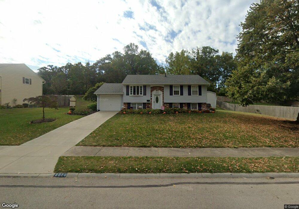
2852 Vineyard St Springfield, OH 45503
Estimated Value: $200,907 - $311,000
3
Beds
2
Baths
951
Sq Ft
$245/Sq Ft
Est. Value
About This Home
This home is located at 2852 Vineyard St, Springfield, OH 45503 and is currently estimated at $233,227, approximately $245 per square foot. 2852 Vineyard St is a home located in Clark County with nearby schools including Northridge Elementary School, Kenton Ridge Middle & High School, and Emmanuel Christian Academy.
Ownership History
Date
Name
Owned For
Owner Type
Purchase Details
Closed on
Mar 11, 2022
Sold by
Kitchen Joseph S and Kitchen Danessa L
Bought by
Lynn Madria J and Lynn Chad E
Current Estimated Value
Home Financials for this Owner
Home Financials are based on the most recent Mortgage that was taken out on this home.
Original Mortgage
$169,375
Outstanding Balance
$157,263
Interest Rate
3.85%
Mortgage Type
FHA
Estimated Equity
$75,964
Purchase Details
Closed on
Jan 2, 1992
Sold by
Cornell Richard A and Cornell Linda L
Bought by
Kitchen Joseph S and Kitchen Danessa L
Purchase Details
Closed on
Apr 15, 1987
Create a Home Valuation Report for This Property
The Home Valuation Report is an in-depth analysis detailing your home's value as well as a comparison with similar homes in the area
Home Values in the Area
Average Home Value in this Area
Purchase History
| Date | Buyer | Sale Price | Title Company |
|---|---|---|---|
| Lynn Madria J | $172,500 | Spencer John M | |
| Kitchen Joseph S | $74,500 | -- | |
| -- | $54,500 | -- |
Source: Public Records
Mortgage History
| Date | Status | Borrower | Loan Amount |
|---|---|---|---|
| Open | Lynn Madria J | $169,375 |
Source: Public Records
Tax History
| Year | Tax Paid | Tax Assessment Tax Assessment Total Assessment is a certain percentage of the fair market value that is determined by local assessors to be the total taxable value of land and additions on the property. | Land | Improvement |
|---|---|---|---|---|
| 2025 | $1,887 | $63,280 | $11,110 | $52,170 |
| 2024 | $1,824 | $44,500 | $11,380 | $33,120 |
| 2023 | $1,824 | $44,500 | $11,380 | $33,120 |
| 2022 | $1,831 | $44,500 | $11,380 | $33,120 |
| 2021 | $1,855 | $38,690 | $8,820 | $29,870 |
| 2020 | $1,857 | $38,690 | $8,820 | $29,870 |
| 2019 | $1,894 | $38,690 | $8,820 | $29,870 |
| 2018 | $1,759 | $34,740 | $7,350 | $27,390 |
| 2017 | $1,495 | $39,417 | $7,350 | $32,067 |
| 2016 | $1,484 | $39,417 | $7,350 | $32,067 |
| 2015 | $1,668 | $39,417 | $7,350 | $32,067 |
| 2014 | $1,668 | $39,417 | $7,350 | $32,067 |
| 2013 | $1,664 | $39,417 | $7,350 | $32,067 |
Source: Public Records
Map
Nearby Homes
- 1924 Marinette Dr
- 2529 Marinette Dr
- 1811 Devon Dr
- 3214 Revels St
- 2400 Thor Dr
- 3300 Revels St
- 1948 Falmouth Ave
- 2022 Westboro Ave
- 2861 Ashlar Dr
- 2553 Derr Rd
- 1628 Yorkshire Ct
- 1032 Armsgate Rd
- 3124 El Camino Dr
- 1040 Carson Ln
- 3126 Lakeview Ct Unit 3126
- 1139 Bradford Dr
- 1046 Fruitland Rd
- 2332 Villa Rd
- 3135 Imperial Blvd
- 1136 Foxboro Rd Unit 202
- 2856 Vineyard St
- 1958 Marinette Dr
- 2636 Marinette Dr
- 2011 Waltham Ave
- 2851 Vineyard St
- 2013 Waltham Ave
- 2919 Brewster Ct
- 1940 Marinette Dr
- 2624 Marinette Dr
- 1918 Devon Dr
- 1926 Devon Dr
- 1957 Marinette Dr
- 2918 Brewster Ct
- 2933 Brewster Ct
- 2015 Waltham Ave
- 2627 Marinette Dr
- 2612 Marinette Dr
- 1932 Marinette Dr
- 2010 Waltham Ave
- 1934 Devon Dr
Your Personal Tour Guide
Ask me questions while you tour the home.